How to get to Rubycube by bus?
Click on the bus route to see step by step directions with maps, line arrival times and updated time schedules.
From Friedhof Käfertal, Käfertal
121 minFrom SAP Campus, Walldorf
63 minFrom Agaplesion Bethanien Krankenhaus Heidelberg, Südstadt
40 minFrom MVV Energie Ladestation, Käfertal
118 minFrom Möbel Höffner, Schwetzingen
64 minFrom GRN-Klinik Schwetzingen, Schwetzingen
61 minFrom Hauptfeuerwache, Berufsfeuerwehr Mannheim, Neckarau
102 minFrom FH 1863, Neckarstadt-Ost/Wohlgelegen
132 min
How to get to Rubycube by train?
Click on the train route to see step by step directions with maps, line arrival times and updated time schedules.
From Agaplesion Bethanien Krankenhaus Heidelberg, Südstadt
59 minFrom MVV Energie Ladestation, Käfertal
87 minFrom Möbel Höffner, Schwetzingen
92 minFrom Krankenhaus GRN, Weinheim
71 minFrom GRN-Klinik Schwetzingen, Schwetzingen
96 minFrom Hauptfeuerwache, Berufsfeuerwehr Mannheim, Neckarau
86 minFrom FH 1863, Neckarstadt-Ost/Wohlgelegen
75 min
Light Rail stations near Rubycube in Wieblingen
- Wieblingen, Taubenfeld, 2 min walk,VIEW
Bus stops near Rubycube in Wieblingen
Bus lines to Rubycube in Wieblingen
What are the closest stations to Rubycube?
The closest stations to Rubycube are:
- Wieblingen, Taubenfeld is 89 meters away, 2 min walk.
- Wieblingen, Maltesergasse is 351 meters away, 5 min walk.
- Wieblingen, Grenzhöfer Weg is 386 meters away, 6 min walk.
Which train lines stop near Rubycube?
These train lines stop near Rubycube: RB68, S3.
Which light rail lines stop near Rubycube?
These light rail lines stop near Rubycube: 5, RNV 5.
Which bus lines stop near Rubycube?
These bus lines stop near Rubycube: 35, 36, 713, RNV 36, RNV 42.
What’s the nearest light rail station to Rubycube in Wieblingen?
The nearest light rail station to Rubycube in Wieblingen is Wieblingen, Taubenfeld. It’s a 2 min walk away.
What’s the nearest bus station to Rubycube in Wieblingen?
The nearest bus station to Rubycube in Wieblingen is Wieblingen, Maltesergasse. It’s a 5 min walk away.
What time is the first light rail to Rubycube in Wieblingen?
The RNV 5 is the first light rail that goes to Rubycube in Wieblingen. It stops nearby at 4:15 AM.
What time is the last light rail to Rubycube in Wieblingen?
The 5 is the last light rail that goes to Rubycube in Wieblingen. It stops nearby at 1:35 AM.
What time is the first bus to Rubycube in Wieblingen?
The 35 is the first bus that goes to Rubycube in Wieblingen. It stops nearby at 4:59 AM.
What time is the last bus to Rubycube in Wieblingen?
The 35 is the last bus that goes to Rubycube in Wieblingen. It stops nearby at 1:25 AM.
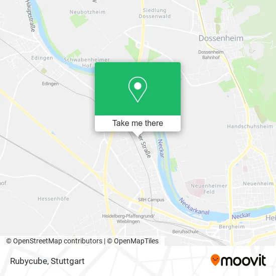
See Rubycube, Wieblingen, on the map
Public Transit to Rubycube in Wieblingen
Wondering how to get to Rubycube in Wieblingen? Moovit helps you find the best way to get to Rubycube with step-by-step directions from the nearest public transit station.
Moovit provides free maps and live directions to help you navigate through your city. View schedules, routes, timetables, and find out how long does it take to get to Rubycube in real time.
Looking for the nearest stop or station to Rubycube? Check out this list of stops closest to your destination: Wieblingen, Taubenfeld; Wieblingen, Maltesergasse; Wieblingen, Grenzhöfer Weg.
Train: RB68, S3.Light Rail: 5, RNV 5.Bus: 35, 36, 713, RNV 36, RNV 42, RNV 35, RNV 1009, RNV MOONLINER 2.
Want to see if there’s another route that gets you there at an earlier time? Moovit helps you find alternative routes or times. Get directions from and directions to Rubycube easily from the Moovit App or Website.
We make riding to Rubycube easy, which is why over 1.5 million users, including users in Wieblingen, trust Moovit as the best app for public transit. You don’t need to download an individual bus app or train app, Moovit is your all-in-one transit app that helps you find the best bus time or train time available.
For information on prices of bus, light rail and train, costs and ride fares to Rubycube, please check the Moovit app.
Use the app to navigate to popular places including to the airport, hospital, stadium, grocery store, mall, coffee shop, school, college, and university.
Rubycube Address: Feudenheimer Straße 20 Wieblingen, 69123 Heidelberg street in Wieblingen
- Kindertagespflege-Ulrike Zöller und Diane Bouhaous,
- 3dm Reifenfilter Ug (Haftungsbeschränkt),
- Schützengesellschaft Heidelberg-Wieblingen e.V. 1925,
- BB Forderungsmanagement,
- Drk Bereitschaft Heidelberg Stadt-Mitte,
- Msc Heidelberg-Wieblingen,
- Fahrschule Formel 1,
- Julie K.,
- Erich Kaminski Fahrschule,
- Haag,
- Haag Haus- und Gartenarbeiten,
- Thomas Translations International,
- Futon-Haus,
- Hair and Beauty / Inh. Sabrina Adam,
- Transportunternehmen,
- Ristorante Il Pescatore,
- Ristorante da Pino,
- Jamrock-Jamaican Restaurant,
- Il Pescatore,
- Weißer Schwan
Places Near Rubycube (Wieblingen)
- Wilhelma (U-Bahn Wilhelma), Bad Cannstatt,
- Mercedes-Benz Museum (Mercedes Museum Stuttgart), Bad Cannstatt,
- Mettingen Eros-Center Puff Laufhaus, Esslingen Am Neckar,
- SI-Centrum, Möhringen,
- Porsche Museum, Zuffenhausen,
- Marmorsaal Im Weissenburgpark, Stuttgart-Süd,
- Im Wizemann (Halle), Bad Cannstatt,
- Gleis 101/102 (tief), Stuttgart-Mitte,
- Hanns-Martin-Schleyer-Halle (Stuttgart Hans-Martin-Schleyerhalle), Bad Cannstatt,
- Porsche-Arena, Bad Cannstatt,
- Klinikum Stuttgart - Katharinenhospital, Stuttgart-Mitte,
- Waldfriedhof, Degerloch,
- Hauptbahnhof Stuttgart, Stuttgart-Mitte,
- Pariser Platz Stuttgart, Stuttgart-Mitte,
- Geilhaus Haus 33a, Reutlingen-Betzingen,
- Mercedes-Benz Museum, Bad Cannstatt,
- Gasometer Pforzheim, Pforzheim,
- Schleyerhalle, Bad Cannstatt,
- Hanns-Martin-Schleyer-Halle, Bad Cannstatt,
- FlixBus Haltestelle, Stuttgart
How to get to popular places in Stuttgart with public transit
Get around Wieblingen by public transit!
Traveling around Wieblingen has never been so easy. See step by step directions as you travel to any attraction, street or major public transit station. View bus and train schedules, arrival times, service alerts and detailed routes on a map, so you know exactly how to get to anywhere in Wieblingen.
When traveling to any destination around Wieblingen use Moovit's Live Directions with Get Off Notifications to know exactly where and how far to walk, how long to wait for your line, and how many stops are left. Moovit will alert you when it's time to get off — no need to constantly re-check whether yours is the next stop.
Wondering how to use public transit in Wieblingen or how to pay for public transit in Wieblingen? Moovit public transit app can help you navigate your way with public transit easily, and at minimum cost. It includes public transit fees, ticket prices, and costs. Looking for a map of Wieblingen public transit lines? Moovit public transit app shows all public transit maps in Wieblingen with all Bus, Train, Subway, Light Rail, Ferry, S-Bahn and Funicular routes and stops on an interactive map.
Stuttgart has 7 transit type(s), including: Bus, Train, Subway, Light Rail, Ferry, S-Bahn and Funicular, operated by several transit agencies, including SSB - Stadtbahn, SSB, SSB - Seilbahn / Zacke, S-Bahn Stuttgart, Rhein-Neckar-Verkehr GmbH (rnv), Karlsruher Verkehrsverbund, DB AG, DB Regiobus BW, Arverio Baden-Württemberg GmbH, DB RegioNetz Verkehrs GmbH Westfrankenbahn, DB Regio AG Baden-Württemberg, Südwestdeutsche Verkehrs-AG, DB Regio AG Mitte Region Hessen, DB and Bodensee-Oberschwaben-Bahn