Directions to Ruda with public transportation
The following transit lines have routes that pass near Ruda
 Bus: G22, G26, G58, 421, G58.
How to get to Ruda by bus?
Click on the bus route to see step by step directions with maps, line arrival times and updated time schedules.
Bus stops near Ruda
- Ruda Liberty Square 4 (City Hall), 1 min walk,
- Ruda Liberty Square (Opposite 4), 1 min walk,
- Ruda Republic Square 13, 2 min walk,
Bus lines to Ruda
- G22, E22,
- G58, Line E58,
- 421, Palmanova Station,
- G22, Line E22,
- G58, E58,
- 421, Fiumicello Papariano National Street 58,
What are the closest stations to Ruda?
The closest stations to Ruda are:
- Ruda Liberty Square 4 (City Hall) stop is 0 meters away, 1 min walk.
- Ruda Liberty Square (Opposite 4) stop is 36 meters away, 1 min walk.
- Ruda Republic Square 13 stop is 104 meters away, 2 min walk.
Which bus lines stop near Ruda?
These bus lines stop near Ruda: G22, G26.
What’s the nearest bus station to Ruda?
The nearest bus stations to Ruda are Ruda Liberty Square 4 (City Hall) and Ruda Liberty Square (Opposite 4). The closest one is a 1 min walk away.
What time is the first bus to Ruda?
The G22 is the first bus that goes to Ruda. It stops nearby at 8:53 AM.
What time is the last bus to Ruda?
The G22 is the last bus that goes to Ruda. It stops nearby at 7:25 PM.
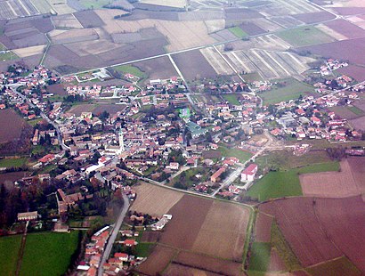
See Ruda on the map
Public Transportation to Ruda
Wondering how to get to Ruda? Moovit helps you find the best way to get to Ruda with step-by-step directions from the nearest public transit station.
Moovit provides free maps and live directions to help you navigate through your city. View schedules, routes, timetables, and find out how long does it take to get to Ruda in real time.
Looking for the nearest stop or station to Ruda? Check out this list of stops closest to your destination: Ruda Liberty Square 4 (City Hall); Ruda Liberty Square (Opposite 4); Ruda Republic Square 13.
Bus: G22, G26, G58, 421, G58, 421.
Want to see if there’s another route that gets you there at an earlier time? Moovit helps you find alternative routes or times. Get directions from and directions to Ruda easily from the Moovit App or Website.
We make riding to Ruda easy, which is why over 1.7 billion users, including users in Trieste, trust Moovit as the best app for public transit. You don’t need to download an individual bus app or train app, Moovit is your all-in-one transit app that helps you find the best bus time or train time available.
For information on prices of bus, costs and ride fares to Ruda, please check the Moovit app.
Use the app to navigate to popular places including to the airport, hospital, stadium, grocery store, mall, coffee shop, school, college, and university.
Location: Trieste
Popular routes to Ruda
Popular routes from Ruda
- Campolongo al Torre,
- Villa Vicentina,
- Turriaco,
- Fiumicello Villa Vicentina,
- Campolongo Tapogliano,
- Tapogliano,
- San Pier d'Isonzo,
- San Pier d'Isonzo,
- San Canzian d'Isonzo,
- Villesse,
- Aiello del Friuli,
- Fiumicello,
- Cervignano del Friuli,
- San Canzian d'Isonzo,
- Terzo d'Aquileia,
- Terzo d'Aquileia,
- Romans d'Isonzo,
- Romans d'Isonzo,
- San Vito al Torre,
- Fogliano Redipuglia
Places Near Ruda
- Manin Villa, Codroipo,
- Warehouse 26, Trieste,
- Major Hospital, Trieste,
- Pineta del Carso Care Home, Duino Aurisina / Devin - Nabrežina,
- Terminal Nord Shopping Center, Udine,
- At the Stadium, Udine,
- Salus Care Home, Trieste,
- Tiare Shopping Center, Villesse,
- Bonaparte Street 4/6, Trieste,
- Cattinara Hospital, Trieste,
- Burlo Garofalo Children's Hospital, Trieste,
- Giovanni Sai Street 7, Trieste,
- Sant'Anna Cemetery, Trieste,
- San Sabba Rice Mill, Trieste,
- Palmanova Village, Aiello del Friuli,
- IKEA, Villesse,
- Villesse HFB Eco, Villesse,
- IKEA, Villesse,
- Trieste Sanatorium, Trieste,
- Domenico Rossetti Street, Trieste
How to get to popular places in Trieste with public transit
Get around Trieste by public transit!
Traveling around Trieste has never been so easy. See step by step directions as you travel to any attraction, street or major public transit station. View bus and train schedules, arrival times, service alerts and detailed routes on a map, so you know exactly how to get to anywhere in Trieste.
When traveling to any destination around Trieste use Moovit's Live Directions with Get Off Notifications to know exactly where and how far to walk, how long to wait for your line, and how many stops are left. Moovit will alert you when it's time to get off — no need to constantly re-check whether yours is the next stop.
Wondering how to use public transit in Trieste or how to pay for public transit in Trieste? Moovit public transit app can help you navigate your way with public transit easily, and at minimum cost. It includes public transit fees, ticket prices, and costs. Looking for a map of Trieste public transit lines? Moovit public transit app shows all public transit maps in Trieste with all Bus, Train and Ferry routes and stops on an interactive map.
Trieste has 3 transit type(s), including: Bus, Train and Ferry, operated by several transit agencies, including TPL FVG s.c.a.r.l., TRENITALIA, Arriva Slovenia Ltd., Nomago, ATVO, UDINE CIVIDALE RAILWAYS and MOM