Directions to Rudd & Diamond PA (Hollywood) with public transportation
The following transit lines have routes that pass near Rudd & Diamond PA
 Bus: 07, 09.
- Train: TRIRAIL, FLORIDIAN, SILVER METEOR.
How to get to Rudd & Diamond PA by bus?
Click on the bus route to see step by step directions with maps, line arrival times and updated time schedules.
From Walmart, Hallandale Beach
53 minFrom Ebay Store, Miami
93 minFrom Calder Race Course (Calder Casino), Miami Gardens
66 minFrom Bass Pro Shops Outdoor World, Hollywood
54 minFrom Oleta River State Recreation (Temptation Island in Oleta River State Park), Miami
103 minFrom Golden Beach, Miami Beach
73 minFrom Pembroke Pines, FL, Miramar-Pembroke Pines
36 minFrom Seminole Hard Rock Hotel & Casino Hollywood (Seminole Hard Rock Hollywood Casino), Davie
36 minFrom 595 Express, Davie
63 minFrom North Miami, Miami
89 min
How to get to Rudd & Diamond PA by train?
Click on the train route to see step by step directions with maps, line arrival times and updated time schedules.
Bus stop near Rudd & Diamond PA in Hollywood
- Circle Drive/North Rainbow Drive, 4 min walk,VIEW
Train stations near Rudd & Diamond PA in Hollywood
Bus lines to Rudd & Diamond PA in Hollywood
- 07, Pembroke Lakes Mall Via Bc South,VIEW
What are the closest stations to Rudd & Diamond PA?
The closest stations to Rudd & Diamond PA are:
- Circle Drive/North Rainbow Drive is 238 yards away, 4 min walk.
- Sheridan Street Station is 4747 yards away, 56 min walk.
- Hollywood Station is 4879 yards away, 57 min walk.
Which bus lines stop near Rudd & Diamond PA?
These bus lines stop near Rudd & Diamond PA: 07, 09.
Which train line stops near Rudd & Diamond PA?
TRIRAIL (Southbound To Miami Airport)
What’s the nearest bus station to Rudd & Diamond PA in Hollywood?
The nearest bus station to Rudd & Diamond PA in Hollywood is Circle Drive/North Rainbow Drive. It’s a 4 min walk away.
What time is the first train to Rudd & Diamond PA in Hollywood?
The TRIRAIL is the first train that goes to Rudd & Diamond PA in Hollywood. It stops nearby at 4:16 AM.
What time is the last train to Rudd & Diamond PA in Hollywood?
The FLORIDIAN is the last train that goes to Rudd & Diamond PA in Hollywood. It stops nearby at 5:29 PM.
What time is the first bus to Rudd & Diamond PA in Hollywood?
The 07 is the first bus that goes to Rudd & Diamond PA in Hollywood. It stops nearby at 5:12 AM.
What time is the last bus to Rudd & Diamond PA in Hollywood?
The 07 is the last bus that goes to Rudd & Diamond PA in Hollywood. It stops nearby at 11:13 PM.
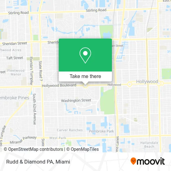
See Rudd & Diamond PA, Hollywood, on the map
Public Transit to Rudd & Diamond PA in Hollywood
Wondering how to get to Rudd & Diamond PA in Hollywood? Moovit helps you find the best way to get to Rudd & Diamond PA with step-by-step directions from the nearest public transit station.
Moovit provides free maps and live directions to help you navigate through your city. View schedules, routes, timetables, and find out how long does it take to get to Rudd & Diamond PA in real time.
Looking for the nearest stop or station to Rudd & Diamond PA? Check out this list of stops closest to your destination: Circle Drive/North Rainbow Drive; Sheridan Street Station; Hollywood Station.
Bus: 07, 09.Train: TRIRAIL, FLORIDIAN, SILVER METEOR.
Want to see if there’s another route that gets you there at an earlier time? Moovit helps you find alternative routes or times. Get directions from and directions to Rudd & Diamond PA easily from the Moovit App or Website.
We make riding to Rudd & Diamond PA easy, which is why over 1.5 million users, including users in Hollywood, trust Moovit as the best app for public transit. You don’t need to download an individual bus app or train app, Moovit is your all-in-one transit app that helps you find the best bus time or train time available.
For information on prices of bus and train, costs and ride fares to Rudd & Diamond PA, please check the Moovit app.
Use the app to navigate to popular places including to the airport, hospital, stadium, grocery store, mall, coffee shop, school, college, and university.
Rudd & Diamond PA Address: 4000 Hollywood Blvd Hollywood, FL 33021 street in Hollywood
- Barash Schatten Law,
- Donoway Center for Cancer Treatment and Prevention-Robert Donoway MD Facs,
- Current Capital Real Estate Group,
- Bernard Cohen Attorney,
- Kley Law, P.A,
- Tax Experts,
- Goldstein Schechter Koch,
- Abacus Therapies,
- Cranial Technologies,
- R Sebastian Wernicke - Premier Brokers International,
- JB Hunt Movers,
- Deonarine,
- Catering by JP,
- TK Bistro,
- 1st Florida Notary,
- Quality Screen Enclosures,
- JLP Education Services,
- Fast Agenda,
- Bank Reo Servicing,
- Legacy Solutions Law Firm
Places Near Rudd & Diamond PA (Hollywood)
- Marlins Park, Miami,
- Sawgrass Mall, Miami,
- Little Havana, Miami,
- Port of Miami Cruise Terminal, Miami,
- Wynwood, Miami,
- Hard Rock Stadium, Miami Gardens,
- Miami Freedom Park, Miami,
- Miami Design District, Miami,
- Sawgrass mall ( FL ), Miami Beach,
- Aventura Mall, Miami Beach,
- Dolphin Mall, Miami,
- Richard E. Gerstein Justice Building, Miami,
- Miami VA Hospital, Miami,
- Bayside Marketplace, Miami,
- Dolphin Mall Bus, Miami,
- Zoo Miami, Miami,
- Miami-Dade County Courthouse, Miami,
- Keiser University Flagship Campus, West Palm Beach,
- Brickell City Centre, Miami,
- Aventura Mall, Miami
How to get to popular places in Miami with public transit
Get around Hollywood by public transit!
Traveling around Hollywood has never been so easy. See step by step directions as you travel to any attraction, street or major public transit station. View bus and train schedules, arrival times, service alerts and detailed routes on a map, so you know exactly how to get to anywhere in Hollywood.
When traveling to any destination around Hollywood use Moovit's Live Directions with Get Off Notifications to know exactly where and how far to walk, how long to wait for your line, and how many stops are left. Moovit will alert you when it's time to get off — no need to constantly re-check whether yours is the next stop.
Wondering how to use public transit in Hollywood or how to pay for public transit in Hollywood? Moovit public transit app can help you navigate your way with public transit easily, and at minimum cost. It includes public transit fees, ticket prices, and costs. Looking for a map of Hollywood public transit lines? Moovit public transit app shows all public transit maps in Hollywood with all Bus, Train, Light Rail and Ferry routes and stops on an interactive map.
Miami has 4 transit type(s), including: Bus, Train, Light Rail and Ferry, operated by several transit agencies, including Broward County Transit, Miami-Dade Transit, Metrorail, Palm Tran, Tri-Rail, Brightline, MARTY, City of Homestead Trolley, Key West Transit, Treasure Coast Connector, GoLine IRT, Amtrak, Greyhound-us, FlixBus-us and Aventura Express Shuttle Bus