Directions to Rudden Peter (New York - New Jersey) with public transportation
The following transit lines have routes that pass near Rudden Peter
 Bus: C, UPL-EB, J MS, P MF.
- Train: 1, EMPIRE SERVICE, ADIRONDACK, BERKSHIRE FLYER, ETHAN ALLEN EXPRESS.
How to get to Rudden Peter by bus?
Click on the bus route to see step by step directions with maps, line arrival times and updated time schedules.
From Palisades mall, West Nyack
191 minFrom Regeneron Pharmaceuticals Inc, Tarrytown
196 minFrom 11A Bus to Port Authority, Spring Valley
301 minFrom Rockland #45 Express Bus to Port Authority Bus Terminal, NYC, Spring Valley
301 minFrom New City (New), New City
412 minFrom Peekskill, NY, Peekskill
247 min
How to get to Rudden Peter by train?
Click on the train route to see step by step directions with maps, line arrival times and updated time schedules.
Bus stops near Rudden Peter in New York - New Jersey
Train station near Rudden Peter in New York - New Jersey
- Poughkeepsie, 27 min walk,VIEW
Bus lines to Rudden Peter in New York - New Jersey
What are the closest stations to Rudden Peter?
The closest stations to Rudden Peter are:
- West Cedar Street E & Garden Street Ext is 501 yards away, 7 min walk.
- Washington Street & Clark Street is 745 yards away, 9 min walk.
- Bain Avenue W & Washington Street is 1102 yards away, 14 min walk.
- Poughkeepsie is 2219 yards away, 27 min walk.
Which bus lines stop near Rudden Peter?
These bus lines stop near Rudden Peter: C, UPL-EB.
Which train lines stop near Rudden Peter?
These train lines stop near Rudden Peter: 1, EMPIRE SERVICE.
What’s the nearest train station to Rudden Peter in New York - New Jersey?
The nearest train station to Rudden Peter in New York - New Jersey is Poughkeepsie. It’s a 27 min walk away.
What’s the nearest bus station to Rudden Peter in New York - New Jersey?
The nearest bus station to Rudden Peter in New York - New Jersey is West Cedar Street E & Garden Street Ext. It’s a 7 min walk away.
What time is the first train to Rudden Peter in New York - New Jersey?
The 1 is the first train that goes to Rudden Peter in New York - New Jersey. It stops nearby at 4:08 AM.
What time is the last train to Rudden Peter in New York - New Jersey?
The 1 is the last train that goes to Rudden Peter in New York - New Jersey. It stops nearby at 2:59 AM.
What time is the first bus to Rudden Peter in New York - New Jersey?
The C is the first bus that goes to Rudden Peter in New York - New Jersey. It stops nearby at 5:41 AM.
What time is the last bus to Rudden Peter in New York - New Jersey?
The C is the last bus that goes to Rudden Peter in New York - New Jersey. It stops nearby at 11:18 PM.
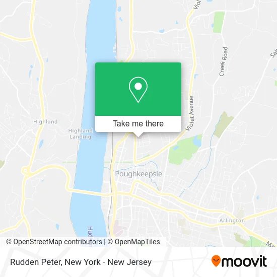
See Rudden Peter, New York - New Jersey, on the map
Public Transit to Rudden Peter in New York - New Jersey
Wondering how to get to Rudden Peter in New York - New Jersey? Moovit helps you find the best way to get to Rudden Peter with step-by-step directions from the nearest public transit station.
Moovit provides free maps and live directions to help you navigate through your city. View schedules, routes, timetables, and find out how long does it take to get to Rudden Peter in real time.
Looking for the nearest stop or station to Rudden Peter? Check out this list of stops closest to your destination: West Cedar Street E & Garden Street Ext; Washington Street & Clark Street; Bain Avenue W & Washington Street; Poughkeepsie.
Bus: C, UPL-EB, J MS, P MF.Train: 1, EMPIRE SERVICE, ADIRONDACK, BERKSHIRE FLYER, ETHAN ALLEN EXPRESS, LAKE SHORE LIMITED.
Want to see if there’s another route that gets you there at an earlier time? Moovit helps you find alternative routes or times. Get directions from and directions to Rudden Peter easily from the Moovit App or Website.
We make riding to Rudden Peter easy, which is why over 1.5 million users, including users in New York - New Jersey, trust Moovit as the best app for public transit. You don’t need to download an individual bus app or train app, Moovit is your all-in-one transit app that helps you find the best bus time or train time available.
For information on prices of bus and train, costs and ride fares to Rudden Peter, please check the Moovit app.
Use the app to navigate to popular places including to the airport, hospital, stadium, grocery store, mall, coffee shop, school, college, and university.
Rudden Peter Address: 1 Adams St Poughkeepsie, NY 12601 street in New York - New Jersey
- Midhudson Regional Hospital Emergency Department,
- Midhudson Regional Hospital Behavioral Health,
- Clark Respiratory,
- Celestino Sepulveda,
- Jean M. Delamothe, Md,
- Dutchess County Mental Hygiene,
- Bchp Neonatology Specialty,
- The Work Place,
- Wmchealth Physicians Advanced Ent Services,
- Wmchealth Physicians Orthopaedics, Webster Avenue, Poughkeepsie,
- Wmchealth Trauma Surgery,
- Bni Pk3k Wealth Builders,
- Wmchealth Physicians Cardiothoracic Surgery, Poughkeepsie,
- Wmchealth Physicians Multi-Specialty, Poughkeepsie,
- Wmchealth Physicians Family Medicine, Poughkeepsie,
- Wmchealth Physicians Pulmonary,
- Wmchealth Physicians Heart and Vascular Institute, Poughkeepsie,
- Professional Radiation Oncology,
- St Francis,
- Jayesh Modi
Places Near Rudden Peter (New York - New Jersey)
- Queens Center Mall, Queens,
- Wall Street, Manhattan,
- qqqq, Manhattan,
- 1 Police Plaza, Manhattan,
- Rockefeller Center, Manhattan,
- 911 Memorial, Manhattan,
- 376 Hudson Street, Manhattan,
- San Gennaro Feast, Manhattan,
- Katz's Deli, Manhattan,
- SoHo, Manhattan,
- 26 Federal Plaza, Manhattan,
- Hudson Yards, Manhattan,
- 3 Stone St, Manhattan,
- 111 Centre New York City Supreme Court, Manhattan,
- Bellevue Hospital, Manhattan,
- 66 John Street, Manhattan,
- Mountainside Hospital, Glen Ridge,
- Chinatown, Manhattan,
- Pier 83, Manhattan,
- Times Square, Manhattan
How to get to popular places in New York - New Jersey with public transit
Get around New York - New Jersey by public transit!
Traveling around New York - New Jersey has never been so easy. See step by step directions as you travel to any attraction, street or major public transit station. View bus and train schedules, arrival times, service alerts and detailed routes on a map, so you know exactly how to get to anywhere in New York - New Jersey.
When traveling to any destination around New York - New Jersey use Moovit's Live Directions with Get Off Notifications to know exactly where and how far to walk, how long to wait for your line, and how many stops are left. Moovit will alert you when it's time to get off — no need to constantly re-check whether yours is the next stop.
Wondering how to use public transit in New York - New Jersey or how to pay for public transit in New York - New Jersey? Moovit public transit app can help you navigate your way with public transit easily, and at minimum cost. It includes public transit fees, ticket prices, and costs. Looking for a map of New York - New Jersey public transit lines? Moovit public transit app shows all public transit maps in New York - New Jersey with all Bus, Train, Subway, Light Rail, Ferry and Cable Car routes and stops on an interactive map.
New York - New Jersey has 6 transit type(s), including: Bus, Train, Subway, Light Rail, Ferry and Cable Car, operated by several transit agencies, including MTA Subway, Metro-North Railroad, LIRR, PATH, MTA New York City Transit - Express routes, MTA Bus, NJ Transit, NYC Ferry, NICE bus, Bee-Line Bus, NJ Transit Rail, Norwalk Transit District, Hartford Line, River Valley Transit and HART