How to get to Rudi App by bus?
Click on the bus route to see step by step directions with maps, line arrival times and updated time schedules.
From Klinikum am Steinenberg, Reutlingen
48 minFrom Freibad Pfullingen, Pfullingen
45 minFrom Robert Bosch, Reutlingen
50 minFrom Stadion an der Kreuzeiche, Reutlingen
55 minFrom Eishalle Reutlingen, Reutlingen
43 minFrom Friedhof Römerschanze, Reutlingen
52 minFrom Geilhaus, Reutlingen-Betzingen
67 minFrom Industriegebiet West, Reutlingen-Betzingen
68 minFrom Hölderlin-Gymasium, Vereinbarte Verwaltungsgemeinschaft Der Stadt Nürtingen
79 minFrom Geilhaus Haus 33a, Reutlingen-Betzingen
67 min
How to get to Rudi App by train?
Click on the train route to see step by step directions with maps, line arrival times and updated time schedules.
From Klinikum am Steinenberg, Reutlingen
54 minFrom Robert Bosch, Reutlingen
46 minFrom Eishalle Reutlingen, Reutlingen
46 minFrom Geilhaus, Reutlingen-Betzingen
55 minFrom Industriegebiet West, Reutlingen-Betzingen
56 minFrom Hölderlin-Gymasium, Vereinbarte Verwaltungsgemeinschaft Der Stadt Nürtingen
67 minFrom Geilhaus Haus 33a, Reutlingen-Betzingen
55 min
Bus stops near Rudi App in Gemeindeverwaltungsverband Metzingen
Train stations near Rudi App in Gemeindeverwaltungsverband Metzingen
Bus lines to Rudi App in Gemeindeverwaltungsverband Metzingen
What are the closest stations to Rudi App?
The closest stations to Rudi App are:
- Neuhausen am Rösegarten is 155 meters away, 3 min walk.
- Metzingen is 543 meters away, 8 min walk.
- Metzingen Bahnhof is 550 meters away, 8 min walk.
- Neuhausen Bahnhof is 637 meters away, 9 min walk.
- Neuhausen Hardtsiedlung is 1039 meters away, 14 min walk.
Which bus lines stop near Rudi App?
These bus lines stop near Rudi App: 100, 197.
Which train lines stop near Rudi App?
These train lines stop near Rudi App: RB 63, RB63.
What’s the nearest train station to Rudi App in Gemeindeverwaltungsverband Metzingen?
The nearest train stations to Rudi App in Gemeindeverwaltungsverband Metzingen are Metzingen and Metzingen Bahnhof. The closest one is a 8 min walk away.
What’s the nearest bus station to Rudi App in Gemeindeverwaltungsverband Metzingen?
The nearest bus station to Rudi App in Gemeindeverwaltungsverband Metzingen is Neuhausen am Rösegarten. It’s a 3 min walk away.
What time is the first train to Rudi App in Gemeindeverwaltungsverband Metzingen?
The MEX12 is the first train that goes to Rudi App in Gemeindeverwaltungsverband Metzingen. It stops nearby at 4:34 AM.
What time is the last train to Rudi App in Gemeindeverwaltungsverband Metzingen?
The MEX12 is the last train that goes to Rudi App in Gemeindeverwaltungsverband Metzingen. It stops nearby at 1:32 AM.
What time is the first bus to Rudi App in Gemeindeverwaltungsverband Metzingen?
The 7640 is the first bus that goes to Rudi App in Gemeindeverwaltungsverband Metzingen. It stops nearby at 4:19 AM.
What time is the last bus to Rudi App in Gemeindeverwaltungsverband Metzingen?
The 7640 is the last bus that goes to Rudi App in Gemeindeverwaltungsverband Metzingen. It stops nearby at 11:24 PM.
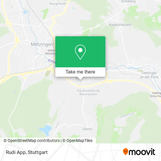
See Rudi App, Gemeindeverwaltungsverband Metzingen, on the map
Public Transit to Rudi App in Gemeindeverwaltungsverband Metzingen
Wondering how to get to Rudi App in Gemeindeverwaltungsverband Metzingen? Moovit helps you find the best way to get to Rudi App with step-by-step directions from the nearest public transit station.
Moovit provides free maps and live directions to help you navigate through your city. View schedules, routes, timetables, and find out how long does it take to get to Rudi App in real time.
Looking for the nearest stop or station to Rudi App? Check out this list of stops closest to your destination: Neuhausen am Rösegarten; Metzingen; Metzingen Bahnhof; Neuhausen Bahnhof; Neuhausen Hardtsiedlung.
Bus: 100, 197, 7640, NA 20, 201.Train: RB 63, RB63, RE6, MEX12, MEX18.
Want to see if there’s another route that gets you there at an earlier time? Moovit helps you find alternative routes or times. Get directions from and directions to Rudi App easily from the Moovit App or Website.
We make riding to Rudi App easy, which is why over 1.5 million users, including users in Gemeindeverwaltungsverband Metzingen, trust Moovit as the best app for public transit. You don’t need to download an individual bus app or train app, Moovit is your all-in-one transit app that helps you find the best bus time or train time available.
For information on prices of bus and train, costs and ride fares to Rudi App, please check the Moovit app.
Use the app to navigate to popular places including to the airport, hospital, stadium, grocery store, mall, coffee shop, school, college, and university.
Rudi App Address: Stauseestraße 5 Neuhausen, 72555 Metzingen street in Gemeindeverwaltungsverband Metzingen
- Glemser Stausee,
- Zwölf-Apostel-Kirche - Evangelische Kirchengemeinde Neuhausen-Erms,
- Gemeindebüro - Evangelische Kirchengemeinde Neuhausen - Erms,
- Ev. Pfarramt Neugereuth,
- Kirchenpflege,
- CVJM Neuhausen,
- Die Apis,
- Winter Bäckerei,
- Stadtbücherei Zweigstelle,
- Diakonie-Sozialstation,
- Vila Metzingen,
- Guski a. Dipl.Ing. FH Architekt,
- BW Fotosatz,
- Gästehaus Reusch,
- Spacelords Gb,
- Motel Route 216,
- Manfred Wagner Techn.Hdl. Kundendienst,
- Adelheid Stein,
- Jahn Irene,
- Kieferorthopädische
Places Near Rudi App (Gemeindeverwaltungsverband Metzingen)
- Mettingen Eros-Center Puff Laufhaus, Esslingen Am Neckar,
- Gasometer Pforzheim, Pforzheim,
- Porsche Museum, Zuffenhausen,
- Schleyerhalle, Bad Cannstatt,
- FlixBus Haltestelle, Stuttgart,
- Klinikum Stuttgart - Katharinenhospital, Stuttgart-Mitte,
- Hanns-Martin-Schleyer-Halle, Bad Cannstatt,
- Mercedes-Benz Museum (Mercedes Museum Stuttgart), Bad Cannstatt,
- SI-Centrum, Möhringen,
- Geilhaus Haus 33a, Reutlingen-Betzingen,
- Hanns-Martin-Schleyer-Halle (Stuttgart Hans-Martin-Schleyerhalle), Bad Cannstatt,
- Hauptbahnhof Stuttgart, Stuttgart-Mitte,
- Mercedes-Benz Museum, Bad Cannstatt,
- Wilhelma (U-Bahn Wilhelma), Bad Cannstatt,
- Pariser Platz Stuttgart, Stuttgart-Mitte,
- Im Wizemann (Halle), Bad Cannstatt,
- Gleis 101/102 (tief), Stuttgart-Mitte,
- Porsche-Arena, Bad Cannstatt,
- Waldfriedhof, Degerloch,
- Marmorsaal Im Weissenburgpark, Stuttgart-Süd
How to get to popular places in Stuttgart with public transit
Get around Gemeindeverwaltungsverband Metzingen by public transit!
Traveling around Gemeindeverwaltungsverband Metzingen has never been so easy. See step by step directions as you travel to any attraction, street or major public transit station. View bus and train schedules, arrival times, service alerts and detailed routes on a map, so you know exactly how to get to anywhere in Gemeindeverwaltungsverband Metzingen.
When traveling to any destination around Gemeindeverwaltungsverband Metzingen use Moovit's Live Directions with Get Off Notifications to know exactly where and how far to walk, how long to wait for your line, and how many stops are left. Moovit will alert you when it's time to get off — no need to constantly re-check whether yours is the next stop.
Wondering how to use public transit in Gemeindeverwaltungsverband Metzingen or how to pay for public transit in Gemeindeverwaltungsverband Metzingen? Moovit public transit app can help you navigate your way with public transit easily, and at minimum cost. It includes public transit fees, ticket prices, and costs. Looking for a map of Gemeindeverwaltungsverband Metzingen public transit lines? Moovit public transit app shows all public transit maps in Gemeindeverwaltungsverband Metzingen with all Bus, Train, Subway, Light Rail, Ferry, S-Bahn and Funicular routes and stops on an interactive map.
Stuttgart has 7 transit type(s), including: Bus, Train, Subway, Light Rail, Ferry, S-Bahn and Funicular, operated by several transit agencies, including SSB - Stadtbahn, SSB, SSB - Seilbahn / Zacke, S-Bahn Stuttgart, Rhein-Neckar-Verkehr GmbH (rnv), Karlsruher Verkehrsverbund, DB AG, DB Regiobus BW, Arverio Baden-Württemberg GmbH, DB RegioNetz Verkehrs GmbH Westfrankenbahn, DB Regio AG Baden-Württemberg, Südwestdeutsche Verkehrs-AG, DB Regio AG Mitte Region Hessen, DB and Bodensee-Oberschwaben-Bahn