How to get to Rudi Pflumm by bus?
Click on the bus route to see step by step directions with maps, line arrival times and updated time schedules.
From 71384, Weinstadt
50 minFrom Stetten, Kernen Im Remstal
73 minFrom Korber Höhe, Waiblingen
36 minFrom Media Markt Fellbach, Fellbach
68 minFrom Großaspach, Vereinbarte Verwaltungsgemeinschaft Der Stadt Backnang
192 minFrom Poppenweiler, Ludwigsburg
92 minFrom Diakonie Stetten, Kernen Im Remstal
106 minFrom Landratsamt, Waiblingen
42 minFrom RemsPark Waiblingen, Waiblingen
59 minFrom Benzach Bildungszentrum, Weinstadt
53 min
How to get to Rudi Pflumm by train?
Click on the train route to see step by step directions with maps, line arrival times and updated time schedules.
Bus stops near Rudi Pflumm in Gemeindeverwaltungsverband Winnenden
Train stations near Rudi Pflumm in Gemeindeverwaltungsverband Winnenden
Light Rail stations near Rudi Pflumm in Gemeindeverwaltungsverband Winnenden
- Nellmersbach Gleis 2, 13 min walk,VIEW
Bus lines to Rudi Pflumm in Gemeindeverwaltungsverband Winnenden
- 331, Ödernhardt Erlenhof,VIEW
- 333, Buoch Gemeindehaus,VIEW
- 334, Weiler Zum Stein Im Hummerholz,VIEW
- 335, Nellmersbach Gewerbegebiet,VIEW
- 336, Winnenden,VIEW
- 337, Baach (Winnenden) Ortsmitte,VIEW
- 339, Schwaikheim,VIEW
- 331, Winnenden - Breuningsweiler - Steinach (- Bretzenacker),VIEW
- 333, Winnenden - Buoch (- Rohrbronn) (Fahrrad2Go),VIEW
- 334, Schelmenholz - Winnenden - Leutenbach - Weiler z. S.,VIEW
- 335, Rems-Murr-Klinikum - Winnenden - Nellmersbach,VIEW
- 336, Winnenden - Birkmannsweiler - Erlenhof - Oppelsbohm,VIEW
- 337, Winnenden - Bürg - Oppelsbohm,VIEW
- 339, Korb - Schwaikheim - Winnenden ZOB - Rems-Murr-Klinikum,VIEW
- RT30, Reichenbach (Wn),VIEW
- RT31, Oppelsbohm Ortsmitte,VIEW
- 332, Hertm. Baacher Weg,VIEW
- RT332, Hertm. Baacher Weg,VIEW
- 337A, Winnenden Bildungsz. II,VIEW
What are the closest stations to Rudi Pflumm?
The closest stations to Rudi Pflumm are:
- Winnenden Wallstraße is 84 meters away, 2 min walk.
- Winnenden Ringstraße is 271 meters away, 4 min walk.
- Winnenden Kronenplatz is 323 meters away, 5 min walk.
- Winnenden Backnanger Str. is 396 meters away, 6 min walk.
- Winnenden Friedhof is 441 meters away, 6 min walk.
- Nellmersbach is 1003 meters away, 13 min walk.
- Nellmersbach Gleis 2 is 1003 meters away, 13 min walk.
- Winnenden is 3114 meters away, 41 min walk.
Which bus lines stop near Rudi Pflumm?
These bus lines stop near Rudi Pflumm: 330, 339, 456.
Which train line stops near Rudi Pflumm?
S3 (Stuttgart-Vaihingen)
Which S-Bahn line stops near Rudi Pflumm?
S3 (Backnang)
What’s the nearest light rail station to Rudi Pflumm in Gemeindeverwaltungsverband Winnenden?
The nearest light rail station to Rudi Pflumm in Gemeindeverwaltungsverband Winnenden is Nellmersbach Gleis 2. It’s a 13 min walk away.
What’s the nearest train station to Rudi Pflumm in Gemeindeverwaltungsverband Winnenden?
The nearest train station to Rudi Pflumm in Gemeindeverwaltungsverband Winnenden is Nellmersbach. It’s a 13 min walk away.
What’s the nearest bus station to Rudi Pflumm in Gemeindeverwaltungsverband Winnenden?
The nearest bus station to Rudi Pflumm in Gemeindeverwaltungsverband Winnenden is Winnenden Wallstraße. It’s a 2 min walk away.
What time is the first light rail to Rudi Pflumm in Gemeindeverwaltungsverband Winnenden?
The S3 is the first light rail that goes to Rudi Pflumm in Gemeindeverwaltungsverband Winnenden. It stops nearby at 4:01 AM.
What time is the last light rail to Rudi Pflumm in Gemeindeverwaltungsverband Winnenden?
The S3 is the last light rail that goes to Rudi Pflumm in Gemeindeverwaltungsverband Winnenden. It stops nearby at 1:42 AM.
What time is the first train to Rudi Pflumm in Gemeindeverwaltungsverband Winnenden?
The S3 is the first train that goes to Rudi Pflumm in Gemeindeverwaltungsverband Winnenden. It stops nearby at 4:01 AM.
What time is the last train to Rudi Pflumm in Gemeindeverwaltungsverband Winnenden?
The S3 is the last train that goes to Rudi Pflumm in Gemeindeverwaltungsverband Winnenden. It stops nearby at 1:42 AM.
What time is the first bus to Rudi Pflumm in Gemeindeverwaltungsverband Winnenden?
The 336 is the first bus that goes to Rudi Pflumm in Gemeindeverwaltungsverband Winnenden. It stops nearby at 5:07 AM.
What time is the last bus to Rudi Pflumm in Gemeindeverwaltungsverband Winnenden?
The RT31 is the last bus that goes to Rudi Pflumm in Gemeindeverwaltungsverband Winnenden. It stops nearby at 1:46 AM.
What time is the first S-Bahn to Rudi Pflumm in Gemeindeverwaltungsverband Winnenden?
The S3 is the first S-Bahn that goes to Rudi Pflumm in Gemeindeverwaltungsverband Winnenden. It stops nearby at 4:05 AM.
What time is the last S-Bahn to Rudi Pflumm in Gemeindeverwaltungsverband Winnenden?
The S3 is the last S-Bahn that goes to Rudi Pflumm in Gemeindeverwaltungsverband Winnenden. It stops nearby at 1:39 AM.
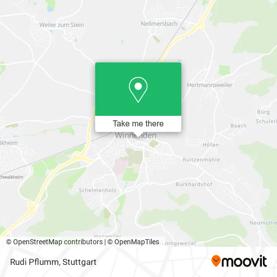
See Rudi Pflumm, Gemeindeverwaltungsverband Winnenden, on the map
Public Transit to Rudi Pflumm in Gemeindeverwaltungsverband Winnenden
Wondering how to get to Rudi Pflumm in Gemeindeverwaltungsverband Winnenden? Moovit helps you find the best way to get to Rudi Pflumm with step-by-step directions from the nearest public transit station.
Moovit provides free maps and live directions to help you navigate through your city. View schedules, routes, timetables, and find out how long does it take to get to Rudi Pflumm in real time.
Looking for the nearest stop or station to Rudi Pflumm? Check out this list of stops closest to your destination: Winnenden Wallstraße; Winnenden Ringstraße; Winnenden Kronenplatz; Winnenden Backnanger Str.; Winnenden Friedhof; Nellmersbach; Nellmersbach Gleis 2; Winnenden.
Bus: 330, 339, 456, 331, 333, 334, 335, 336, 331, 333, 334, 335, 336, RT30, RT31.Train: S3, MEX19, MEX90, RE90, MEX19, MEX90, RE90.S-Bahn: S3.
Want to see if there’s another route that gets you there at an earlier time? Moovit helps you find alternative routes or times. Get directions from and directions to Rudi Pflumm easily from the Moovit App or Website.
We make riding to Rudi Pflumm easy, which is why over 1.5 million users, including users in Gemeindeverwaltungsverband Winnenden, trust Moovit as the best app for public transit. You don’t need to download an individual bus app or train app, Moovit is your all-in-one transit app that helps you find the best bus time or train time available.
For information on prices of bus, S-Bahn and train, costs and ride fares to Rudi Pflumm, please check the Moovit app.
Use the app to navigate to popular places including to the airport, hospital, stadium, grocery store, mall, coffee shop, school, college, and university.
Rudi Pflumm Address: Schloßstraße 4 71364 Winnenden street in Gemeindeverwaltungsverband Winnenden
- Chaibella Fremdenzimmer & Monteurzimmer,
- B.Prestige,
- Bäckerei Pflumm,
- Pipolino,
- Mode Atelier Ka-Rio-Ka,
- Augenarzt Winnenden,
- Hörzentrum Feit - für Ihre Ohren Nur das Beste.,
- Hörzentrum Feit,
- Bäckerei Haag,
- Beauty Skin,
- Wiedmann GmbH Spielwaren,
- Вінненден,
- Виненден,
- Eva Kosmetik,
- Kertu Haare Ilona Derer,
- Altes Rathaus by What the Food,
- Vhs Winnenden,
- Bürgerstiftung Winnenden,
- Volksbank,
- Dz Bank AG Deutsche Zentral Genossenschaftsbank
Places Near Rudi Pflumm (Gemeindeverwaltungsverband Winnenden)
- Pariser Platz Stuttgart, Stuttgart-Mitte,
- Mercedes-Benz Museum, Bad Cannstatt,
- Marmorsaal Im Weissenburgpark, Stuttgart-Süd,
- Mercedes-Benz Museum (Mercedes Museum Stuttgart), Bad Cannstatt,
- Hauptbahnhof Stuttgart, Stuttgart-Mitte,
- Hanns-Martin-Schleyer-Halle (Stuttgart Hans-Martin-Schleyerhalle), Bad Cannstatt,
- Hanns-Martin-Schleyer-Halle, Bad Cannstatt,
- Mettingen Eros-Center Puff Laufhaus, Esslingen Am Neckar,
- Schleyerhalle, Bad Cannstatt,
- Im Wizemann (Halle), Bad Cannstatt,
- Geilhaus Haus 33a, Reutlingen-Betzingen,
- FlixBus Haltestelle, Stuttgart,
- Klinikum Stuttgart - Katharinenhospital, Stuttgart-Mitte,
- Wilhelma (U-Bahn Wilhelma), Bad Cannstatt,
- Porsche Museum, Zuffenhausen,
- Gasometer Pforzheim, Pforzheim,
- Porsche-Arena, Bad Cannstatt,
- Waldfriedhof, Degerloch,
- SI-Centrum, Möhringen,
- Gleis 101/102 (tief), Stuttgart-Mitte
How to get to popular places in Stuttgart with public transit
Get around Gemeindeverwaltungsverband Winnenden by public transit!
Traveling around Gemeindeverwaltungsverband Winnenden has never been so easy. See step by step directions as you travel to any attraction, street or major public transit station. View bus and train schedules, arrival times, service alerts and detailed routes on a map, so you know exactly how to get to anywhere in Gemeindeverwaltungsverband Winnenden.
When traveling to any destination around Gemeindeverwaltungsverband Winnenden use Moovit's Live Directions with Get Off Notifications to know exactly where and how far to walk, how long to wait for your line, and how many stops are left. Moovit will alert you when it's time to get off — no need to constantly re-check whether yours is the next stop.
Wondering how to use public transit in Gemeindeverwaltungsverband Winnenden or how to pay for public transit in Gemeindeverwaltungsverband Winnenden? Moovit public transit app can help you navigate your way with public transit easily, and at minimum cost. It includes public transit fees, ticket prices, and costs. Looking for a map of Gemeindeverwaltungsverband Winnenden public transit lines? Moovit public transit app shows all public transit maps in Gemeindeverwaltungsverband Winnenden with all Bus, Train, Subway, Light Rail, Ferry, S-Bahn and Funicular routes and stops on an interactive map.
Stuttgart has 7 transit type(s), including: Bus, Train, Subway, Light Rail, Ferry, S-Bahn and Funicular, operated by several transit agencies, including SSB - Stadtbahn, SSB, SSB - Seilbahn / Zacke, S-Bahn Stuttgart, Rhein-Neckar-Verkehr GmbH (rnv), Karlsruher Verkehrsverbund, DB AG, DB Regiobus BW, Arverio Baden-Württemberg GmbH, DB RegioNetz Verkehrs GmbH Westfrankenbahn, DB Regio AG Baden-Württemberg, Südwestdeutsche Verkehrs-AG, DB Regio AG Mitte Region Hessen, DB and Bodensee-Oberschwaben-Bahn