How to get to Rudolf-Bau by bus?
Click on the bus route to see step by step directions with maps, line arrival times and updated time schedules.
From Alb Thermen Bad Urach, Gemeindeverwaltungsverband Bad Urach
126 minFrom Reha-klinik Schwäbische Alb, Gemeindeverwaltungsverband Bad Urach
131 minFrom Freibad Pfullingen, Pfullingen
166 minFrom I&M Fachkliniken Hohenurach Haus 2, Gemeindeverwaltungsverband Bad Urach
128 minFrom M&I Fachkliniken Hohenurach, Gemeindeverwaltungsverband Bad Urach
132 minFrom 72793, Pfullingen
177 minFrom Parkplatz Ratiopharm Arena, Neu-Ulm
231 minFrom Uracher Wasserfall, Gemeindeverwaltungsverband Bad Urach
137 minFrom Kaufland, Pfullingen
174 min
How to get to Rudolf-Bau by train?
Click on the train route to see step by step directions with maps, line arrival times and updated time schedules.
From Alb Thermen Bad Urach, Gemeindeverwaltungsverband Bad Urach
239 minFrom Reha-klinik Schwäbische Alb, Gemeindeverwaltungsverband Bad Urach
240 minFrom I&M Fachkliniken Hohenurach Haus 2, Gemeindeverwaltungsverband Bad Urach
244 minFrom M&I Fachkliniken Hohenurach, Gemeindeverwaltungsverband Bad Urach
242 minFrom Parkplatz Ratiopharm Arena, Neu-Ulm
156 minFrom Uracher Wasserfall, Gemeindeverwaltungsverband Bad Urach
236 min
Bus stops near Rudolf-Bau in Obermarchtal
Train stations near Rudolf-Bau in Obermarchtal
Bus lines to Rudolf-Bau in Obermarchtal
What are the closest stations to Rudolf-Bau?
The closest stations to Rudolf-Bau are:
- Obermarchtal Schule is 262 meters away, 4 min walk.
- Obermarchtal S.-Sailer-Straße is 375 meters away, 6 min walk.
- Obermarchtal Kloster is 1144 meters away, 16 min walk.
- Rechtenstein Bahnhof is 2088 meters away, 28 min walk.
- Rechtenstein (Bahn) is 2090 meters away, 28 min walk.
Which train line stops near Rudolf-Bau?
RE 55 (Donaueschingen Bahnhof)
Which bus lines stop near Rudolf-Bau?
These bus lines stop near Rudolf-Bau: 316, 320.
What’s the nearest train station to Rudolf-Bau in Obermarchtal?
The nearest train stations to Rudolf-Bau in Obermarchtal are Rechtenstein Bahnhof and Rechtenstein (Bahn). The closest one is a 28 min walk away.
What’s the nearest bus station to Rudolf-Bau in Obermarchtal?
The nearest bus station to Rudolf-Bau in Obermarchtal is Obermarchtal Schule. It’s a 4 min walk away.
What time is the first train to Rudolf-Bau in Obermarchtal?
The RE 55 is the first train that goes to Rudolf-Bau in Obermarchtal. It stops nearby at 5:01 AM.
What time is the last train to Rudolf-Bau in Obermarchtal?
The RE55 is the last train that goes to Rudolf-Bau in Obermarchtal. It stops nearby at 11:26 PM.
What time is the first bus to Rudolf-Bau in Obermarchtal?
The 320 is the first bus that goes to Rudolf-Bau in Obermarchtal. It stops nearby at 5:29 AM.
What time is the last bus to Rudolf-Bau in Obermarchtal?
The ADK5 is the last bus that goes to Rudolf-Bau in Obermarchtal. It stops nearby at 12:28 AM.
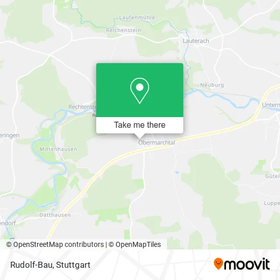
See Rudolf-Bau, Obermarchtal, on the map
Public Transit to Rudolf-Bau in Obermarchtal
Wondering how to get to Rudolf-Bau in Obermarchtal? Moovit helps you find the best way to get to Rudolf-Bau with step-by-step directions from the nearest public transit station.
Moovit provides free maps and live directions to help you navigate through your city. View schedules, routes, timetables, and find out how long does it take to get to Rudolf-Bau in real time.
Looking for the nearest stop or station to Rudolf-Bau? Check out this list of stops closest to your destination: Obermarchtal Schule; Obermarchtal S.-Sailer-Straße; Obermarchtal Kloster; Rechtenstein Bahnhof; Rechtenstein (Bahn).
Train: RE 55, RS3, RE55, RS 3.Bus: 316, 320, 329, ADK5, 325.
Want to see if there’s another route that gets you there at an earlier time? Moovit helps you find alternative routes or times. Get directions from and directions to Rudolf-Bau easily from the Moovit App or Website.
We make riding to Rudolf-Bau easy, which is why over 1.5 million users, including users in Obermarchtal, trust Moovit as the best app for public transit. You don’t need to download an individual bus app or train app, Moovit is your all-in-one transit app that helps you find the best bus time or train time available.
For information on prices of bus and train, costs and ride fares to Rudolf-Bau, please check the Moovit app.
Use the app to navigate to popular places including to the airport, hospital, stadium, grocery store, mall, coffee shop, school, college, and university.
Rudolf-Bau Address: Norbert-Jäger-Straße 21 89611 Obermarchtal street in Obermarchtal
- Karl-Heinz Stiehle Fahrschule,
- Jürgen Resch,
- Feuerwehr Obermarchtal,
- Annemarie Stöhr Hebamme,
- Sixtus-Bachmann-Grundschule Obermarchtal,
- Sixtus-Bachmann-Grundschule,
- Schule,
- German Bluegrass Music Association,
- Feldkreuz,
- Sporthalle,
- Gutberlet Energiekonzepte,
- Hans-Peter Striegel,
- Thurn & Taxis Waldpflege,
- Bikecity Marchtal,
- Leuchtdisplays Fertigung,
- Gsm Werbetechnik,
- Berghofstüble,
- J.W. Zander GmbH & Co. KG Freiburg i.Br.,
- Hubitron,
- Küchenzentrum Marchtal
Places Near Rudolf-Bau (Obermarchtal)
- Waldfriedhof, Degerloch,
- FlixBus Haltestelle, Stuttgart,
- Geilhaus Haus 33a, Reutlingen-Betzingen,
- Porsche-Arena, Bad Cannstatt,
- Gleis 101/102 (tief), Stuttgart-Mitte,
- Gasometer Pforzheim, Pforzheim,
- Wilhelma (U-Bahn Wilhelma), Bad Cannstatt,
- Hauptbahnhof Stuttgart, Stuttgart-Mitte,
- Hanns-Martin-Schleyer-Halle, Bad Cannstatt,
- Hanns-Martin-Schleyer-Halle (Stuttgart Hans-Martin-Schleyerhalle), Bad Cannstatt,
- Im Wizemann (Halle), Bad Cannstatt,
- Marmorsaal Im Weissenburgpark, Stuttgart-Süd,
- Mettingen Eros-Center Puff Laufhaus, Esslingen Am Neckar,
- SI-Centrum, Möhringen,
- Pariser Platz Stuttgart, Stuttgart-Mitte,
- Klinikum Stuttgart - Katharinenhospital, Stuttgart-Mitte,
- Mercedes-Benz Museum (Mercedes Museum Stuttgart), Bad Cannstatt,
- Porsche Museum, Zuffenhausen,
- Mercedes-Benz Museum, Bad Cannstatt,
- Schleyerhalle, Bad Cannstatt
How to get to popular places in Stuttgart with public transit
Get around Obermarchtal by public transit!
Traveling around Obermarchtal has never been so easy. See step by step directions as you travel to any attraction, street or major public transit station. View bus and train schedules, arrival times, service alerts and detailed routes on a map, so you know exactly how to get to anywhere in Obermarchtal.
When traveling to any destination around Obermarchtal use Moovit's Live Directions with Get Off Notifications to know exactly where and how far to walk, how long to wait for your line, and how many stops are left. Moovit will alert you when it's time to get off — no need to constantly re-check whether yours is the next stop.
Wondering how to use public transit in Obermarchtal or how to pay for public transit in Obermarchtal? Moovit public transit app can help you navigate your way with public transit easily, and at minimum cost. It includes public transit fees, ticket prices, and costs. Looking for a map of Obermarchtal public transit lines? Moovit public transit app shows all public transit maps in Obermarchtal with all Bus, Train, Subway, Light Rail, Ferry, S-Bahn and Funicular routes and stops on an interactive map.
Stuttgart has 7 transit type(s), including: Bus, Train, Subway, Light Rail, Ferry, S-Bahn and Funicular, operated by several transit agencies, including SSB - Stadtbahn, SSB, SSB - Seilbahn / Zacke, S-Bahn Stuttgart, Rhein-Neckar-Verkehr GmbH (rnv), Karlsruher Verkehrsverbund, DB AG, DB Regiobus BW, Arverio Baden-Württemberg GmbH, DB RegioNetz Verkehrs GmbH Westfrankenbahn, DB Regio AG Baden-Württemberg, Südwestdeutsche Verkehrs-AG, DB Regio AG Mitte Region Hessen, DB and Bodensee-Oberschwaben-Bahn