How to get to Rudolf Mohr by bus?
Click on the bus route to see step by step directions with maps, line arrival times and updated time schedules.
From Oh VV, Leutkirch
158 minFrom Asia World, Verwaltungsgemeinschaft Friedrichshafen
109 minFrom Klinik Tettnang, Tettnang
120 minFrom Kloster Untermarchtal, Verwaltungsgemeinschaft Munderkingen
248 minFrom Camping Iriswiese, Verwaltungsverband Eriskirch-Kressbronn am Bodensee-Langenargen
186 minFrom Compleo, Verwaltungsverband Mittleres Schussental
68 min
How to get to Rudolf Mohr by train?
Click on the train route to see step by step directions with maps, line arrival times and updated time schedules.
Bus stops near Rudolf Mohr in Verwaltungsverband Altshausen
Train station near Rudolf Mohr in Verwaltungsverband Altshausen
- Altshausen Bahnhof, 21 min walk,VIEW
Bus lines to Rudolf Mohr in Verwaltungsverband Altshausen
- 7567, Pfullendorf Zob,VIEW
- 290, Bad Saulgau Hummelschule,VIEW
- 7567.1, Riedhausen Schule - Altshausen Schule,VIEW
- 7570, Herbertingen Schule - Bad Saulgau Bahnhof,VIEW
- 7573.1, Aul.-Zollenreute Ambergstraße - Aulendorf Blönried Kindergarten,VIEW
- 240, Wilhelmsdorf Zußdorfer Straße,VIEW
- R65, Altshausen Rathaus,VIEW
What are the closest stations to Rudolf Mohr?
The closest stations to Rudolf Mohr are:
- Altshausen Schönenberg is 155 meters away, 3 min walk.
- Altshausen Schule is 199 meters away, 3 min walk.
- Altshausen Rathaus is 729 meters away, 10 min walk.
- Altshausen Bahnhof is 1595 meters away, 21 min walk.
Which train lines stop near Rudolf Mohr?
These train lines stop near Rudolf Mohr: RB 51, RE 6.
Which bus lines stop near Rudolf Mohr?
These bus lines stop near Rudolf Mohr: 7567, R65.
What’s the nearest train station to Rudolf Mohr in Verwaltungsverband Altshausen?
The nearest train station to Rudolf Mohr in Verwaltungsverband Altshausen is Altshausen Bahnhof. It’s a 21 min walk away.
What’s the nearest bus station to Rudolf Mohr in Verwaltungsverband Altshausen?
The nearest bus stations to Rudolf Mohr in Verwaltungsverband Altshausen are Altshausen Schönenberg and Altshausen Schule. The closest one is a 3 min walk away.
What time is the first bus to Rudolf Mohr in Verwaltungsverband Altshausen?
The 7567 is the first bus that goes to Rudolf Mohr in Verwaltungsverband Altshausen. It stops nearby at 5:36 AM.
What time is the last bus to Rudolf Mohr in Verwaltungsverband Altshausen?
The R65 is the last bus that goes to Rudolf Mohr in Verwaltungsverband Altshausen. It stops nearby at 11:59 PM.
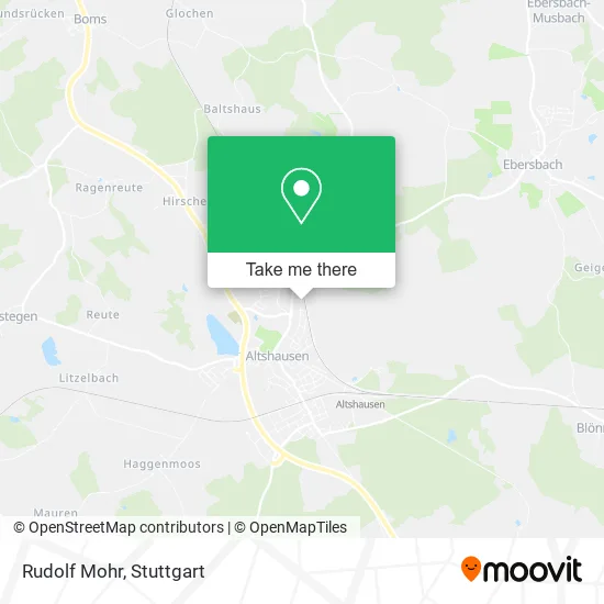
See Rudolf Mohr, Verwaltungsverband Altshausen, on the map
Public Transit to Rudolf Mohr in Verwaltungsverband Altshausen
Wondering how to get to Rudolf Mohr in Verwaltungsverband Altshausen? Moovit helps you find the best way to get to Rudolf Mohr with step-by-step directions from the nearest public transit station.
Moovit provides free maps and live directions to help you navigate through your city. View schedules, routes, timetables, and find out how long does it take to get to Rudolf Mohr in real time.
Looking for the nearest stop or station to Rudolf Mohr? Check out this list of stops closest to your destination: Altshausen Schönenberg; Altshausen Schule; Altshausen Rathaus; Altshausen Bahnhof.
Train: RB 51, RE 6, RB54, RB54.Bus: 7567, R65, 290, 7567.1, 7570, 7573.1, 240.
Want to see if there’s another route that gets you there at an earlier time? Moovit helps you find alternative routes or times. Get directions from and directions to Rudolf Mohr easily from the Moovit App or Website.
We make riding to Rudolf Mohr easy, which is why over 1.5 million users, including users in Verwaltungsverband Altshausen, trust Moovit as the best app for public transit. You don’t need to download an individual bus app or train app, Moovit is your all-in-one transit app that helps you find the best bus time or train time available.
For information on prices of train and bus, costs and ride fares to Rudolf Mohr, please check the Moovit app.
Use the app to navigate to popular places including to the airport, hospital, stadium, grocery store, mall, coffee shop, school, college, and university.
Rudolf Mohr Address: Saumstraße 46 88361 Altshausen street in Verwaltungsverband Altshausen
- Schulsportplatz Altshausen,
- Schönenberg,
- Annakapelle,
- Birkenmaier Otto J. Ingenieurbüro,
- Itek Ingenieurgesellschaft für Technische Entwicklung und Konstruktion,
- Altshausen,
- Schule,
- Oswald Horn,
- Grund- und Werkrealschule,
- Volkshochschule Oberschwaben,
- Gemeindeverwaltung Altshausen,
- Schönenberg,
- Progymnasium Altshausen,
- Ferienwohnung Engstler,
- Applyzer,
- Frank Schlageter,
- Green-Dan-Dragon-Tattoo,
- Medizinisches Versorgungszentrum Dr. König und Kollegen,
- Nikola Kseery,
- Kirsten Hinderer
Places Near Rudolf Mohr (Verwaltungsverband Altshausen)
- Hanns-Martin-Schleyer-Halle (Stuttgart Hans-Martin-Schleyerhalle), Bad Cannstatt,
- Pariser Platz Stuttgart, Stuttgart-Mitte,
- Hanns-Martin-Schleyer-Halle, Bad Cannstatt,
- Porsche Museum, Zuffenhausen,
- Wilhelma (U-Bahn Wilhelma), Bad Cannstatt,
- Porsche-Arena, Bad Cannstatt,
- Hauptbahnhof Stuttgart, Stuttgart-Mitte,
- Geilhaus Haus 33a, Reutlingen-Betzingen,
- Mercedes-Benz Museum, Bad Cannstatt,
- SI-Centrum, Möhringen,
- Schleyerhalle, Bad Cannstatt,
- Mercedes-Benz Museum (Mercedes Museum Stuttgart), Bad Cannstatt,
- Mettingen Eros-Center Puff Laufhaus, Esslingen Am Neckar,
- Klinikum Stuttgart - Katharinenhospital, Stuttgart-Mitte,
- Gasometer Pforzheim, Pforzheim,
- FlixBus Haltestelle, Stuttgart,
- Waldfriedhof, Degerloch,
- Gleis 101/102 (tief), Stuttgart-Mitte,
- Marmorsaal Im Weissenburgpark, Stuttgart-Süd,
- Im Wizemann (Halle), Bad Cannstatt
How to get to popular places in Stuttgart with public transit
Get around Verwaltungsverband Altshausen by public transit!
Traveling around Verwaltungsverband Altshausen has never been so easy. See step by step directions as you travel to any attraction, street or major public transit station. View bus and train schedules, arrival times, service alerts and detailed routes on a map, so you know exactly how to get to anywhere in Verwaltungsverband Altshausen.
When traveling to any destination around Verwaltungsverband Altshausen use Moovit's Live Directions with Get Off Notifications to know exactly where and how far to walk, how long to wait for your line, and how many stops are left. Moovit will alert you when it's time to get off — no need to constantly re-check whether yours is the next stop.
Wondering how to use public transit in Verwaltungsverband Altshausen or how to pay for public transit in Verwaltungsverband Altshausen? Moovit public transit app can help you navigate your way with public transit easily, and at minimum cost. It includes public transit fees, ticket prices, and costs. Looking for a map of Verwaltungsverband Altshausen public transit lines? Moovit public transit app shows all public transit maps in Verwaltungsverband Altshausen with all Bus, Train, Subway, Light Rail, Ferry, S-Bahn and Funicular routes and stops on an interactive map.
Stuttgart has 7 transit type(s), including: Bus, Train, Subway, Light Rail, Ferry, S-Bahn and Funicular, operated by several transit agencies, including SSB - Stadtbahn, SSB, SSB - Seilbahn / Zacke, S-Bahn Stuttgart, Rhein-Neckar-Verkehr GmbH (rnv), Karlsruher Verkehrsverbund, DB AG, DB Regiobus BW, Arverio Baden-Württemberg GmbH, DB RegioNetz Verkehrs GmbH Westfrankenbahn, DB Regio AG Baden-Württemberg, Südwestdeutsche Verkehrs-AG, DB Regio AG Mitte Region Hessen, DB and Bodensee-Oberschwaben-Bahn