Directions to Rudolph Pediatric Emergency Center (Queens) with public transportation
The following transit lines have routes that pass near Rudolph Pediatric Emergency Center
 Bus: N25, Q46, QM6, QM36, N26.
- Train: HEMPSTEAD BRANCH, PORT JEFFERSON BRANCH, RONKONKOMA BRANCH, PORT WASHINGTON BRANCH.
How to get to Rudolph Pediatric Emergency Center by bus?
Click on the bus route to see step by step directions with maps, line arrival times and updated time schedules.
From DMV Jamaica Office, Queens
55 minFrom Roosevelt Field Mall Bus Terminal, East Garden City
72 minFrom Walmart, Valley Stream
78 minFrom New World Mall, Queens
60 minFrom Fresh Meadows, Queens
46 minFrom Queens County Civil Court, Queens
64 minFrom St. John's University, Queens
41 minFrom Walmart, Queens
62 minFrom Westbury, NY, Westbury
93 minFrom Green Acres Mall, South Valley Stream
82 min
How to get to Rudolph Pediatric Emergency Center by train?
Click on the train route to see step by step directions with maps, line arrival times and updated time schedules.
Bus stops near Rudolph Pediatric Emergency Center in Queens
Train stations near Rudolph Pediatric Emergency Center in Queens
Bus lines to Rudolph Pediatric Emergency Center in Queens
What are the closest stations to Rudolph Pediatric Emergency Center?
The closest stations to Rudolph Pediatric Emergency Center are:
- Lij Medical Ctr/271 St is 399 yards away, 5 min walk.
- Li Jewish Medical Ctr is 897 yards away, 11 min walk.
- New Hyde Park is 3392 yards away, 40 min walk.
- Floral Park is 3489 yards away, 41 min walk.
- Little Neck is 3953 yards away, 47 min walk.
Which bus lines stop near Rudolph Pediatric Emergency Center?
These bus lines stop near Rudolph Pediatric Emergency Center: N25, Q46.
Which train lines stop near Rudolph Pediatric Emergency Center?
These train lines stop near Rudolph Pediatric Emergency Center: HEMPSTEAD BRANCH, PORT JEFFERSON BRANCH.
What’s the nearest bus station to Rudolph Pediatric Emergency Center in Queens?
The nearest bus station to Rudolph Pediatric Emergency Center in Queens is Lij Medical Ctr/271 St. It’s a 5 min walk away.
What time is the first train to Rudolph Pediatric Emergency Center in Queens?
The HEMPSTEAD BRANCH is the first train that goes to Rudolph Pediatric Emergency Center in Queens. It stops nearby at 3:11 AM.
What time is the last train to Rudolph Pediatric Emergency Center in Queens?
The HEMPSTEAD BRANCH is the last train that goes to Rudolph Pediatric Emergency Center in Queens. It stops nearby at 3:13 AM.
What time is the first bus to Rudolph Pediatric Emergency Center in Queens?
The Q46 is the first bus that goes to Rudolph Pediatric Emergency Center in Queens. It stops nearby at 3:40 AM.
What time is the last bus to Rudolph Pediatric Emergency Center in Queens?
The Q46 is the last bus that goes to Rudolph Pediatric Emergency Center in Queens. It stops nearby at 2:46 AM.
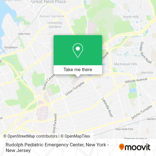
See Rudolph Pediatric Emergency Center, Queens, on the map
Public Transit to Rudolph Pediatric Emergency Center in Queens
Wondering how to get to Rudolph Pediatric Emergency Center in Queens? Moovit helps you find the best way to get to Rudolph Pediatric Emergency Center with step-by-step directions from the nearest public transit station.
Moovit provides free maps and live directions to help you navigate through your city. View schedules, routes, timetables, and find out how long does it take to get to Rudolph Pediatric Emergency Center in real time.
Looking for the nearest stop or station to Rudolph Pediatric Emergency Center? Check out this list of stops closest to your destination: Lij Medical Ctr/271 St; Li Jewish Medical Ctr; New Hyde Park; Floral Park; Little Neck.
Bus: N25, Q46, QM6, QM36, N26, N25/58.Train: HEMPSTEAD BRANCH, PORT JEFFERSON BRANCH, RONKONKOMA BRANCH, PORT WASHINGTON BRANCH.
Want to see if there’s another route that gets you there at an earlier time? Moovit helps you find alternative routes or times. Get directions from and directions to Rudolph Pediatric Emergency Center easily from the Moovit App or Website.
We make riding to Rudolph Pediatric Emergency Center easy, which is why over 1.5 million users, including users in Queens, trust Moovit as the best app for public transit. You don’t need to download an individual bus app or train app, Moovit is your all-in-one transit app that helps you find the best bus time or train time available.
For information on prices of bus and train, costs and ride fares to Rudolph Pediatric Emergency Center, please check the Moovit app.
Use the app to navigate to popular places including to the airport, hospital, stadium, grocery store, mall, coffee shop, school, college, and university.
Location: Queens, New York - New Jersey
- Lij Emergency Room,
- Children's Heart Center,
- Lij Medical Center,
- 270-05 76th Ave,
- Cohen Children's Medical Center of New York,
- Sujatha Rajan,
- Jose M Prince,
- Suresh K Nathan,
- Anshul K Vagrecha,
- Christine A Capone,
- Mark P Atlas,
- Ccmc - Dept Of Pediatrics/ Infectious Diseases,
- Abena O Appiah-Kubi,
- Matthew D Taylor,
- Mundeep K Kainth,
- Kimberly W Lau,
- Robert I Koppel,
- Joel Aaron Brochstein, Md,
- Peter Charles Silver, Md, Mba,
- Rachel Markowitz Kessel, Md
Places Near Rudolph Pediatric Emergency Center (Queens)
- 66 John Street, Manhattan,
- Wall Street, Manhattan,
- Hudson Yards, Manhattan,
- 911 Memorial, Manhattan,
- Mountainside Hospital, Glen Ridge,
- Bellevue Hospital, Manhattan,
- Pier 83, Manhattan,
- Queens Center Mall, Queens,
- qqqq, Manhattan,
- Chinatown, Manhattan,
- 26 Federal Plaza, Manhattan,
- Katz's Deli, Manhattan,
- SoHo, Manhattan,
- 1 Police Plaza, Manhattan,
- Rockefeller Center, Manhattan,
- 3 Stone St, Manhattan,
- 376 Hudson Street, Manhattan,
- 111 Centre New York City Supreme Court, Manhattan,
- San Gennaro Feast, Manhattan,
- Times Square, Manhattan
How to get to popular places in New York - New Jersey with public transit
Get around Queens by public transit!
Traveling around Queens has never been so easy. See step by step directions as you travel to any attraction, street or major public transit station. View bus and train schedules, arrival times, service alerts and detailed routes on a map, so you know exactly how to get to anywhere in Queens.
When traveling to any destination around Queens use Moovit's Live Directions with Get Off Notifications to know exactly where and how far to walk, how long to wait for your line, and how many stops are left. Moovit will alert you when it's time to get off — no need to constantly re-check whether yours is the next stop.
Wondering how to use public transit in Queens or how to pay for public transit in Queens? Moovit public transit app can help you navigate your way with public transit easily, and at minimum cost. It includes public transit fees, ticket prices, and costs. Looking for a map of Queens public transit lines? Moovit public transit app shows all public transit maps in Queens with all Bus, Train, Subway, Light Rail, Ferry and Cable Car routes and stops on an interactive map.
New York - New Jersey has 6 transit type(s), including: Bus, Train, Subway, Light Rail, Ferry and Cable Car, operated by several transit agencies, including MTA Subway, Metro-North Railroad, LIRR, PATH, MTA New York City Transit - Express routes, MTA Bus, NJ Transit, NYC Ferry, NICE bus, Bee-Line Bus, NJ Transit Rail, Norwalk Transit District, Hartford Line, River Valley Transit and HART