How to get to Rudraks by bus?
Click on the bus route to see step by step directions with maps, line arrival times and updated time schedules.
From Astor Place, Manhattan
66 minFrom Armory Track & Field, Manhattan
37 minFrom Bronx VA Medical Center, Bronx
50 minFrom Trinity Church, Manhattan
83 minFrom Pier 16, Manhattan
77 minFrom One World Observatory, Manhattan
84 minFrom Columbia Presbyterian Hospital, Manhattan
61 minFrom South Street Seaport, Manhattan
77 minFrom Printemps, Manhattan
85 minFrom Walmart, Jersey City
90 min
How to get to Rudraks by train?
Click on the train route to see step by step directions with maps, line arrival times and updated time schedules.
How to get to Rudraks by subway?
Click on the subway route to see step by step directions with maps, line arrival times and updated time schedules.
From Astor Place, Manhattan
25 minFrom Armory Track & Field, Manhattan
23 minFrom Bronx VA Medical Center, Bronx
47 minFrom Trinity Church, Manhattan
35 minFrom Pier 16, Manhattan
35 minFrom One World Observatory, Manhattan
29 minFrom Columbia Presbyterian Hospital, Manhattan
32 minFrom South Street Seaport, Manhattan
35 minFrom Printemps, Manhattan
29 min
Bus stops near Rudraks in Manhattan
Subway stations near Rudraks in Manhattan
- 96 St, 3 min walk,VIEW
Bus lines to Rudraks in Manhattan
What are the closest stations to Rudraks?
The closest stations to Rudraks are:
- Amsterdam Av/W 93 St is 94 yards away, 2 min walk.
- W 96 St/Amsterdam Av is 156 yards away, 2 min walk.
- 96 St is 199 yards away, 3 min walk.
- Broadway/W 93 St is 230 yards away, 3 min walk.
Which bus lines stop near Rudraks?
These bus lines stop near Rudraks: M104, M5, M7, M96.
Which train lines stop near Rudraks?
These train lines stop near Rudraks: 1, 3.
Which subway lines stop near Rudraks?
These subway lines stop near Rudraks: 1, 2, 3.
What’s the nearest subway station to Rudraks in Manhattan?
The nearest subway station to Rudraks in Manhattan is 96 St. It’s a 3 min walk away.
What’s the nearest bus station to Rudraks in Manhattan?
The nearest bus stations to Rudraks in Manhattan are Amsterdam Av/W 93 St and W 96 St/Amsterdam Av. The closest one is a 2 min walk away.
What time is the first subway to Rudraks in Manhattan?
The 1 is the first subway that goes to Rudraks in Manhattan. It stops nearby at 3:01 AM.
What time is the last subway to Rudraks in Manhattan?
The A is the last subway that goes to Rudraks in Manhattan. It stops nearby at 4:08 AM.
What time is the first bus to Rudraks in Manhattan?
The M96 is the first bus that goes to Rudraks in Manhattan. It stops nearby at 3:00 AM.
What time is the last bus to Rudraks in Manhattan?
The M7 is the last bus that goes to Rudraks in Manhattan. It stops nearby at 3:01 AM.
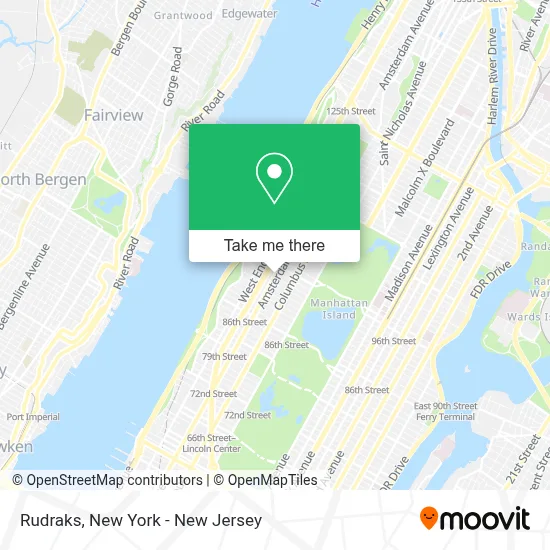
See Rudraks, Manhattan, on the map
Public Transit to Rudraks in Manhattan
Wondering how to get to Rudraks in Manhattan? Moovit helps you find the best way to get to Rudraks with step-by-step directions from the nearest public transit station.
Moovit provides free maps and live directions to help you navigate through your city. View schedules, routes, timetables, and find out how long does it take to get to Rudraks in real time.
Looking for the nearest stop or station to Rudraks? Check out this list of stops closest to your destination: Amsterdam Av/W 93 St; W 96 St/Amsterdam Av; 96 St; Broadway/W 93 St.
Bus: M104, M5, M7, M96, M11, M106.Train: 1, 3.Subway: 1, 2, 3, A, B, C.
Want to see if there’s another route that gets you there at an earlier time? Moovit helps you find alternative routes or times. Get directions from and directions to Rudraks easily from the Moovit App or Website.
We make riding to Rudraks easy, which is why over 1.5 million users, including users in Manhattan, trust Moovit as the best app for public transit. You don’t need to download an individual bus app or train app, Moovit is your all-in-one transit app that helps you find the best bus time or train time available.
For information on prices of subway, bus and train, costs and ride fares to Rudraks, please check the Moovit app.
Use the app to navigate to popular places including to the airport, hospital, stadium, grocery store, mall, coffee shop, school, college, and university.
Rudraks Address: 706 Amsterdam Ave street in Manhattan
- 710west Bar, Restaurant, & Lounge,
- The Throwback,
- Asia Kan,
- Arts In Action Vap,
- Jls Photo,
- Enterprise Rent-A-Car,
- Aveda,
- Soccer Post Upper West Side,
- W 95th and Amsterdam,
- Dahlia Upper West Side,
- Back Porch Soap Company,
- Nycha De Hostos Community Center,
- Vine,
- Shah's Halal Food,
- Tandoori Bar & Restaurant,
- Days Hotel by Wyndham on Broadway Nyc,
- Omakase 95,
- The West Side Commons,
- Charm Thai,
- Night Hotel Broadway
Places Near Rudraks (Manhattan)
- Times Square, Manhattan,
- Bellevue Hospital, Manhattan,
- Wall Street, Manhattan,
- Chinatown, Manhattan,
- 26 Federal Plaza, Manhattan,
- SoHo, Manhattan,
- Rockefeller Center, Manhattan,
- 1 Police Plaza, Manhattan,
- Hudson Yards, Manhattan,
- 111 Centre New York City Supreme Court, Manhattan,
- 911 Memorial, Manhattan,
- Pier 83, Manhattan,
- qqqq, Manhattan,
- 376 Hudson Street, Manhattan,
- Mountainside Hospital, Glen Ridge,
- Queens Center Mall, Queens,
- San Gennaro Feast, Manhattan,
- 66 John Street, Manhattan,
- 3 Stone St, Manhattan,
- Katz's Deli, Manhattan
How to get to popular places in New York - New Jersey with public transit
Get around Manhattan by public transit!
Traveling around Manhattan has never been so easy. See step by step directions as you travel to any attraction, street or major public transit station. View bus and train schedules, arrival times, service alerts and detailed routes on a map, so you know exactly how to get to anywhere in Manhattan.
When traveling to any destination around Manhattan use Moovit's Live Directions with Get Off Notifications to know exactly where and how far to walk, how long to wait for your line, and how many stops are left. Moovit will alert you when it's time to get off — no need to constantly re-check whether yours is the next stop.
Wondering how to use public transit in Manhattan or how to pay for public transit in Manhattan? Moovit public transit app can help you navigate your way with public transit easily, and at minimum cost. It includes public transit fees, ticket prices, and costs. Looking for a map of Manhattan public transit lines? Moovit public transit app shows all public transit maps in Manhattan with all Bus, Train, Subway, Light Rail, Ferry and Cable Car routes and stops on an interactive map.
New York - New Jersey has 6 transit type(s), including: Bus, Train, Subway, Light Rail, Ferry and Cable Car, operated by several transit agencies, including MTA Subway, Metro-North Railroad, LIRR, PATH, MTA New York City Transit - Express routes, MTA Bus, NJ Transit, NYC Ferry, NICE bus, Bee-Line Bus, NJ Transit Rail, Norwalk Transit District, Hartford Line, River Valley Transit and HART