How to get to Rue 21 by bus?
Click on the bus route to see step by step directions with maps, line arrival times and updated time schedules.
From City-County Building Observation Deck, Indianapolis City (Balance)
40 minFrom Marion Superior Court Probation Drug Testing Laboratory, Indianapolis City (Balance)
42 minFrom Averhealth - in Centra, Indianapolis City (Balance)
40 minFrom Yrc/Usf Drop Lot, Indianapolis City (Balance)
86 minFrom Amazon Fulfillment Center - IND8, Indianapolis City (Balance)
89 minFrom North Street and New Jersey Street, Indianapolis City (Balance)
48 minFrom Murat Theater At Old National Center, Indianapolis City (Balance)
41 minFrom Great Oaks Commons (dog park), Indianapolis City (Balance)
51 minFrom Greyhound Bus, Indianapolis City (Balance)
52 min
Bus stops near Rue 21 in Speedway
What are the closest stations to Rue 21?
The closest stations to Rue 21 are:
- Meadowood Dr & Private Dr is 191 yards away, 3 min walk.
- Cunningham Rd & Private Dr is 362 yards away, 5 min walk.
Which bus lines stop near Rue 21?
These bus lines stop near Rue 21: 10, 25.
What’s the nearest bus station to Rue 21 in Speedway?
The nearest bus station to Rue 21 in Speedway is Meadowood Dr & Private Dr. It’s a 3 min walk away.
What time is the first bus to Rue 21 in Speedway?
The 25 is the first bus that goes to Rue 21 in Speedway. It stops nearby at 4:48 AM.
What time is the last bus to Rue 21 in Speedway?
The 10 is the last bus that goes to Rue 21 in Speedway. It stops nearby at 11:45 PM.
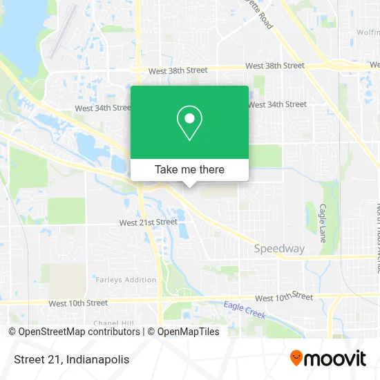
See Rue 21, Speedway, on the map
Public Transit to Rue 21 in Speedway
Wondering how to get to Rue 21 in Speedway? Moovit helps you find the best way to get to Rue 21 with step-by-step directions from the nearest public transit station.
Moovit provides free maps and live directions to help you navigate through your city. View schedules, routes, timetables, and find out how long does it take to get to Rue 21 in real time.
Looking for the nearest stop or station to Rue 21? Check out this list of stops closest to your destination: Meadowood Dr & Private Dr; Cunningham Rd & Private Dr.
Bus: 10, 25.
Want to see if there’s another route that gets you there at an earlier time? Moovit helps you find alternative routes or times. Get directions from and directions to Rue 21 easily from the Moovit App or Website.
We make riding to Rue 21 easy, which is why over 1.5 million users, including users in Speedway, trust Moovit as the best app for public transit. You don’t need to download an individual bus app or train app, Moovit is your all-in-one transit app that helps you find the best bus time or train time available.
For information on prices of bus, costs and ride fares to Rue 21, please check the Moovit app.
Use the app to navigate to popular places including to the airport, hospital, stadium, grocery store, mall, coffee shop, school, college, and university.
Rue 21 Address: 5840 Crawfordsville Rd street in Speedway
- Popshelf,
- Rainbow Apparel Company,
- #1 China,
- Marias Hair Braiding,
- Arshiya Baig, do,
- Brooke Humphrey, NP,
- Maria Wilson, MD,
- Stephanie A. McCardle, MD,
- Dr Charles Miramonti, MD Primary Care Physician,
- Diana Nguyen, DPM,
- Brenda L. Hardin, LCSW,
- Ecoatm,
- Coinstar - Bitcoin ATM,
- Speedway Shopping Center,
- Blue Locksmith Inc Indianapolis,
- Fifth Third Mortgage - Elgin Wren,
- Luxx Nail Lounge,
- Plumbing Slab Leak Repair,
- Harbor Freight Tools,
- Indianapolis Virtuoso Plumbing Service
Places Near Rue 21 (Speedway)
- Gainbridge Fieldhouse, Indianapolis City (Balance),
- Indianapolis Motor Speedway, Speedway,
- Cotter's Massage Parlor With Happy Endings, Indianapolis City (Balance),
- Train Ride At Castleton Mall, Indianapolis City (Balance),
- I U Health Methodist Hospital, Indianapolis City (Balance),
- Plainfield, IN, Plainfield,
- Indiana Convention Center, Indianapolis City (Balance),
- Eskenazi Hospital, Indianapolis City (Balance),
- Indiana, Indianapolis City (Balance),
- Indianapolis Airport Zone 2, Indianapolis City (Balance),
- Methodist Hospital of Indianapolis, Indianapolis City (Balance),
- St. Vincent entrance #1, Indianapolis City (Balance),
- 119 W 19th St Parking, Indianapolis City (Balance),
- I-465 / I-65 Interchange, Indianapolis City (Balance),
- Lucas Oil Stadium, Indianapolis City (Balance),
- THE BALT, Indianapolis City (Balance),
- St. Vincent Hospital - Indianapolis, Indianapolis City (Balance),
- Lilly Corporate Center (Eli Lilly & Co), Indianapolis City (Balance),
- Jersey Barn, Indianapolis City (Balance),
- Castleton Square Mall, Indianapolis
How to get to popular places in Indianapolis with public transit
Get around Speedway by public transit!
Traveling around Speedway has never been so easy. See step by step directions as you travel to any attraction, street or major public transit station. View bus and train schedules, arrival times, service alerts and detailed routes on a map, so you know exactly how to get to anywhere in Speedway.
When traveling to any destination around Speedway use Moovit's Live Directions with Get Off Notifications to know exactly where and how far to walk, how long to wait for your line, and how many stops are left. Moovit will alert you when it's time to get off — no need to constantly re-check whether yours is the next stop.
Wondering how to use public transit in Speedway or how to pay for public transit in Speedway? Moovit public transit app can help you navigate your way with public transit easily, and at minimum cost. It includes public transit fees, ticket prices, and costs. Looking for a map of Speedway public transit lines? Moovit public transit app shows all public transit maps in Speedway with all bus routes and stops on an interactive map.
Indianapolis has 1 transit type(s), including: bus, operated by several transit agencies, including IndyGo, FlixBus-us and Greyhound-us