How to get to Rue Charlemagne by bus?
Click on the bus route to see step by step directions with maps, line arrival times and updated time schedules.
From 40 Rue de Paris, Clichy
44 minFrom Meudon, Meudon
69 minFrom 93130, Noisy-Le-Sec
66 minFrom Parc Floral de Paris, Paris
56 minFrom Passerelle de l'Avre, Saint-Cloud
56 minFrom Chevilly-Larue, Chevilly-Larue
74 minFrom La Seine Musicale, Boulogne-Billancourt
62 minFrom Suresnes, Suresnes
65 minFrom Centre Cardiologique du Nord, Saint-Denis
71 minFrom Novotel Paris Centre Tour Eiffel, Paris
32 min
How to get to Rue Charlemagne by metro?
Click on the metro route to see step by step directions with maps, line arrival times and updated time schedules.
From 40 Rue de Paris, Clichy
33 minFrom 93130, Noisy-Le-Sec
51 minFrom Parc Floral de Paris, Paris
38 minFrom Passerelle de l'Avre, Saint-Cloud
63 minFrom Chevilly-Larue, Chevilly-Larue
53 minFrom La Seine Musicale, Boulogne-Billancourt
50 minFrom Centre Cardiologique du Nord, Saint-Denis
57 minFrom Novotel Paris Centre Tour Eiffel, Paris
37 min
Bus stops near Rue Charlemagne in Paris
Metro stations near Rue Charlemagne in Paris
Bus lines to Rue Charlemagne in Paris
What are the closest stations to Rue Charlemagne?
The closest stations to Rue Charlemagne are:
- Birague is 161 meters away, 3 min walk.
- Saint-Paul is 221 meters away, 4 min walk.
- Saint-Paul (Le Marais) is 283 meters away, 4 min walk.
- Sully - Morland is 326 meters away, 5 min walk.
- Pont Marie is 371 meters away, 5 min walk.
- Place Des Vosges is 394 meters away, 6 min walk.
- Bastille is 414 meters away, 6 min walk.
Which metro lines stop near Rue Charlemagne?
These metro lines stop near Rue Charlemagne: 1, 7.
Which bus lines stop near Rue Charlemagne?
These bus lines stop near Rue Charlemagne: 69, 72, 86, 96.
What’s the nearest metro station to Rue Charlemagne in Paris?
The nearest metro station to Rue Charlemagne in Paris is Saint-Paul (Le Marais). It’s a 4 min walk away.
What’s the nearest bus station to Rue Charlemagne in Paris?
The nearest bus station to Rue Charlemagne in Paris is Birague. It’s a 3 min walk away.
What time is the first metro to Rue Charlemagne in Paris?
The 1 is the first metro that goes to Rue Charlemagne in Paris. It stops nearby at 5:32 AM.
What time is the last metro to Rue Charlemagne in Paris?
The 5 is the last metro that goes to Rue Charlemagne in Paris. It stops nearby at 1:07 AM.
What time is the first bus to Rue Charlemagne in Paris?
The N11 is the first bus that goes to Rue Charlemagne in Paris. It stops nearby at 3:00 AM.
What time is the last bus to Rue Charlemagne in Paris?
The N16 is the last bus that goes to Rue Charlemagne in Paris. It stops nearby at 3:28 AM.
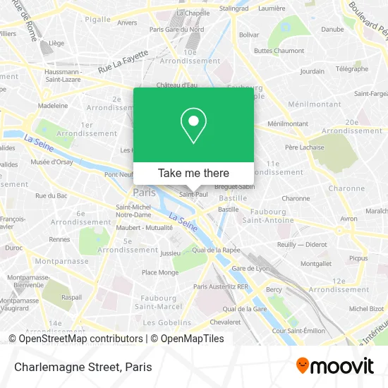
See Rue Charlemagne, Paris, on the map
Public Transit to Rue Charlemagne in Paris
Wondering how to get to Rue Charlemagne in Paris? Moovit helps you find the best way to get to Rue Charlemagne with step-by-step directions from the nearest public transit station.
Moovit provides free maps and live directions to help you navigate through your city. View schedules, routes, timetables, and find out how long does it take to get to Rue Charlemagne in real time.
Looking for the nearest stop or station to Rue Charlemagne? Check out this list of stops closest to your destination: Birague; Saint-Paul; Saint-Paul (Le Marais); Sully - Morland; Pont Marie; Place Des Vosges; Bastille.
Metro: 1, 7, 5, 8.Bus: 69, 72, 86, 96, 76, N11, N16, 87.
Want to see if there’s another route that gets you there at an earlier time? Moovit helps you find alternative routes or times. Get directions from and directions to Rue Charlemagne easily from the Moovit App or Website.
We make riding to Rue Charlemagne easy, which is why over 1.5 million users, including users in Paris, trust Moovit as the best app for public transit. You don’t need to download an individual bus app or train app, Moovit is your all-in-one transit app that helps you find the best bus time or train time available.
For information on prices of metro, bus, RER, light rail and train, costs and ride fares to Rue Charlemagne, please check the Moovit app.
Use the app to navigate to popular places including to the airport, hospital, stadium, grocery store, mall, coffee shop, school, college, and university.
Rue Charlemagne Address: Rue Charlemagne, 75004 Paris, France street in Paris
- Lycée Charlemagne,
- Charlemagne,
- Stade Charlemagne,
- 11 Rue du Fauconnier,
- Église Saint-Paul Saint-Louis,
- Village Saint-Paul,
- 111 Rue Saint-Antoine,
- MIJE,
- Mije Fourcy,
- Le Temple De Jeanne Paris,
- Lulu Dans Ma Rue,
- L'Enoteca,
- Dôme,
- Musée de la Magie,
- Place Saint-Paul,
- Bibliothèque Forney,
- 1 Rue du Figuier, 75004 Paris-4E-Arrondissement Rue du Figuier,
- Fromagerie Laurent Dubois,
- Square Federico García Lorca,
- La Favorite
Places Near Rue Charlemagne (Paris)
- Marché Saint-Pierre, Paris,
- Hôpital Henri Mondor, Creteil,
- 29 Rue Manin, Paris,
- Beaugrenelle, Paris,
- Fondation Louis Vuitton, Paris,
- Théâtre Mogador, Paris,
- Galeries Lafayette Haussmann, Paris,
- Créteil Soleil, Creteil,
- Hôpital Beaujon, Clichy,
- Gare Routière Flixbus, Paris,
- Atelier Des Lumieres, Paris,
- Hôpital Saint-Joseph, Paris,
- Hopital Foch, Suresnes,
- Hôpital Pitié Salpêtrière, Paris,
- Hôpital Cochin, Paris,
- Hopital Lariboisière, Paris,
- Galeries Lafayette, Paris,
- Hôpital Necker, Paris,
- Hôpital de la Pitié-Salpêtrière, Paris,
- Centre Hospitalier des 15/20, Paris
How to get to popular places in Paris with public transit
Get around Paris by public transit!
Traveling around Paris has never been so easy. See step by step directions as you travel to any attraction, street or major public transit station. View bus and train schedules, arrival times, service alerts and detailed routes on a map, so you know exactly how to get to anywhere in Paris.
When traveling to any destination around Paris use Moovit's Live Directions with Get Off Notifications to know exactly where and how far to walk, how long to wait for your line, and how many stops are left. Moovit will alert you when it's time to get off — no need to constantly re-check whether yours is the next stop.
Wondering how to use public transit in Paris or how to pay for public transit in Paris? Moovit public transit app can help you navigate your way with public transit easily, and at minimum cost. It includes public transit fees, ticket prices, and costs. Looking for a map of Paris public transit lines? Moovit public transit app shows all public transit maps in Paris with all Bus, Train, Metro, Light Rail, RER, Funicular and Gondola routes and stops on an interactive map.
Paris has 7 transit type(s), including: Bus, Train, Metro, Light Rail, RER, Funicular and Gondola, operated by several transit agencies, including RATP, RER, RER Bus de remplacement, Train, Train Bus de remplacement, Tramway Bus de remplacement, TER, ADP, Magical Shuttle, Argenteuil - Boucles de Seine, Autocars Dominique, Bièvre, Brie et 2 Morin, Le Bus - C.C. du Clermontois and Cœur d’Essonne