How to get to Rue De Cadix by bus?
Click on the bus route to see step by step directions with maps, line arrival times and updated time schedules.
From Gare de Bercy, Paris
51 minFrom Consulat De Tunisie - Pantin, Pantin
79 minFrom Hôpital Bégin, Saint-Mande
76 minFrom Hôpital National de Saint-Maurice, Saint-Maurice
77 minFrom Gare routière Pershing – Porte Maillot, Paris
38 minFrom Le Zénith, Paris
77 minFrom Rosa Parks, Paris
60 minFrom Institut Gustave Roussy, Villejuif
65 minFrom Grande Galerie de l'Évolution, Paris
37 minFrom Colombes, Colombes
59 min
How to get to Rue De Cadix by metro?
Click on the metro route to see step by step directions with maps, line arrival times and updated time schedules.
From Gare de Bercy, Paris
36 minFrom Consulat De Tunisie - Pantin, Pantin
62 minFrom Hôpital Bégin, Saint-Mande
55 minFrom Hôpital National de Saint-Maurice, Saint-Maurice
61 minFrom Gare routière Pershing – Porte Maillot, Paris
44 minFrom Le Zénith, Paris
62 minFrom Rosa Parks, Paris
58 minFrom Institut Gustave Roussy, Villejuif
50 minFrom Grande Galerie de l'Évolution, Paris
47 min
Bus stops near Rue De Cadix in Paris
Light Rail stations near Rue De Cadix in Paris
Metro station near Rue De Cadix in Paris
- Boucicaut, 11 min walk,VIEW
Bus lines to Rue De Cadix in Paris
- 80, Porte de Versailles,VIEW
- 39, Gare du Nord,VIEW
- N13, Bobigny - Pablo Picasso,VIEW
- N62, Gare Montparnasse,VIEW
- N161, Gare Montparnasse - La Verrière Gare - Quai C,VIEW
- N162, Gare Montparnasse - Gare De Rambouillet - Prud'homme,VIEW
- TRAVERSE, Parc Georges Brassens,VIEW
- 3754, Porte de Saint-Cloud - Murat,VIEW
What are the closest stations to Rue De Cadix?
The closest stations to Rue De Cadix are:
- Hameau is 34 meters away, 1 min walk.
- Vaugirard - Croix-Nivert is 276 meters away, 4 min walk.
- Firmin Gillot is 298 meters away, 4 min walk.
- Porte de Versailles is 298 meters away, 4 min walk.
- Desnouettes is 471 meters away, 7 min walk.
- Porte de Versailles (Parc Des Expositions) is 719 meters away, 10 min walk.
- Boucicaut is 791 meters away, 11 min walk.
Which metro line stops near Rue De Cadix?
12 (Front Populaire)
Which bus lines stop near Rue De Cadix?
These bus lines stop near Rue De Cadix: 62, 80.
What’s the nearest light rail station to Rue De Cadix in Paris?
The nearest light rail station to Rue De Cadix in Paris is Desnouettes. It’s a 7 min walk away.
What’s the nearest metro station to Rue De Cadix in Paris?
The nearest metro station to Rue De Cadix in Paris is Boucicaut. It’s a 11 min walk away.
What’s the nearest bus station to Rue De Cadix in Paris?
The nearest bus station to Rue De Cadix in Paris is Hameau. It’s a 1 min walk away.
What time is the first light rail to Rue De Cadix in Paris?
The T3A is the first light rail that goes to Rue De Cadix in Paris. It stops nearby at 6:10 AM.
What time is the last light rail to Rue De Cadix in Paris?
The T3A is the last light rail that goes to Rue De Cadix in Paris. It stops nearby at 1:41 AM.
What time is the first metro to Rue De Cadix in Paris?
The 8 is the first metro that goes to Rue De Cadix in Paris. It stops nearby at 5:24 AM.
What time is the last metro to Rue De Cadix in Paris?
The 8 is the last metro that goes to Rue De Cadix in Paris. It stops nearby at 1:13 AM.
What time is the first bus to Rue De Cadix in Paris?
The N13 is the first bus that goes to Rue De Cadix in Paris. It stops nearby at 3:04 AM.
What time is the last bus to Rue De Cadix in Paris?
The N162 is the last bus that goes to Rue De Cadix in Paris. It stops nearby at 3:32 AM.
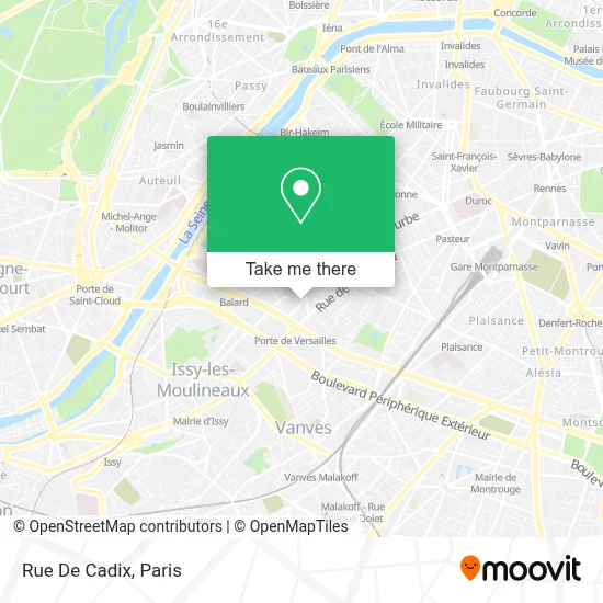
See Rue De Cadix, Paris, on the map
Public Transit to Rue De Cadix in Paris
Wondering how to get to Rue De Cadix in Paris? Moovit helps you find the best way to get to Rue De Cadix with step-by-step directions from the nearest public transit station.
Moovit provides free maps and live directions to help you navigate through your city. View schedules, routes, timetables, and find out how long does it take to get to Rue De Cadix in real time.
Looking for the nearest stop or station to Rue De Cadix? Check out this list of stops closest to your destination: Hameau; Vaugirard - Croix-Nivert; Firmin Gillot; Porte de Versailles; Desnouettes; Porte de Versailles (Parc Des Expositions); Boucicaut.
Metro: 12, 8.Bus: 62, 80, 39, N13, N62, N161, N162, TRAVERSE.
Want to see if there’s another route that gets you there at an earlier time? Moovit helps you find alternative routes or times. Get directions from and directions to Rue De Cadix easily from the Moovit App or Website.
We make riding to Rue De Cadix easy, which is why over 1.5 million users, including users in Paris, trust Moovit as the best app for public transit. You don’t need to download an individual bus app or train app, Moovit is your all-in-one transit app that helps you find the best bus time or train time available.
For information on prices of metro, bus, train and RER, costs and ride fares to Rue De Cadix, please check the Moovit app.
Use the app to navigate to popular places including to the airport, hospital, stadium, grocery store, mall, coffee shop, school, college, and university.
Location: Paris
- Choki Choki,
- 232 Rue de la Croix Nivert,
- Le Week-End,
- 15ème,
- 244 Rue Croix Nivert,
- Cantine CRE-RATP,
- Exelmans,
- Terräng,
- Vice Versa,
- Vice Versa Hotel,
- 366 Rue de Vaugirard,
- Petite Ceinture du 15e,
- Arrêt Desnouettes Vasco de Gama [39],
- Dépôt Sauvel Natal,
- Cambodge,
- Arrêt Boulevard Victor [80],
- 364 Bis,
- 397 Bis Rue de Vaugirard,
- 33 Rue du Hameau,
- Square du Clos Feuquières
Places Near Rue De Cadix (Paris)
- Beaugrenelle, Paris,
- Hôpital Necker, Paris,
- Galeries Lafayette Haussmann, Paris,
- Hôpital Cochin, Paris,
- Hôpital Pitié Salpêtrière, Paris,
- Marché Saint-Pierre, Paris,
- Hopital Foch, Suresnes,
- Atelier Des Lumieres, Paris,
- Hôpital Henri Mondor, Creteil,
- 29 Rue Manin, Paris,
- Hôpital Saint-Joseph, Paris,
- Galeries Lafayette, Paris,
- Hôpital Beaujon, Clichy,
- Hôpital de la Pitié-Salpêtrière, Paris,
- Créteil Soleil, Creteil,
- Théâtre Mogador, Paris,
- Hopital Lariboisière, Paris,
- Centre Hospitalier des 15/20, Paris,
- Fondation Louis Vuitton, Paris,
- Gare Routière Flixbus, Paris
How to get to popular places in Paris with public transit
Get around Paris by public transit!
Traveling around Paris has never been so easy. See step by step directions as you travel to any attraction, street or major public transit station. View bus and train schedules, arrival times, service alerts and detailed routes on a map, so you know exactly how to get to anywhere in Paris.
When traveling to any destination around Paris use Moovit's Live Directions with Get Off Notifications to know exactly where and how far to walk, how long to wait for your line, and how many stops are left. Moovit will alert you when it's time to get off — no need to constantly re-check whether yours is the next stop.
Wondering how to use public transit in Paris or how to pay for public transit in Paris? Moovit public transit app can help you navigate your way with public transit easily, and at minimum cost. It includes public transit fees, ticket prices, and costs. Looking for a map of Paris public transit lines? Moovit public transit app shows all public transit maps in Paris with all Bus, Train, Metro, Light Rail, RER, Funicular and Gondola routes and stops on an interactive map.
Paris has 7 transit type(s), including: Bus, Train, Metro, Light Rail, RER, Funicular and Gondola, operated by several transit agencies, including RATP, RER, RER Bus de remplacement, Train, Train Bus de remplacement, Tramway Bus de remplacement, TER, ADP, Magical Shuttle, Argenteuil - Boucles de Seine, Autocars Dominique, Bièvre, Brie et 2 Morin, Le Bus - C.C. du Clermontois and Cœur d’Essonne