How to get to Rue Faullain de Banville by bus?
Click on the bus route to see step by step directions with maps, line arrival times and updated time schedules.
From Chambourcy, Chambourcy
84 minFrom Fête des Loges, Saint-Germain-En-Laye
69 minFrom Vaucresson, Vaucresson
94 minFrom Hyatt Regency Paris Étoile, Paris
90 minFrom Solidays, Paris
89 minFrom Espace Champerret, Paris
99 minFrom IKEA, Franconville
79 minFrom 25-27 Boulevard Victor Hugo, Neuilly-Sur-Seine
97 minFrom Ambassade du Cameroun, Paris
90 minFrom Stade Jean Bouin, Paris
97 min
Bus stops near Rue Faullain de Banville in Chatou
Bus lines to Rue Faullain de Banville in Chatou
- B, Gare De Sartrouville - Gare De Rueil-Malmaison,VIEW
- C, Gare De Houilles - Carrières-Sur-Seine - Gare Du Vésinet - Le Pecq,VIEW
- P, Gare De Houilles - Carrières-Sur-Seine - Berges De Montesson,VIEW
- S2, Lycée Evariste Galois - Berges De Montesson,VIEW
- F, La Tour,VIEW
- L, Mayoly,VIEW
- 1, Lycée Les Pierres Vives,VIEW
- 12, Centre Madeleine Daniélou,VIEW
- A, Renoir,VIEW
- S3, Paul Bert,VIEW
- T, Place du Docteur Roux,VIEW
What are the closest stations to Rue Faullain de Banville?
The closest stations to Rue Faullain de Banville are:
- Poste is 190 meters away, 3 min walk.
- Général Leclerc is 393 meters away, 5 min walk.
- Europe is 454 meters away, 6 min walk.
- Maurice de Vlaminck is 559 meters away, 8 min walk.
Which bus lines stop near Rue Faullain de Banville?
These bus lines stop near Rue Faullain de Banville: B, C, P.
What’s the nearest bus station to Rue Faullain de Banville in Chatou?
The nearest bus station to Rue Faullain de Banville in Chatou is Poste. It’s a 3 min walk away.
What time is the first bus to Rue Faullain de Banville in Chatou?
The C is the first bus that goes to Rue Faullain de Banville in Chatou. It stops nearby at 4:43 AM.
What time is the last bus to Rue Faullain de Banville in Chatou?
The A is the last bus that goes to Rue Faullain de Banville in Chatou. It stops nearby at 1:34 AM.
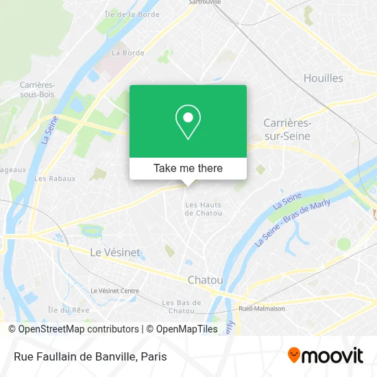
See Rue Faullain de Banville, Chatou, on the map
Public Transit to Rue Faullain de Banville in Chatou
Wondering how to get to Rue Faullain de Banville in Chatou? Moovit helps you find the best way to get to Rue Faullain de Banville with step-by-step directions from the nearest public transit station.
Moovit provides free maps and live directions to help you navigate through your city. View schedules, routes, timetables, and find out how long does it take to get to Rue Faullain de Banville in real time.
Looking for the nearest stop or station to Rue Faullain de Banville? Check out this list of stops closest to your destination: Poste; Général Leclerc; Europe; Maurice de Vlaminck.
Bus: B, C, P, S2, F, L, 1, 12, A, S3, T.
Want to see if there’s another route that gets you there at an earlier time? Moovit helps you find alternative routes or times. Get directions from and directions to Rue Faullain de Banville easily from the Moovit App or Website.
We make riding to Rue Faullain de Banville easy, which is why over 1.5 million users, including users in Chatou, trust Moovit as the best app for public transit. You don’t need to download an individual bus app or train app, Moovit is your all-in-one transit app that helps you find the best bus time or train time available.
For information on prices of bus, RER, train and metro, costs and ride fares to Rue Faullain de Banville, please check the Moovit app.
Use the app to navigate to popular places including to the airport, hospital, stadium, grocery store, mall, coffee shop, school, college, and university.
Rue Faullain de Banville Address: Rue Faullain de Banville, 78360 Montesson, France street in Chatou
- Zenpark,
- Centre Hospitalier Théophile Roussel,
- Notaire à Montesson,
- Centre Medical Paul Doumer,
- Arrêt "Champs Roger" Bus [7, 19],
- Alves Rénovation,
- Mustang Éditions,
- Avenue Paul Doumer,
- L'Atelier des 4 C,
- Florilège de Papiers,
- Umbrela Eats,
- Sophie,
- Terres de Song,
- Carine Blum,
- Melato Michel Elie,
- Cordellier Romain,
- Autour de Soi,
- Abaca,
- Le Nails,
- Auxidom
Places Near Rue Faullain de Banville (Chatou)
- Hôpital Henri Mondor, Creteil,
- Hopital Foch, Suresnes,
- Galeries Lafayette, Paris,
- Hôpital Cochin, Paris,
- Théâtre Mogador, Paris,
- 29 Rue Manin, Paris,
- Hopital Lariboisière, Paris,
- Hôpital Beaujon, Clichy,
- Fondation Louis Vuitton, Paris,
- Institut Curie, Paris,
- Centre Hospitalier des 15/20, Paris,
- Marché Saint-Pierre, Paris,
- Atelier Des Lumieres, Paris,
- Galeries Lafayette Haussmann, Paris,
- Gare Routière Flixbus, Paris,
- Créteil Soleil, Creteil,
- Hôpital de la Pitié-Salpêtrière, Paris,
- Hôpital Pitié Salpêtrière, Paris,
- Hôpital Necker, Paris,
- Hôpital Saint-Joseph, Paris
How to get to popular places in Paris with public transit
Get around Chatou by public transit!
Traveling around Chatou has never been so easy. See step by step directions as you travel to any attraction, street or major public transit station. View bus and train schedules, arrival times, service alerts and detailed routes on a map, so you know exactly how to get to anywhere in Chatou.
When traveling to any destination around Chatou use Moovit's Live Directions with Get Off Notifications to know exactly where and how far to walk, how long to wait for your line, and how many stops are left. Moovit will alert you when it's time to get off — no need to constantly re-check whether yours is the next stop.
Wondering how to use public transit in Chatou or how to pay for public transit in Chatou? Moovit public transit app can help you navigate your way with public transit easily, and at minimum cost. It includes public transit fees, ticket prices, and costs. Looking for a map of Chatou public transit lines? Moovit public transit app shows all public transit maps in Chatou with all Bus, Train, Metro, Light Rail, RER, Funicular and Gondola routes and stops on an interactive map.
Paris has 7 transit type(s), including: Bus, Train, Metro, Light Rail, RER, Funicular and Gondola, operated by several transit agencies, including RATP, RER, RER Bus de remplacement, Train, Train Bus de remplacement, Tramway Bus de remplacement, TER, ADP, Magical Shuttle, Argenteuil - Boucles de Seine, Autocars Dominique, Bièvre, Brie et 2 Morin, Le Bus - C.C. du Clermontois and Cœur d’Essonne