How to get to Rue Geo Chavez by bus?
Click on the bus route to see step by step directions with maps, line arrival times and updated time schedules.
From Rue Jeanne d'Arc, Paris
94 minFrom Cachan, Cachan
79 minFrom Hôpital Européen Georges-Pompidou, Paris
91 minFrom Théâtre des Mathurins, Paris
56 minFrom Université Paris-Dauphine, Paris
94 minFrom Créteil Soleil, Creteil
94 minFrom Hôpital Albert Chenevier, Créteil
110 minFrom Créteil, Creteil
106 minFrom Rue Saint-Dominique, Paris
59 minFrom Parc André Citroën, Paris
83 min
How to get to Rue Geo Chavez by metro?
Click on the metro route to see step by step directions with maps, line arrival times and updated time schedules.
From Rue Jeanne d'Arc, Paris
44 minFrom Hôpital Européen Georges-Pompidou, Paris
43 minFrom Théâtre des Mathurins, Paris
22 minFrom Université Paris-Dauphine, Paris
41 minFrom Créteil Soleil, Creteil
48 minFrom Hôpital Albert Chenevier, Créteil
59 minFrom Créteil, Creteil
56 minFrom Rue Saint-Dominique, Paris
33 minFrom Parc André Citroën, Paris
45 min
Bus stops near Rue Geo Chavez in Paris
Bus lines to Rue Geo Chavez in Paris
What are the closest stations to Rue Geo Chavez?
The closest stations to Rue Geo Chavez are:
- Porte de Bagnolet is 136 meters away, 2 min walk.
- Pelleport - Bagnolet is 276 meters away, 4 min walk.
- Porte de Bagnolet - Louis Ganne is 371 meters away, 5 min walk.
- Lefèvre - Surmelin is 522 meters away, 7 min walk.
- Pelleport is 628 meters away, 9 min walk.
- Gambetta is 671 meters away, 9 min walk.
Which metro line stops near Rue Geo Chavez?
3 (Pont de Levallois-Bécon)
Which bus lines stop near Rue Geo Chavez?
These bus lines stop near Rue Geo Chavez: 26, 318, 57, 64, 69, 76, 96.
What’s the nearest metro station to Rue Geo Chavez in Paris?
The nearest metro stations to Rue Geo Chavez in Paris are Pelleport and Gambetta. The closest one is a 9 min walk away.
What’s the nearest bus station to Rue Geo Chavez in Paris?
The nearest bus station to Rue Geo Chavez in Paris is Porte de Bagnolet. It’s a 2 min walk away.
What time is the first light rail to Rue Geo Chavez in Paris?
The T3B is the first light rail that goes to Rue Geo Chavez in Paris. It stops nearby at 5:16 AM.
What time is the last light rail to Rue Geo Chavez in Paris?
The T3B is the last light rail that goes to Rue Geo Chavez in Paris. It stops nearby at 1:32 AM.
What time is the first metro to Rue Geo Chavez in Paris?
The 3B is the first metro that goes to Rue Geo Chavez in Paris. It stops nearby at 5:29 AM.
What time is the last metro to Rue Geo Chavez in Paris?
The 3 is the last metro that goes to Rue Geo Chavez in Paris. It stops nearby at 1:15 AM.
What time is the first bus to Rue Geo Chavez in Paris?
The N141 is the first bus that goes to Rue Geo Chavez in Paris. It stops nearby at 3:01 AM.
What time is the last bus to Rue Geo Chavez in Paris?
The N34 is the last bus that goes to Rue Geo Chavez in Paris. It stops nearby at 4:06 AM.
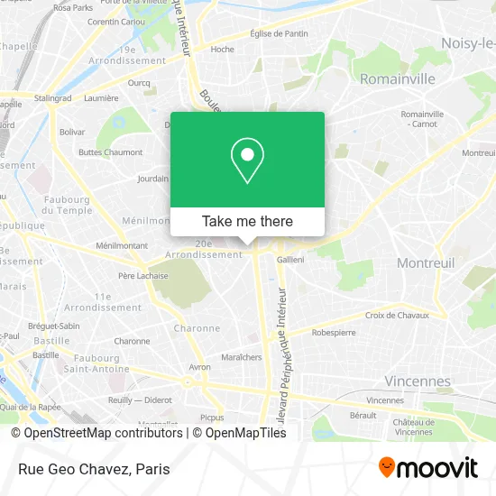
See Rue Geo Chavez, Paris, on the map
Public Transit to Rue Geo Chavez in Paris
Wondering how to get to Rue Geo Chavez in Paris? Moovit helps you find the best way to get to Rue Geo Chavez with step-by-step directions from the nearest public transit station.
Moovit provides free maps and live directions to help you navigate through your city. View schedules, routes, timetables, and find out how long does it take to get to Rue Geo Chavez in real time.
Looking for the nearest stop or station to Rue Geo Chavez? Check out this list of stops closest to your destination: Porte de Bagnolet; Pelleport - Bagnolet; Porte de Bagnolet - Louis Ganne; Lefèvre - Surmelin; Pelleport; Gambetta.
Metro: 3, 3B.Bus: 26, 318, 57, 64, 69, 76, 96, 102, 351, N16, N34, CHARONNE, 61.
Want to see if there’s another route that gets you there at an earlier time? Moovit helps you find alternative routes or times. Get directions from and directions to Rue Geo Chavez easily from the Moovit App or Website.
We make riding to Rue Geo Chavez easy, which is why over 1.5 million users, including users in Paris, trust Moovit as the best app for public transit. You don’t need to download an individual bus app or train app, Moovit is your all-in-one transit app that helps you find the best bus time or train time available.
For information on prices of metro, bus and RER, costs and ride fares to Rue Geo Chavez, please check the Moovit app.
Use the app to navigate to popular places including to the airport, hospital, stadium, grocery store, mall, coffee shop, school, college, and university.
Rue Geo Chavez Address: Rue Geo Chavez, 75020 Paris, France street in Paris
- La Campagne à Paris,
- 45 Rue Belgrand,
- Val de Rance,
- Boulevard Mortier,
- Bar de la Place Edith Piaf,
- Rue du Capitaine Ferber,
- Place Édith Piaf,
- 167 Rue de Bagnolet,
- 2 Bis Rue Etienne Marey,
- Mosquée Madina,
- Mosquée de Bagnolet,
- 38 Boulevard Mortier,
- Station Porte de Bagnolet [T3b],
- Laverie,
- Studio Ferber,
- 42 Bis Rue Belgrand,
- Rue Des Montiboeufs,
- 18-20 Rue des Montiboeufs,
- 14 Rue Etienne Marey,
- Station Séverine [T3b]
Places Near Rue Geo Chavez (Paris)
- Fondation Louis Vuitton, Paris,
- Atelier Des Lumieres, Paris,
- Hôpital Pitié Salpêtrière, Paris,
- Hôpital Henri Mondor, Creteil,
- Hôpital Saint-Joseph, Paris,
- Galeries Lafayette Haussmann, Paris,
- Théâtre Mogador, Paris,
- Hôpital Necker, Paris,
- Institut Curie, Paris,
- Hopital Lariboisière, Paris,
- Marché Saint-Pierre, Paris,
- Créteil Soleil, Creteil,
- Hôpital Beaujon, Clichy,
- 29 Rue Manin, Paris,
- Centre Hospitalier des 15/20, Paris,
- Hôpital de la Pitié-Salpêtrière, Paris,
- Hopital Foch, Suresnes,
- Galeries Lafayette, Paris,
- Gare Routière Flixbus, Paris,
- Hôpital Cochin, Paris
How to get to popular places in Paris with public transit
Get around Paris by public transit!
Traveling around Paris has never been so easy. See step by step directions as you travel to any attraction, street or major public transit station. View bus and train schedules, arrival times, service alerts and detailed routes on a map, so you know exactly how to get to anywhere in Paris.
When traveling to any destination around Paris use Moovit's Live Directions with Get Off Notifications to know exactly where and how far to walk, how long to wait for your line, and how many stops are left. Moovit will alert you when it's time to get off — no need to constantly re-check whether yours is the next stop.
Wondering how to use public transit in Paris or how to pay for public transit in Paris? Moovit public transit app can help you navigate your way with public transit easily, and at minimum cost. It includes public transit fees, ticket prices, and costs. Looking for a map of Paris public transit lines? Moovit public transit app shows all public transit maps in Paris with all Bus, Train, Metro, Light Rail, RER, Funicular and Gondola routes and stops on an interactive map.
Paris has 7 transit type(s), including: Bus, Train, Metro, Light Rail, RER, Funicular and Gondola, operated by several transit agencies, including RATP, RER, RER Bus de remplacement, Train, Train Bus de remplacement, Tramway Bus de remplacement, TER, ADP, Magical Shuttle, Argenteuil - Boucles de Seine, Autocars Dominique, Bièvre, Brie et 2 Morin, Le Bus - C.C. du Clermontois and Cœur d’Essonne