How to get to Rue Lamarck by bus?
Click on the bus route to see step by step directions with maps, line arrival times and updated time schedules.
From Hippodrome d'Auteuil, Paris
70 minFrom Jardin des Serres d'Auteuil, Paris
70 minFrom Rue de Picpus, Paris
62 minFrom Arcueil, Arcueil
105 minFrom Rue du Chateau des Rentiers, Paris
68 minFrom Conforama Bondy, Bondy
106 minFrom Hôpital National de Saint-Maurice, Saint-Maurice
89 minFrom Gare SNCF de Paris Montparnasse, Paris
50 minFrom Hôpital Percy, Clamart
96 minFrom Grille Clemenceau, Arrondissement de Nanterre
82 min
How to get to Rue Lamarck by train?
Click on the train route to see step by step directions with maps, line arrival times and updated time schedules.
How to get to Rue Lamarck by metro?
Click on the metro route to see step by step directions with maps, line arrival times and updated time schedules.
From Hippodrome d'Auteuil, Paris
48 minFrom Jardin des Serres d'Auteuil, Paris
44 minFrom Rue de Picpus, Paris
37 minFrom Arcueil, Arcueil
59 minFrom Rue du Chateau des Rentiers, Paris
31 minFrom Conforama Bondy, Bondy
59 minFrom Hôpital National de Saint-Maurice, Saint-Maurice
57 minFrom Gare SNCF de Paris Montparnasse, Paris
28 minFrom Hôpital Percy, Clamart
56 minFrom Grille Clemenceau, Arrondissement de Nanterre
49 min
Bus stops near Rue Lamarck in Paris
Metro stations near Rue Lamarck in Paris
Funicular station near Rue Lamarck in Paris
- Funiculaire Gare Haute, 13 min walk,VIEW
Bus lines to Rue Lamarck in Paris
What are the closest stations to Rue Lamarck?
The closest stations to Rue Lamarck are:
- Damrémont - Lamarck is 177 meters away, 3 min walk.
- Square Caulaincourt is 188 meters away, 3 min walk.
- Guy Môquet is 191 meters away, 3 min walk.
- Lamarck - Caulaincourt is 268 meters away, 4 min walk.
- Funiculaire Gare Haute is 975 meters away, 13 min walk.
Which train line stops near Rue Lamarck?
L (Paris-Saint-Lazare)
Which metro line stops near Rue Lamarck?
12 (Mairie D'Issy)
Which bus lines stop near Rue Lamarck?
These bus lines stop near Rue Lamarck: 21, 56, 80, 95.
What’s the nearest metro station to Rue Lamarck in Paris?
The nearest metro station to Rue Lamarck in Paris is Guy Môquet. It’s a 3 min walk away.
What’s the nearest bus station to Rue Lamarck in Paris?
The nearest bus stations to Rue Lamarck in Paris are Damrémont - Lamarck and Square Caulaincourt. The closest one is a 3 min walk away.
What’s the nearest funicular station to Rue Lamarck in Paris?
The nearest funicular station to Rue Lamarck in Paris is Funiculaire Gare Haute. It’s a 13 min walk away.
What time is the first metro to Rue Lamarck in Paris?
The 12 is the first metro that goes to Rue Lamarck in Paris. It stops nearby at 5:36 AM.
What time is the last metro to Rue Lamarck in Paris?
The 13 is the last metro that goes to Rue Lamarck in Paris. It stops nearby at 1:02 AM.
What time is the first bus to Rue Lamarck in Paris?
The 80 is the first bus that goes to Rue Lamarck in Paris. It stops nearby at 5:48 AM.
What time is the last bus to Rue Lamarck in Paris?
The 80 is the last bus that goes to Rue Lamarck in Paris. It stops nearby at 1:44 AM.
What time is the first funicular to Rue Lamarck in Paris?
The FUN is the first funicular that goes to Rue Lamarck in Paris. It stops nearby at 6:02 AM.
What time is the last funicular to Rue Lamarck in Paris?
The FUN is the last funicular that goes to Rue Lamarck in Paris. It stops nearby at 12:35 AM.
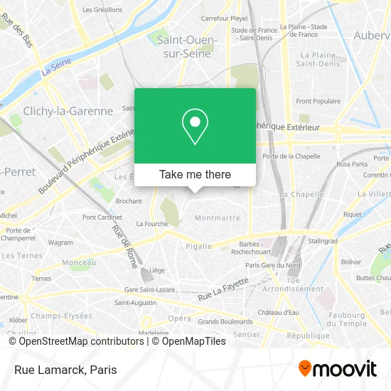
See Rue Lamarck, Paris, on the map
Public Transit to Rue Lamarck in Paris
Wondering how to get to Rue Lamarck in Paris? Moovit helps you find the best way to get to Rue Lamarck with step-by-step directions from the nearest public transit station.
Moovit provides free maps and live directions to help you navigate through your city. View schedules, routes, timetables, and find out how long does it take to get to Rue Lamarck in real time.
Looking for the nearest stop or station to Rue Lamarck? Check out this list of stops closest to your destination: Damrémont - Lamarck; Square Caulaincourt; Guy Môquet; Lamarck - Caulaincourt; Funiculaire Gare Haute.
Train: L.Metro: 12, 13.Bus: 21, 56, 80, 95, 40.Funicular: FUN.
Want to see if there’s another route that gets you there at an earlier time? Moovit helps you find alternative routes or times. Get directions from and directions to Rue Lamarck easily from the Moovit App or Website.
We make riding to Rue Lamarck easy, which is why over 1.5 million users, including users in Paris, trust Moovit as the best app for public transit. You don’t need to download an individual bus app or train app, Moovit is your all-in-one transit app that helps you find the best bus time or train time available.
For information on prices of metro, bus, train and RER, costs and ride fares to Rue Lamarck, please check the Moovit app.
Use the app to navigate to popular places including to the airport, hospital, stadium, grocery store, mall, coffee shop, school, college, and university.
Rue Lamarck Address: Rue Lamarck, 75018 Paris, France street in Paris
- El Pulpo,
- Au Pied du Sacré Coeur,
- Hôtel de Flore,
- Le Caulaincourt,
- 110 Rue Lamarck,
- Airbnb,
- 61 Rue Caulaincourt,
- Eugène Carrière,
- Rue Duhesme,
- Place Claude Nougaro,
- Lamark,
- 165-167 Rue Marcadet,
- 183 Rue Marcadet,
- 18 Rue Duhesme,
- Métro Lamarck–Caulaincourt [12],
- Escaliers de Lamarck-Caulaincourt,
- Chez Ginette,
- Cité internationale des arts / Montmartre,
- Boris Lumé Patisserie Boulangerie,
- Pâtisserie Boulangerie Boris
Places Near Rue Lamarck (Paris)
- Hôpital de la Pitié-Salpêtrière, Paris,
- Atelier Des Lumieres, Paris,
- Centre Hospitalier des 15/20, Paris,
- Théâtre Mogador, Paris,
- Hopital Lariboisière, Paris,
- Gare Routière Flixbus, Paris,
- Galeries Lafayette, Paris,
- Hôpital Henri Mondor, Creteil,
- Hopital Foch, Suresnes,
- Hôpital Beaujon, Clichy,
- Hôpital Cochin, Paris,
- Hôpital Necker, Paris,
- Marché Saint-Pierre, Paris,
- Galeries Lafayette Haussmann, Paris,
- Hôpital Pitié Salpêtrière, Paris,
- 29 Rue Manin, Paris,
- Hôpital Saint-Joseph, Paris,
- Fondation Louis Vuitton, Paris,
- Créteil Soleil, Creteil,
- Institut Curie, Paris
How to get to popular places in Paris with public transit
Get around Paris by public transit!
Traveling around Paris has never been so easy. See step by step directions as you travel to any attraction, street or major public transit station. View bus and train schedules, arrival times, service alerts and detailed routes on a map, so you know exactly how to get to anywhere in Paris.
When traveling to any destination around Paris use Moovit's Live Directions with Get Off Notifications to know exactly where and how far to walk, how long to wait for your line, and how many stops are left. Moovit will alert you when it's time to get off — no need to constantly re-check whether yours is the next stop.
Wondering how to use public transit in Paris or how to pay for public transit in Paris? Moovit public transit app can help you navigate your way with public transit easily, and at minimum cost. It includes public transit fees, ticket prices, and costs. Looking for a map of Paris public transit lines? Moovit public transit app shows all public transit maps in Paris with all Bus, Train, Metro, Light Rail, RER, Funicular and Gondola routes and stops on an interactive map.
Paris has 7 transit type(s), including: Bus, Train, Metro, Light Rail, RER, Funicular and Gondola, operated by several transit agencies, including RATP, RER, RER Bus de remplacement, Train, Train Bus de remplacement, Tramway Bus de remplacement, TER, ADP, Magical Shuttle, Argenteuil - Boucles de Seine, Autocars Dominique, Bièvre, Brie et 2 Morin, Le Bus - C.C. du Clermontois and Cœur d’Essonne