How to get to Rue Maurice Ravel by bus?
Click on the bus route to see step by step directions with maps, line arrival times and updated time schedules.
From IKEA, Plaisir
33 minFrom Les Pyramides Le Port Marly, Le Port-Marly
80 minFrom Vaucresson, Vaucresson
74 minFrom Le Port-Marly, Le Port-Marly
69 minFrom Versailles-Chantiers, Versailles
30 minFrom Clinique de la Porte Verte, Versailles
48 minFrom Clinique de L'Europe, Le Port-Marly
72 minFrom Hôpital la Porte Verte, Versailles
46 minFrom Clinique des Franciscaines, Versailles
37 minFrom Hôpital Raymond Poincaré, Garches
75 min
How to get to Rue Maurice Ravel by train?
Click on the train route to see step by step directions with maps, line arrival times and updated time schedules.
From IKEA, Plaisir
41 minFrom Vaucresson, Vaucresson
134 minFrom Le Port-Marly, Le Port-Marly
148 minFrom Versailles-Chantiers, Versailles
31 minFrom Clinique de la Porte Verte, Versailles
112 minFrom Clinique de L'Europe, Le Port-Marly
149 minFrom Hôpital la Porte Verte, Versailles
110 minFrom Clinique des Franciscaines, Versailles
41 minFrom Hôpital Raymond Poincaré, Garches
136 min
Bus stops near Rue Maurice Ravel in Bois-D'Arcy
Train station near Rue Maurice Ravel in Bois-D'Arcy
- Fontenay-Le-Fleury, 22 min walk,VIEW
Bus lines to Rue Maurice Ravel in Bois-D'Arcy
What are the closest stations to Rue Maurice Ravel?
The closest stations to Rue Maurice Ravel are:
- Le Puits is 196 meters away, 3 min walk.
- Chemin Vert is 535 meters away, 7 min walk.
- Turpault is 653 meters away, 9 min walk.
- Fontenay-Le-Fleury is 1654 meters away, 22 min walk.
Which train line stops near Rue Maurice Ravel?
N (Rambouillet/ Mantes-la-Jolie/ Dreux)
Which bus lines stop near Rue Maurice Ravel?
These bus lines stop near Rue Maurice Ravel: 5111, 6211, 6251.
What’s the nearest train station to Rue Maurice Ravel in Bois-D'Arcy?
The nearest train station to Rue Maurice Ravel in Bois-D'Arcy is Fontenay-Le-Fleury. It’s a 22 min walk away.
What’s the nearest bus station to Rue Maurice Ravel in Bois-D'Arcy?
The nearest bus station to Rue Maurice Ravel in Bois-D'Arcy is Le Puits. It’s a 3 min walk away.
What time is the first train to Rue Maurice Ravel in Bois-D'Arcy?
The N is the first train that goes to Rue Maurice Ravel in Bois-D'Arcy. It stops nearby at 5:22 AM.
What time is the last train to Rue Maurice Ravel in Bois-D'Arcy?
The N is the last train that goes to Rue Maurice Ravel in Bois-D'Arcy. It stops nearby at 10:55 PM.
What time is the first bus to Rue Maurice Ravel in Bois-D'Arcy?
The 5105 is the first bus that goes to Rue Maurice Ravel in Bois-D'Arcy. It stops nearby at 5:09 AM.
What time is the last bus to Rue Maurice Ravel in Bois-D'Arcy?
The 5105 is the last bus that goes to Rue Maurice Ravel in Bois-D'Arcy. It stops nearby at 1:27 AM.
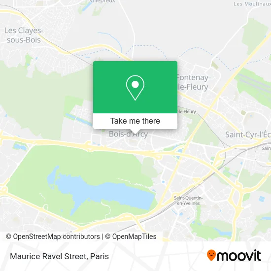
See Rue Maurice Ravel, Bois-D'Arcy, on the map
Public Transit to Rue Maurice Ravel in Bois-D'Arcy
Wondering how to get to Rue Maurice Ravel in Bois-D'Arcy? Moovit helps you find the best way to get to Rue Maurice Ravel with step-by-step directions from the nearest public transit station.
Moovit provides free maps and live directions to help you navigate through your city. View schedules, routes, timetables, and find out how long does it take to get to Rue Maurice Ravel in real time.
Looking for the nearest stop or station to Rue Maurice Ravel? Check out this list of stops closest to your destination: Le Puits; Chemin Vert; Turpault; Fontenay-Le-Fleury.
Train: N.Bus: 5111, 6211, 6251, 5105, 6241.
Want to see if there’s another route that gets you there at an earlier time? Moovit helps you find alternative routes or times. Get directions from and directions to Rue Maurice Ravel easily from the Moovit App or Website.
We make riding to Rue Maurice Ravel easy, which is why over 1.5 million users, including users in Bois-D'Arcy, trust Moovit as the best app for public transit. You don’t need to download an individual bus app or train app, Moovit is your all-in-one transit app that helps you find the best bus time or train time available.
For information on prices of bus and train, costs and ride fares to Rue Maurice Ravel, please check the Moovit app.
Use the app to navigate to popular places including to the airport, hospital, stadium, grocery store, mall, coffee shop, school, college, and university.
Rue Maurice Ravel Address: Rue Maurice Ravel, 78390 Bois-d'Arcy, France street in Bois-D'Arcy
- Bois d'Arcy Auto Moto École,
- Entreprise Laplaine,
- SQYBUS Bois d'Arcy Le Puits [415],
- Continental,
- le puits,
- Adv,
- Le Bois d'Arcy,
- Gymnase Colette Besson,
- Bois d Arcy,
- Collège Mozart,
- Coiffure,
- FedEx,
- Domaine de la Tremblaye,
- 78390,
- Espace Baragué,
- Police Municipale,
- Europe Loisirs Manege Carrousel 1900,
- Besson Jean Claude,
- Attitudes,
- Sodetrel
Places Near Rue Maurice Ravel (Bois-D'Arcy)
- Hôpital de la Pitié-Salpêtrière, Paris,
- Centre Hospitalier des 15/20, Paris,
- Hôpital Cochin, Paris,
- Hôpital Saint-Joseph, Paris,
- Théâtre Mogador, Paris,
- Créteil Soleil, Creteil,
- Gare Routière Flixbus, Paris,
- Hopital Foch, Suresnes,
- Hôpital Pitié Salpêtrière, Paris,
- Institut Curie, Paris,
- Galeries Lafayette Haussmann, Paris,
- Atelier Des Lumieres, Paris,
- 29 Rue Manin, Paris,
- Hôpital Henri Mondor, Creteil,
- Galeries Lafayette, Paris,
- Marché Saint-Pierre, Paris,
- Hôpital Necker, Paris,
- Hôpital Beaujon, Clichy,
- Fondation Louis Vuitton, Paris,
- Hopital Lariboisière, Paris
How to get to popular places in Paris with public transit
Get around Bois-D'Arcy by public transit!
Traveling around Bois-D'Arcy has never been so easy. See step by step directions as you travel to any attraction, street or major public transit station. View bus and train schedules, arrival times, service alerts and detailed routes on a map, so you know exactly how to get to anywhere in Bois-D'Arcy.
When traveling to any destination around Bois-D'Arcy use Moovit's Live Directions with Get Off Notifications to know exactly where and how far to walk, how long to wait for your line, and how many stops are left. Moovit will alert you when it's time to get off — no need to constantly re-check whether yours is the next stop.
Wondering how to use public transit in Bois-D'Arcy or how to pay for public transit in Bois-D'Arcy? Moovit public transit app can help you navigate your way with public transit easily, and at minimum cost. It includes public transit fees, ticket prices, and costs. Looking for a map of Bois-D'Arcy public transit lines? Moovit public transit app shows all public transit maps in Bois-D'Arcy with all Bus, Train, Metro, Light Rail, RER, Funicular and Gondola routes and stops on an interactive map.
Paris has 7 transit type(s), including: Bus, Train, Metro, Light Rail, RER, Funicular and Gondola, operated by several transit agencies, including RATP, RER, RER Bus de remplacement, Train, Train Bus de remplacement, Tramway Bus de remplacement, TER, ADP, Magical Shuttle, Argenteuil - Boucles de Seine, Autocars Dominique, Bièvre, Brie et 2 Morin, Le Bus - C.C. du Clermontois and Cœur d’Essonne