How to get to Rue Pierre Sergent by bus?
Click on the bus route to see step by step directions with maps, line arrival times and updated time schedules.
From Malakoff, Malakoff
75 minFrom Rue Balzac, Paris
48 minFrom Place Colette, Paris
84 minFrom Comédie-Française, Paris
84 minFrom Angelina, Paris
66 minFrom Hôtel Pullman Paris Montparnasse, Paris
76 minFrom Rue de Turin, Paris
63 minFrom Madeleine, Paris
54 minFrom Rue de Rennes, Paris
67 minFrom Théâtre Saint-Georges, Paris
60 min
Bus stops near Rue Pierre Sergent in Nanterre
RER station near Rue Pierre Sergent in Nanterre
- Nanterre Ville, 22 min walk,VIEW
Bus lines to Rue Pierre Sergent in Nanterre
What are the closest stations to Rue Pierre Sergent?
The closest stations to Rue Pierre Sergent are:
- Ecole Jules Ferry is 14 meters away, 1 min walk.
- Les Gibets is 111 meters away, 2 min walk.
- Pierre Sergent is 130 meters away, 2 min walk.
- Place de la Boule - Clémenceau is 578 meters away, 8 min walk.
- Nanterre Ville is 1648 meters away, 22 min walk.
Which bus lines stop near Rue Pierre Sergent?
These bus lines stop near Rue Pierre Sergent: 158, 160, 258.
What’s the nearest bus station to Rue Pierre Sergent in Nanterre?
The nearest bus station to Rue Pierre Sergent in Nanterre is Ecole Jules Ferry. It’s a 1 min walk away.
What’s the nearest RER station to Rue Pierre Sergent in Nanterre?
The nearest RER station to Rue Pierre Sergent in Nanterre is Nanterre Ville. It’s a 22 min walk away.
What time is the first bus to Rue Pierre Sergent in Nanterre?
The 258 is the first bus that goes to Rue Pierre Sergent in Nanterre. It stops nearby at 5:55 AM.
What time is the last bus to Rue Pierre Sergent in Nanterre?
The 160 is the last bus that goes to Rue Pierre Sergent in Nanterre. It stops nearby at 1:47 AM.
What time is the first RER to Rue Pierre Sergent in Nanterre?
The A is the first RER that goes to Rue Pierre Sergent in Nanterre. It stops nearby at 5:01 AM.
What time is the last RER to Rue Pierre Sergent in Nanterre?
The A is the last RER that goes to Rue Pierre Sergent in Nanterre. It stops nearby at 1:19 AM.
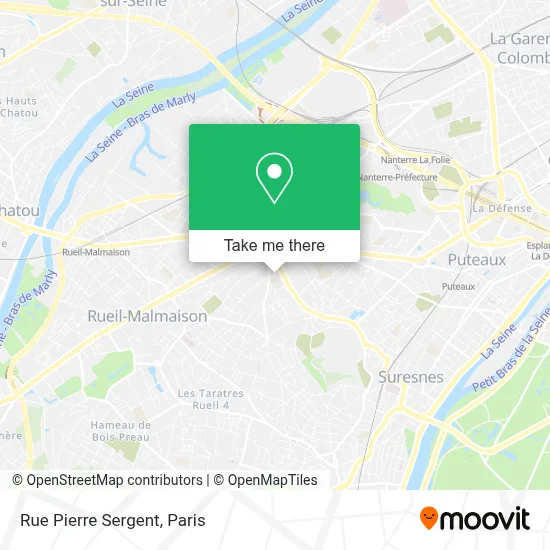
See Rue Pierre Sergent, Nanterre, on the map
Public Transit to Rue Pierre Sergent in Nanterre
Wondering how to get to Rue Pierre Sergent in Nanterre? Moovit helps you find the best way to get to Rue Pierre Sergent with step-by-step directions from the nearest public transit station.
Moovit provides free maps and live directions to help you navigate through your city. View schedules, routes, timetables, and find out how long does it take to get to Rue Pierre Sergent in real time.
Looking for the nearest stop or station to Rue Pierre Sergent? Check out this list of stops closest to your destination: Ecole Jules Ferry; Les Gibets; Pierre Sergent; Place de la Boule - Clémenceau; Nanterre Ville.
RER: A.Bus: 158, 160, 258, 263, 559, 141, 163.
Want to see if there’s another route that gets you there at an earlier time? Moovit helps you find alternative routes or times. Get directions from and directions to Rue Pierre Sergent easily from the Moovit App or Website.
We make riding to Rue Pierre Sergent easy, which is why over 1.5 million users, including users in Nanterre, trust Moovit as the best app for public transit. You don’t need to download an individual bus app or train app, Moovit is your all-in-one transit app that helps you find the best bus time or train time available.
For information on prices of bus, metro and RER, costs and ride fares to Rue Pierre Sergent, please check the Moovit app.
Use the app to navigate to popular places including to the airport, hospital, stadium, grocery store, mall, coffee shop, school, college, and university.
Rue Pierre Sergent Address: Rue Pierre Sergent, 92000 Nanterre, France street in Nanterre
- E.Leclerc,
- E. Leclerc,
- 8 Allée Jules Vallès,
- Rue des Chailliers Nanterre,
- 10 Allée de la Libération,
- 9 Rue des Suisses,
- 76-78 Rue des Suisses,
- 65 Rue du Docteur Charcot,
- Ibis Budget Nanterre,
- Les Damades,
- 38 Avenue Georges Clemenceau,
- ibis budget Nanterre La Defense,
- Pole Emploi Cadre Nanterre,
- Arret Bus 244 Hôpital Stell,
- La Fabrik,
- Arrêt Place de la Boule,
- Place de la Boule,
- Place de la Boule & Avenue Georges Clemenceau,
- Totalenergies,
- 33 Avenue du Maréchal Joffre
Places Near Rue Pierre Sergent (Nanterre)
- Hôpital Necker, Paris,
- Hôpital Henri Mondor, Creteil,
- Gare Routière Flixbus, Paris,
- Atelier Des Lumieres, Paris,
- Hôpital Pitié Salpêtrière, Paris,
- Théâtre Mogador, Paris,
- Fondation Louis Vuitton, Paris,
- Galeries Lafayette, Paris,
- Hopital Foch, Suresnes,
- Beaugrenelle, Paris,
- Hôpital de la Pitié-Salpêtrière, Paris,
- Centre Hospitalier des 15/20, Paris,
- Marché Saint-Pierre, Paris,
- Galeries Lafayette Haussmann, Paris,
- Hôpital Beaujon, Clichy,
- Hôpital Cochin, Paris,
- Créteil Soleil, Creteil,
- 29 Rue Manin, Paris,
- Hôpital Saint-Joseph, Paris,
- Hopital Lariboisière, Paris
How to get to popular places in Paris with public transit
Get around Nanterre by public transit!
Traveling around Nanterre has never been so easy. See step by step directions as you travel to any attraction, street or major public transit station. View bus and train schedules, arrival times, service alerts and detailed routes on a map, so you know exactly how to get to anywhere in Nanterre.
When traveling to any destination around Nanterre use Moovit's Live Directions with Get Off Notifications to know exactly where and how far to walk, how long to wait for your line, and how many stops are left. Moovit will alert you when it's time to get off — no need to constantly re-check whether yours is the next stop.
Wondering how to use public transit in Nanterre or how to pay for public transit in Nanterre? Moovit public transit app can help you navigate your way with public transit easily, and at minimum cost. It includes public transit fees, ticket prices, and costs. Looking for a map of Nanterre public transit lines? Moovit public transit app shows all public transit maps in Nanterre with all Bus, Train, Metro, Light Rail, RER, Funicular and Gondola routes and stops on an interactive map.
Paris has 7 transit type(s), including: Bus, Train, Metro, Light Rail, RER, Funicular and Gondola, operated by several transit agencies, including RATP, RER, RER Bus de remplacement, Train, Train Bus de remplacement, Tramway Bus de remplacement, TER, ADP, Magical Shuttle, Argenteuil - Boucles de Seine, Autocars Dominique, Bièvre, Brie et 2 Morin, Le Bus - C.C. du Clermontois and Cœur d’Essonne