How to get to Rue Renoir by bus?
Click on the bus route to see step by step directions with maps, line arrival times and updated time schedules.
From Groupe BPCE, Paris
76 minFrom Place Jacques Rueff, Paris
73 minFrom Rue De Santeuil, Paris
69 minFrom Université Paris-Dauphine, Paris
90 minFrom Fnac Paris Montparnasse, Paris
71 minFrom Hôtel Novotel Paris Est, Bagnolet
80 minFrom Place Vendôme, Paris
71 minFrom Place Victor Hugo, Paris
80 minFrom École Boulle, Paris
82 minFrom Basilique du Sacré-Cœur de Montmartre (Basilique du Sacré-Cœur), Paris
64 min
How to get to Rue Renoir by metro?
Click on the metro route to see step by step directions with maps, line arrival times and updated time schedules.
From Groupe BPCE, Paris
69 minFrom Place Jacques Rueff, Paris
72 minFrom Rue De Santeuil, Paris
69 minFrom Université Paris-Dauphine, Paris
67 minFrom Fnac Paris Montparnasse, Paris
63 minFrom Hôtel Novotel Paris Est, Bagnolet
71 minFrom Place Vendôme, Paris
58 minFrom Place Victor Hugo, Paris
63 minFrom École Boulle, Paris
71 minFrom Basilique du Sacré-Cœur de Montmartre (Basilique du Sacré-Cœur), Paris
51 min
Light Rail stations near Rue Renoir in Saint-Denis
- Cosmonautes, 5 min walk,VIEW
Bus stops near Rue Renoir in Saint-Denis
Metro station near Rue Renoir in Saint-Denis
- La Courneuve - Aubervilliers, 17 min walk,VIEW
Bus lines to Rue Renoir in Saint-Denis
What are the closest stations to Rue Renoir?
The closest stations to Rue Renoir are:
- Cosmonautes is 332 meters away, 5 min walk.
- Langevin - Wallon is 436 meters away, 6 min walk.
- Genève is 452 meters away, 6 min walk.
- Six Routes - Tramway is 691 meters away, 9 min walk.
- La Courneuve - Aubervilliers is 1328 meters away, 17 min walk.
Which RER line stops near Rue Renoir?
B (Saint Rémy les Chèvreuses/ Massy Palaiseau/ Robinson)
Which metro line stops near Rue Renoir?
12 (Mairie D'Issy)
Which bus lines stop near Rue Renoir?
These bus lines stop near Rue Renoir: 143, 150, 153, 249, 253.
Which light rail line stops near Rue Renoir?
T1 (Gare de Saint-Denis)
What’s the nearest light rail station to Rue Renoir in Saint-Denis?
The nearest light rail station to Rue Renoir in Saint-Denis is Cosmonautes. It’s a 5 min walk away.
What’s the nearest metro station to Rue Renoir in Saint-Denis?
The nearest metro station to Rue Renoir in Saint-Denis is La Courneuve - Aubervilliers. It’s a 17 min walk away.
What’s the nearest bus station to Rue Renoir in Saint-Denis?
The nearest bus stations to Rue Renoir in Saint-Denis are Langevin - Wallon and Genève. The closest one is a 6 min walk away.
What time is the first light rail to Rue Renoir in Saint-Denis?
The T1 is the first light rail that goes to Rue Renoir in Saint-Denis. It stops nearby at 6:05 AM.
What time is the last light rail to Rue Renoir in Saint-Denis?
The T1 is the last light rail that goes to Rue Renoir in Saint-Denis. It stops nearby at 1:13 AM.
What time is the first bus to Rue Renoir in Saint-Denis?
The N43 is the first bus that goes to Rue Renoir in Saint-Denis. It stops nearby at 3:10 AM.
What time is the last bus to Rue Renoir in Saint-Denis?
The N43 is the last bus that goes to Rue Renoir in Saint-Denis. It stops nearby at 3:18 AM.
What time is the first RER to Rue Renoir in Saint-Denis?
The B is the first RER that goes to Rue Renoir in Saint-Denis. It stops nearby at 5:05 AM.
What time is the last RER to Rue Renoir in Saint-Denis?
The B is the last RER that goes to Rue Renoir in Saint-Denis. It stops nearby at 12:58 AM.
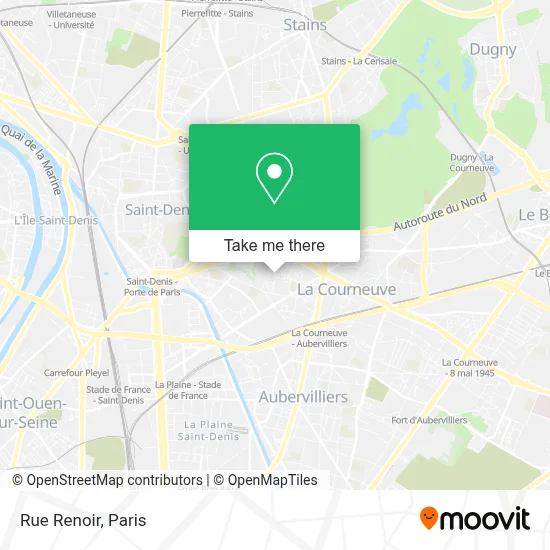
See Rue Renoir, Saint-Denis, on the map
Public Transit to Rue Renoir in Saint-Denis
Wondering how to get to Rue Renoir in Saint-Denis? Moovit helps you find the best way to get to Rue Renoir with step-by-step directions from the nearest public transit station.
Moovit provides free maps and live directions to help you navigate through your city. View schedules, routes, timetables, and find out how long does it take to get to Rue Renoir in real time.
Looking for the nearest stop or station to Rue Renoir? Check out this list of stops closest to your destination: Cosmonautes; Langevin - Wallon; Genève; Six Routes - Tramway; La Courneuve - Aubervilliers.
RER: B.Metro: 12.Bus: 143, 150, 153, 249, 253, 302, 250, N43.Light Rail: T1.
Want to see if there’s another route that gets you there at an earlier time? Moovit helps you find alternative routes or times. Get directions from and directions to Rue Renoir easily from the Moovit App or Website.
We make riding to Rue Renoir easy, which is why over 1.5 million users, including users in Saint-Denis, trust Moovit as the best app for public transit. You don’t need to download an individual bus app or train app, Moovit is your all-in-one transit app that helps you find the best bus time or train time available.
For information on prices of metro, bus, light rail and RER, costs and ride fares to Rue Renoir, please check the Moovit app.
Use the app to navigate to popular places including to the airport, hospital, stadium, grocery store, mall, coffee shop, school, college, and university.
Rue Renoir Address: Rue Renoir, 93120 La Courneuve, France street in Saint-Denis
- 1 Avenue de Presov,
- Centre Commercial Tour,
- 1 Rue Maurice Ravel,
- Groupe SOS – MAS de Pressensé,
- Cosmonautes,
- Station Cosmonautes [T1],
- 9 Chemin de Crèvecoeur,
- Crèche Départementale Toni Morrison,
- Parking Zenpark - la Courneuve - Stade - Général Leclerc,
- Collège Fédérico Garcia Lorca,
- 1 Rue Lucienne,
- Fort De L'Est,
- Maison des Associations,
- 1 Place Youri Gagarine,
- Rue Alexis Léonov,
- 2-4-6 Rue du Fort de l'Est,
- P.M.I.,
- Crèche Départementale Georges Braque,
- Tribunal d'instance de saint denis,
- Place Georges Braque
Places Near Rue Renoir (Saint-Denis)
- Créteil Soleil, Creteil,
- Hopital Lariboisière, Paris,
- Hôpital Henri Mondor, Creteil,
- Hôpital Necker, Paris,
- Beaugrenelle, Paris,
- Centre Hospitalier des 15/20, Paris,
- Hôpital Saint-Joseph, Paris,
- Hôpital de la Pitié-Salpêtrière, Paris,
- Galeries Lafayette, Paris,
- Marché Saint-Pierre, Paris,
- Atelier Des Lumieres, Paris,
- Gare Routière Flixbus, Paris,
- Fondation Louis Vuitton, Paris,
- 29 Rue Manin, Paris,
- Hôpital Cochin, Paris,
- Galeries Lafayette Haussmann, Paris,
- Hopital Foch, Suresnes,
- Hôpital Beaujon, Clichy,
- Hôpital Pitié Salpêtrière, Paris,
- Théâtre Mogador, Paris
How to get to popular places in Paris with public transit
Get around Saint-Denis by public transit!
Traveling around Saint-Denis has never been so easy. See step by step directions as you travel to any attraction, street or major public transit station. View bus and train schedules, arrival times, service alerts and detailed routes on a map, so you know exactly how to get to anywhere in Saint-Denis.
When traveling to any destination around Saint-Denis use Moovit's Live Directions with Get Off Notifications to know exactly where and how far to walk, how long to wait for your line, and how many stops are left. Moovit will alert you when it's time to get off — no need to constantly re-check whether yours is the next stop.
Wondering how to use public transit in Saint-Denis or how to pay for public transit in Saint-Denis? Moovit public transit app can help you navigate your way with public transit easily, and at minimum cost. It includes public transit fees, ticket prices, and costs. Looking for a map of Saint-Denis public transit lines? Moovit public transit app shows all public transit maps in Saint-Denis with all Bus, Train, Metro, Light Rail, RER, Funicular and Gondola routes and stops on an interactive map.
Paris has 7 transit type(s), including: Bus, Train, Metro, Light Rail, RER, Funicular and Gondola, operated by several transit agencies, including RATP, RER, RER Bus de remplacement, Train, Train Bus de remplacement, Tramway Bus de remplacement, TER, ADP, Magical Shuttle, Argenteuil - Boucles de Seine, Autocars Dominique, Bièvre, Brie et 2 Morin, Le Bus - C.C. du Clermontois and Cœur d’Essonne