How to get to Rue Rousselet by bus?
Click on the bus route to see step by step directions with maps, line arrival times and updated time schedules.
From Boulevard Soult, Paris
53 minFrom Basilique Saint-Denis, Saint-Denis
84 minFrom La Courneuve, La Courneuve
97 minFrom Amphi 1A Ernest Vilgrain UP7, Paris
34 minFrom Hippodrome de Vincennes, Paris
89 minFrom Action, Paris
65 minFrom Hôpital Delafontaine, Saint-Denis
81 minFrom S.P.A, Gennevilliers
84 minFrom Hôpital Privé d'Antony, Antony
63 minFrom Conforama, Colombes
61 min
How to get to Rue Rousselet by train?
Click on the train route to see step by step directions with maps, line arrival times and updated time schedules.
How to get to Rue Rousselet by metro?
Click on the metro route to see step by step directions with maps, line arrival times and updated time schedules.
Bus stops near Rue Rousselet in Paris
Bus lines to Rue Rousselet in Paris
What are the closest stations to Rue Rousselet?
The closest stations to Rue Rousselet are:
- Vaneau - Saint-Romain is 208 meters away, 3 min walk.
- Duroc is 317 meters away, 5 min walk.
- Oudinot is 364 meters away, 5 min walk.
- Hôpital Des Enfants Malades / Duroc is 384 meters away, 5 min walk.
- Saint-Placide is 951 meters away, 13 min walk.
Which train line stops near Rue Rousselet?
N (Paris-Montparnasse)
Which metro lines stop near Rue Rousselet?
These metro lines stop near Rue Rousselet: 10, 12, 13.
Which bus lines stop near Rue Rousselet?
These bus lines stop near Rue Rousselet: 28, 63, 68, 82, 86, 89, 92, 96.
What’s the nearest metro station to Rue Rousselet in Paris?
The nearest metro station to Rue Rousselet in Paris is Duroc. It’s a 5 min walk away.
What’s the nearest bus station to Rue Rousselet in Paris?
The nearest bus station to Rue Rousselet in Paris is Vaneau - Saint-Romain. It’s a 3 min walk away.
What time is the first metro to Rue Rousselet in Paris?
The 4 is the first metro that goes to Rue Rousselet in Paris. It stops nearby at 5:35 AM.
What time is the last metro to Rue Rousselet in Paris?
The 10 is the last metro that goes to Rue Rousselet in Paris. It stops nearby at 1:04 AM.
What time is the first bus to Rue Rousselet in Paris?
The 28 is the first bus that goes to Rue Rousselet in Paris. It stops nearby at 6:03 AM.
What time is the last bus to Rue Rousselet in Paris?
The 86 is the last bus that goes to Rue Rousselet in Paris. It stops nearby at 1:20 AM.
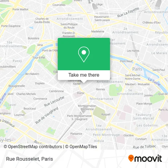
See Rue Rousselet, Paris, on the map
Public Transit to Rue Rousselet in Paris
Wondering how to get to Rue Rousselet in Paris? Moovit helps you find the best way to get to Rue Rousselet with step-by-step directions from the nearest public transit station.
Moovit provides free maps and live directions to help you navigate through your city. View schedules, routes, timetables, and find out how long does it take to get to Rue Rousselet in real time.
Looking for the nearest stop or station to Rue Rousselet? Check out this list of stops closest to your destination: Vaneau - Saint-Romain; Duroc; Oudinot; Hôpital Des Enfants Malades / Duroc; Saint-Placide.
Train: N.Metro: 10, 12, 13, 4.Bus: 28, 63, 68, 82, 86, 89, 92, 96, 70.
Want to see if there’s another route that gets you there at an earlier time? Moovit helps you find alternative routes or times. Get directions from and directions to Rue Rousselet easily from the Moovit App or Website.
We make riding to Rue Rousselet easy, which is why over 1.5 million users, including users in Paris, trust Moovit as the best app for public transit. You don’t need to download an individual bus app or train app, Moovit is your all-in-one transit app that helps you find the best bus time or train time available.
For information on prices of metro, bus, RER, light rail and train, costs and ride fares to Rue Rousselet, please check the Moovit app.
Use the app to navigate to popular places including to the airport, hospital, stadium, grocery store, mall, coffee shop, school, college, and university.
Rue Rousselet Address: Rue Rousselet, 75007 Paris, France street in Paris
- Dr Romain Beaufort,
- Saglio & Dru,
- 15B Rue Rousselet,
- Copr 15 B Rue Rousselet 75007 Paris,
- ISFEC (Institut Supérieur de Formation de l'enseignement Catholique),
- 21B Rue Pierre Leroux,
- 1er Etage,
- Clinique Saint Jean De Dieu,
- Chez Germaine,
- Boucherie Paul & Alexis,
- Lycée Albert de Mun,
- Fondation Saint Jean de Dieu - Clinique Oudinot,
- Urgences de l'Hôpital Necker,
- Arrêt Oudinot [82,92],
- Gemini,
- Hôtel Vaneau Saint Germain Paris,
- Hotel Vaneau Saint-Germain,
- Bernachon,
- Siège de la Banque Postale,
- Ministère de l'Outre-Mer
Places Near Rue Rousselet (Paris)
- 29 Rue Manin, Paris,
- Beaugrenelle, Paris,
- Théâtre Mogador, Paris,
- Hôpital de la Pitié-Salpêtrière, Paris,
- Hôpital Beaujon, Clichy,
- Marché Saint-Pierre, Paris,
- Gare Routière Flixbus, Paris,
- Hopital Lariboisière, Paris,
- Créteil Soleil, Creteil,
- Galeries Lafayette Haussmann, Paris,
- Hôpital Pitié Salpêtrière, Paris,
- Atelier Des Lumieres, Paris,
- Hopital Foch, Suresnes,
- Hôpital Cochin, Paris,
- Hôpital Saint-Joseph, Paris,
- Hôpital Necker, Paris,
- Galeries Lafayette, Paris,
- Hôpital Henri Mondor, Creteil,
- Centre Hospitalier des 15/20, Paris,
- Fondation Louis Vuitton, Paris
How to get to popular places in Paris with public transit
Get around Paris by public transit!
Traveling around Paris has never been so easy. See step by step directions as you travel to any attraction, street or major public transit station. View bus and train schedules, arrival times, service alerts and detailed routes on a map, so you know exactly how to get to anywhere in Paris.
When traveling to any destination around Paris use Moovit's Live Directions with Get Off Notifications to know exactly where and how far to walk, how long to wait for your line, and how many stops are left. Moovit will alert you when it's time to get off — no need to constantly re-check whether yours is the next stop.
Wondering how to use public transit in Paris or how to pay for public transit in Paris? Moovit public transit app can help you navigate your way with public transit easily, and at minimum cost. It includes public transit fees, ticket prices, and costs. Looking for a map of Paris public transit lines? Moovit public transit app shows all public transit maps in Paris with all Bus, Train, Metro, Light Rail, RER, Funicular and Gondola routes and stops on an interactive map.
Paris has 7 transit type(s), including: Bus, Train, Metro, Light Rail, RER, Funicular and Gondola, operated by several transit agencies, including RATP, RER, RER Bus de remplacement, Train, Train Bus de remplacement, Tramway Bus de remplacement, TER, ADP, Magical Shuttle, Argenteuil - Boucles de Seine, Autocars Dominique, Bièvre, Brie et 2 Morin, Le Bus - C.C. du Clermontois and Cœur d’Essonne