How to get to Rue Thiers by bus?
Click on the bus route to see step by step directions with maps, line arrival times and updated time schedules.
From Rue Chanzy, Paris
96 minFrom Bercy Village, Paris
85 minFrom Atelier Des Lumieres, Paris
72 minFrom Boulevard Saint-Michel, Paris
64 minFrom Rue Eugénie Eboué, Paris
82 minFrom Marché aux puces de Clignancourt, Paris
94 minFrom Le Ruban Bleu, Nanterre
89 minFrom Rue Vieille du Temple, Paris
66 minFrom Clinique Ambroise Paré, Neuilly-Sur-Seine
48 minFrom 28 Rue de Charenton, Paris
76 min
How to get to Rue Thiers by metro?
Click on the metro route to see step by step directions with maps, line arrival times and updated time schedules.
From Rue Chanzy, Paris
49 minFrom Bercy Village, Paris
44 minFrom Atelier Des Lumieres, Paris
50 minFrom Boulevard Saint-Michel, Paris
35 minFrom Rue Eugénie Eboué, Paris
49 minFrom Marché aux puces de Clignancourt, Paris
55 minFrom Rue Vieille du Temple, Paris
50 minFrom Clinique Ambroise Paré, Neuilly-Sur-Seine
51 minFrom 28 Rue de Charenton, Paris
48 min
Bus stops near Rue Thiers in Boulogne-Billancourt
Metro station near Rue Thiers in Boulogne-Billancourt
- Exelmans, 2 min walk,VIEW
RER station near Rue Thiers in Boulogne-Billancourt
- Issy - Val de Seine, 4 min walk,VIEW
Bus lines to Rue Thiers in Boulogne-Billancourt
What are the closest stations to Rue Thiers?
The closest stations to Rue Thiers are:
- Thiers - Maison du Combattant is 87 meters away, 2 min walk.
- Exelmans is 110 meters away, 2 min walk.
- René Descartes is 218 meters away, 3 min walk.
- Issy - Val de Seine is 257 meters away, 4 min walk.
- Rue du Point du Jour is 285 meters away, 4 min walk.
- Victor Hugo - Gallieni is 516 meters away, 7 min walk.
- Gallieni is 536 meters away, 8 min walk.
Which bus lines stop near Rue Thiers?
These bus lines stop near Rue Thiers: 126, 42, 72, PC.
Which metro line stops near Rue Thiers?
9 (Pont de Sèvres)
What’s the nearest metro station to Rue Thiers in Boulogne-Billancourt?
The nearest metro station to Rue Thiers in Boulogne-Billancourt is Exelmans. It’s a 2 min walk away.
What’s the nearest bus station to Rue Thiers in Boulogne-Billancourt?
The nearest bus station to Rue Thiers in Boulogne-Billancourt is Thiers - Maison du Combattant. It’s a 2 min walk away.
What’s the nearest RER station to Rue Thiers in Boulogne-Billancourt?
The nearest RER station to Rue Thiers in Boulogne-Billancourt is Issy - Val de Seine. It’s a 4 min walk away.
What time is the first light rail to Rue Thiers in Boulogne-Billancourt?
The T2 is the first light rail that goes to Rue Thiers in Boulogne-Billancourt. It stops nearby at 5:08 AM.
What time is the last light rail to Rue Thiers in Boulogne-Billancourt?
The T2 is the last light rail that goes to Rue Thiers in Boulogne-Billancourt. It stops nearby at 1:30 AM.
What time is the first metro to Rue Thiers in Boulogne-Billancourt?
The 9 is the first metro that goes to Rue Thiers in Boulogne-Billancourt. It stops nearby at 5:30 AM.
What time is the last metro to Rue Thiers in Boulogne-Billancourt?
The 9 is the last metro that goes to Rue Thiers in Boulogne-Billancourt. It stops nearby at 1:15 AM.
What time is the first bus to Rue Thiers in Boulogne-Billancourt?
The N61 is the first bus that goes to Rue Thiers in Boulogne-Billancourt. It stops nearby at 3:00 AM.
What time is the last bus to Rue Thiers in Boulogne-Billancourt?
The N12 is the last bus that goes to Rue Thiers in Boulogne-Billancourt. It stops nearby at 3:55 AM.
What time is the first RER to Rue Thiers in Boulogne-Billancourt?
The C is the first RER that goes to Rue Thiers in Boulogne-Billancourt. It stops nearby at 5:37 AM.
What time is the last RER to Rue Thiers in Boulogne-Billancourt?
The C is the last RER that goes to Rue Thiers in Boulogne-Billancourt. It stops nearby at 10:47 PM.
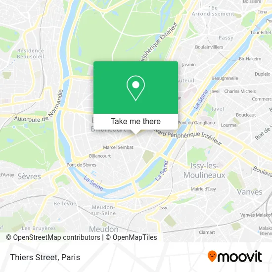
See Rue Thiers, Boulogne-Billancourt, on the map
Public Transit to Rue Thiers in Boulogne-Billancourt
Wondering how to get to Rue Thiers in Boulogne-Billancourt? Moovit helps you find the best way to get to Rue Thiers with step-by-step directions from the nearest public transit station.
Moovit provides free maps and live directions to help you navigate through your city. View schedules, routes, timetables, and find out how long does it take to get to Rue Thiers in real time.
Looking for the nearest stop or station to Rue Thiers? Check out this list of stops closest to your destination: Thiers - Maison du Combattant; Exelmans; René Descartes; Issy - Val de Seine; Rue du Point du Jour; Victor Hugo - Gallieni; Gallieni.
Bus: 126, 42, 72, PC, SUBB S, 175, N12, N61, 289.Metro: 9.RER: C, T2.
Want to see if there’s another route that gets you there at an earlier time? Moovit helps you find alternative routes or times. Get directions from and directions to Rue Thiers easily from the Moovit App or Website.
We make riding to Rue Thiers easy, which is why over 1.5 million users, including users in Boulogne-Billancourt, trust Moovit as the best app for public transit. You don’t need to download an individual bus app or train app, Moovit is your all-in-one transit app that helps you find the best bus time or train time available.
For information on prices of metro, bus and RER, costs and ride fares to Rue Thiers, please check the Moovit app.
Use the app to navigate to popular places including to the airport, hospital, stadium, grocery store, mall, coffee shop, school, college, and university.
Rue Thiers Address: Rue Thiers, 92100 Boulogne-Billancourt, France street in Boulogne-Billancourt
- Rue Marcel Dassault,
- Carrefour City,
- 77/81 Rue Marcel Dassault,
- Aubay,
- Salle Seminaire le Karé Magik Paris,
- Les Cent Ciels,
- Arrêt de Bus 175: René Descartes,
- Université René Descartes - Centre Henri Pieron,
- Institut de Psychologie Paris V – René Descartes,
- BU Henri Pieron,
- Reworld Media,
- 74 Avenue Edouard Vaillant,
- Moulin Rouge Paris,
- 23 BIS Rue Barthélémy Danjou,
- 4 Rue Barthelemy Danjou,
- 14 Rue Samarcq,
- budo fight,
- Radisson Blu Hôtel Paris Boulogne,
- Feira Fresca,
- Rue Danjou
Places Near Rue Thiers (Boulogne-Billancourt)
- Hôpital Beaujon, Clichy,
- Atelier Des Lumieres, Paris,
- Hôpital Necker, Paris,
- Théâtre Mogador, Paris,
- Marché Saint-Pierre, Paris,
- Fondation Louis Vuitton, Paris,
- Centre Hospitalier des 15/20, Paris,
- Hôpital de la Pitié-Salpêtrière, Paris,
- Gare Routière Flixbus, Paris,
- 29 Rue Manin, Paris,
- Créteil Soleil, Creteil,
- Hôpital Saint-Joseph, Paris,
- Hôpital Cochin, Paris,
- Institut Curie, Paris,
- Galeries Lafayette, Paris,
- Hôpital Pitié Salpêtrière, Paris,
- Hôpital Henri Mondor, Creteil,
- Hopital Foch, Suresnes,
- Galeries Lafayette Haussmann, Paris,
- Hopital Lariboisière, Paris
How to get to popular places in Paris with public transit
Get around Boulogne-Billancourt by public transit!
Traveling around Boulogne-Billancourt has never been so easy. See step by step directions as you travel to any attraction, street or major public transit station. View bus and train schedules, arrival times, service alerts and detailed routes on a map, so you know exactly how to get to anywhere in Boulogne-Billancourt.
When traveling to any destination around Boulogne-Billancourt use Moovit's Live Directions with Get Off Notifications to know exactly where and how far to walk, how long to wait for your line, and how many stops are left. Moovit will alert you when it's time to get off — no need to constantly re-check whether yours is the next stop.
Wondering how to use public transit in Boulogne-Billancourt or how to pay for public transit in Boulogne-Billancourt? Moovit public transit app can help you navigate your way with public transit easily, and at minimum cost. It includes public transit fees, ticket prices, and costs. Looking for a map of Boulogne-Billancourt public transit lines? Moovit public transit app shows all public transit maps in Boulogne-Billancourt with all Bus, Train, Metro, Light Rail, RER, Funicular and Gondola routes and stops on an interactive map.
Paris has 7 transit type(s), including: Bus, Train, Metro, Light Rail, RER, Funicular and Gondola, operated by several transit agencies, including RATP, RER, RER Bus de remplacement, Train, Train Bus de remplacement, Tramway Bus de remplacement, TER, ADP, Magical Shuttle, Argenteuil - Boucles de Seine, Autocars Dominique, Bièvre, Brie et 2 Morin, Le Bus - C.C. du Clermontois and Cœur d’Essonne