How to get to Rue Toussaint Louverture by bus?
Click on the bus route to see step by step directions with maps, line arrival times and updated time schedules.
From Ikea Paris Nord, Sarcelles
41 minFrom Rue La Boétie, Paris
64 minFrom Musée Grévin, Paris
50 minFrom RTL, Neuilly-Sur-Seine
68 minFrom Sarcelles, Sarcelles
32 minFrom Avenue Marceau, Paris
86 minFrom La Samaritaine, Paris
55 minFrom Dior, Paris
62 minFrom Le Point-Virgule, Paris
65 minFrom Rue de Bretagne, Paris
71 min
How to get to Rue Toussaint Louverture by metro?
Click on the metro route to see step by step directions with maps, line arrival times and updated time schedules.
Bus stops near Rue Toussaint Louverture in Saint-Denis
Metro station near Rue Toussaint Louverture in Saint-Denis
- Saint-Denis - Université, 4 min walk,VIEW
Light Rail stations near Rue Toussaint Louverture in Saint-Denis
- Roger Semât, 13 min walk,VIEW
Bus lines to Rue Toussaint Louverture in Saint-Denis
What are the closest stations to Rue Toussaint Louverture?
The closest stations to Rue Toussaint Louverture are:
- Toussaint Louverture is 194 meters away, 3 min walk.
- Université Paris VIII is 212 meters away, 3 min walk.
- Saint-Denis - Université is 216 meters away, 3 min walk.
- Roger Semât is 962 meters away, 13 min walk.
Which metro line stops near Rue Toussaint Louverture?
13 (Saint-Denis - Université)
Which bus lines stop near Rue Toussaint Louverture?
These bus lines stop near Rue Toussaint Louverture: 11, 168, 255, 268.
What’s the nearest light rail station to Rue Toussaint Louverture in Saint-Denis?
The nearest light rail station to Rue Toussaint Louverture in Saint-Denis is Roger Semât. It’s a 13 min walk away.
What’s the nearest metro station to Rue Toussaint Louverture in Saint-Denis?
The nearest metro station to Rue Toussaint Louverture in Saint-Denis is Saint-Denis - Université. It’s a 4 min walk away.
What’s the nearest bus station to Rue Toussaint Louverture in Saint-Denis?
The nearest bus stations to Rue Toussaint Louverture in Saint-Denis are Toussaint Louverture, Université Paris VIII and Saint-Denis - Université. The closest one is a 3 min walk away.
What time is the first light rail to Rue Toussaint Louverture in Saint-Denis?
The T5 is the first light rail that goes to Rue Toussaint Louverture in Saint-Denis. It stops nearby at 6:31 AM.
What time is the last light rail to Rue Toussaint Louverture in Saint-Denis?
The T5 is the last light rail that goes to Rue Toussaint Louverture in Saint-Denis. It stops nearby at 12:51 AM.
What time is the first metro to Rue Toussaint Louverture in Saint-Denis?
The 13 is the first metro that goes to Rue Toussaint Louverture in Saint-Denis. It stops nearby at 12:00 PM.
What time is the last metro to Rue Toussaint Louverture in Saint-Denis?
The 13 is the last metro that goes to Rue Toussaint Louverture in Saint-Denis. It stops nearby at 1:15 AM.
What time is the first bus to Rue Toussaint Louverture in Saint-Denis?
The 356 is the first bus that goes to Rue Toussaint Louverture in Saint-Denis. It stops nearby at 6:07 AM.
What time is the last bus to Rue Toussaint Louverture in Saint-Denis?
The 255 is the last bus that goes to Rue Toussaint Louverture in Saint-Denis. It stops nearby at 2:14 AM.
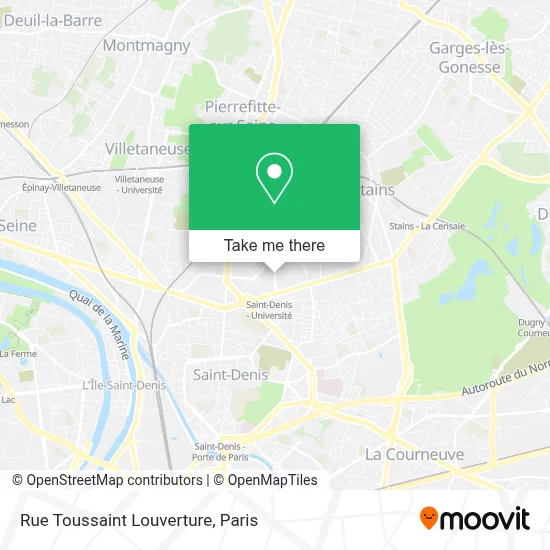
See Rue Toussaint Louverture, Saint-Denis, on the map
Public Transit to Rue Toussaint Louverture in Saint-Denis
Wondering how to get to Rue Toussaint Louverture in Saint-Denis? Moovit helps you find the best way to get to Rue Toussaint Louverture with step-by-step directions from the nearest public transit station.
Moovit provides free maps and live directions to help you navigate through your city. View schedules, routes, timetables, and find out how long does it take to get to Rue Toussaint Louverture in real time.
Looking for the nearest stop or station to Rue Toussaint Louverture? Check out this list of stops closest to your destination: Toussaint Louverture; Université Paris VIII; Saint-Denis - Université; Roger Semât.
Metro: 13.Bus: 11, 168, 255, 268, 253, 256, 356, 353.
Want to see if there’s another route that gets you there at an earlier time? Moovit helps you find alternative routes or times. Get directions from and directions to Rue Toussaint Louverture easily from the Moovit App or Website.
We make riding to Rue Toussaint Louverture easy, which is why over 1.5 million users, including users in Saint-Denis, trust Moovit as the best app for public transit. You don’t need to download an individual bus app or train app, Moovit is your all-in-one transit app that helps you find the best bus time or train time available.
For information on prices of metro, bus and RER, costs and ride fares to Rue Toussaint Louverture, please check the Moovit app.
Use the app to navigate to popular places including to the airport, hospital, stadium, grocery store, mall, coffee shop, school, college, and university.
Rue Toussaint Louverture Address: Rue Toussaint Louverture, 93200 Saint-Denis, France street in Saint-Denis
- 59 Rue Guynemer,
- Archives Nationales,
- Paris Nord Saint Denis Université,
- Indigo,
- 65 Avenue Emile Zola,
- Ts.Elec,
- Bus 268 - Arrêt université-métro,
- Rue Guynemer,
- Rue Porte Maillot,
- 50 Avenue de Stalingrad,
- Métro Saint-Denis — Université [13],
- Sarl le Cap 1,
- Université Paris 8,
- Université Paris VIII - Vincennes Saint-Denis,
- Place Paul Langevin,
- 2 Rue de la Liberté,
- University of Paris 8 Vincennes Saint Denis,
- 1 Place Edouard Branly,
- Kassa Service,
- Univ. Paris 8 Saint-Denis
Places Near Rue Toussaint Louverture (Saint-Denis)
- Fondation Louis Vuitton, Paris,
- Créteil Soleil, Creteil,
- Gare Routière Flixbus, Paris,
- Théâtre Mogador, Paris,
- Centre Hospitalier des 15/20, Paris,
- Marché Saint-Pierre, Paris,
- Atelier Des Lumieres, Paris,
- Galeries Lafayette Haussmann, Paris,
- Galeries Lafayette, Paris,
- Hopital Lariboisière, Paris,
- Beaugrenelle, Paris,
- 29 Rue Manin, Paris,
- Hôpital Saint-Joseph, Paris,
- Hôpital Henri Mondor, Creteil,
- Hôpital Beaujon, Clichy,
- Hôpital Cochin, Paris,
- Hôpital Pitié Salpêtrière, Paris,
- Hôpital Necker, Paris,
- Hopital Foch, Suresnes,
- Hôpital de la Pitié-Salpêtrière, Paris
How to get to popular places in Paris with public transit
Get around Saint-Denis by public transit!
Traveling around Saint-Denis has never been so easy. See step by step directions as you travel to any attraction, street or major public transit station. View bus and train schedules, arrival times, service alerts and detailed routes on a map, so you know exactly how to get to anywhere in Saint-Denis.
When traveling to any destination around Saint-Denis use Moovit's Live Directions with Get Off Notifications to know exactly where and how far to walk, how long to wait for your line, and how many stops are left. Moovit will alert you when it's time to get off — no need to constantly re-check whether yours is the next stop.
Wondering how to use public transit in Saint-Denis or how to pay for public transit in Saint-Denis? Moovit public transit app can help you navigate your way with public transit easily, and at minimum cost. It includes public transit fees, ticket prices, and costs. Looking for a map of Saint-Denis public transit lines? Moovit public transit app shows all public transit maps in Saint-Denis with all Bus, Train, Metro, Light Rail, RER, Funicular and Gondola routes and stops on an interactive map.
Paris has 7 transit type(s), including: Bus, Train, Metro, Light Rail, RER, Funicular and Gondola, operated by several transit agencies, including RATP, RER, RER Bus de remplacement, Train, Train Bus de remplacement, Tramway Bus de remplacement, TER, ADP, Magical Shuttle, Argenteuil - Boucles de Seine, Autocars Dominique, Bièvre, Brie et 2 Morin, Le Bus - C.C. du Clermontois and Cœur d’Essonne