How to get to Rue Vauban by bus?
Click on the bus route to see step by step directions with maps, line arrival times and updated time schedules.
How to get to Rue Vauban by train?
Click on the train route to see step by step directions with maps, line arrival times and updated time schedules.
Bus stops near Rue Vauban in Nancy
Bus lines to Rue Vauban in Nancy
What are the closest stations to Rue Vauban?
The closest stations to Rue Vauban are:
- Artem - Vauban is 298 meters away, 4 min walk.
- Artem - Blandan - Thermal is 585 meters away, 8 min walk.
- Général Mangin is 612 meters away, 8 min walk.
- Baudricourt is 701 meters away, 9 min walk.
- Rond-Point Des Familles is 747 meters away, 10 min walk.
Which bus lines stop near Rue Vauban?
These bus lines stop near Rue Vauban: 11, 16, T3.
Which train line stops near Rue Vauban?
C50+ (Nancy)
Which light rail line stops near Rue Vauban?
T1 (Braboishopitaux)
What’s the nearest bus station to Rue Vauban in Nancy?
The nearest bus station to Rue Vauban in Nancy is Artem - Vauban. It’s a 4 min walk away.
What time is the first light rail to Rue Vauban in Nancy?
The T1 is the first light rail that goes to Rue Vauban in Nancy. It stops nearby at 5:03 AM.
What time is the last light rail to Rue Vauban in Nancy?
The T1 is the last light rail that goes to Rue Vauban in Nancy. It stops nearby at 12:48 AM.
What time is the first bus to Rue Vauban in Nancy?
The 43 is the first bus that goes to Rue Vauban in Nancy. It stops nearby at 3:43 AM.
What time is the last bus to Rue Vauban in Nancy?
The T5 is the last bus that goes to Rue Vauban in Nancy. It stops nearby at 12:38 AM.
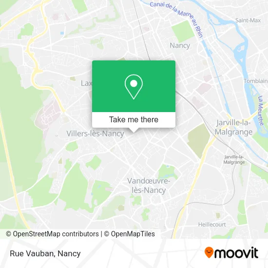
See Rue Vauban, Nancy, on the map
Public Transit to Rue Vauban in Nancy
Wondering how to get to Rue Vauban in Nancy? Moovit helps you find the best way to get to Rue Vauban with step-by-step directions from the nearest public transit station.
Moovit provides free maps and live directions to help you navigate through your city. View schedules, routes, timetables, and find out how long does it take to get to Rue Vauban in real time.
Looking for the nearest stop or station to Rue Vauban? Check out this list of stops closest to your destination: Artem - Vauban; Artem - Blandan - Thermal; Général Mangin; Baudricourt; Rond-Point Des Familles.
Bus: 11, 16, T3, T1, T5, 43, COROL, 42.Train: C50+.Light Rail: T1.
Want to see if there’s another route that gets you there at an earlier time? Moovit helps you find alternative routes or times. Get directions from and directions to Rue Vauban easily from the Moovit App or Website.
We make riding to Rue Vauban easy, which is why over 1.5 million users, including users in Nancy, trust Moovit as the best app for public transit. You don’t need to download an individual bus app or train app, Moovit is your all-in-one transit app that helps you find the best bus time or train time available.
For information on prices of train, bus and light rail, costs and ride fares to Rue Vauban, please check the Moovit app.
Use the app to navigate to popular places including to the airport, hospital, stadium, grocery store, mall, coffee shop, school, college, and university.
Rue Vauban Address: Rue Vauban, 54000 Nancy, France street in Nancy
- Amicale Anciens Insee de Nancy,
- Caserne Verneau,
- 45 Rue Général Custine,
- Alimentation Générale,
- 109 Boulevard d'Haussonville,
- Busin Juliette,
- Pension Canine Votre Chien en Securité Sevignac Broons,
- Le Gourmand,
- Chiche & Bon,
- Marché D'Haussonville,
- Iae Nancy School Of Management,
- Dr Leroy,
- Boulangerie Baudet Fils,
- École Nationale Supérieure d'Éléctricité et de Mécanique (ENSEM),
- Deflin William,
- Axa Assurance Fabien Preaux,
- 10 Rue Pierre de Sivry,
- Balland Jérôme Coiffure Mixte,
- Bio Cbd Nancy Artem,
- FedEx
Places Near Rue Vauban (Nancy)
- Haut Du Lièvre, Nancy,
- Piscine Nancy Thermal, Nancy,
- Clinique Pasteur, Essey-Lès-Nancy,
- Nancy Thermal, Nancy,
- centre d'imagerie jacques callot, Maxéville,
- Houdemont, Houdemont,
- Hôpital Central, Nancy,
- Zénith De Nancy, Maxéville,
- Maxéville, Maxéville,
- E.Leclerc, VandUvre-Lès-Nancy,
- Essey-Lès-Nancy, Essey-Lès-Nancy,
- Villers-Lès-Nancy, Villers-Lès-Nancy,
- Clinique Majorelle, Nancy,
- Rue Colette, Nancy,
- Polyclinique De Gentilly, Nancy,
- Villa Majorelle, Nancy,
- Kinepolis Nancy, Nancy,
- Tomblaine, Tomblaine,
- Dépose-Minute, Nancy,
- Hopital de Brabois CHU, VandUvre-Lès-Nancy
How to get to popular places in Nancy with public transit
Get around Nancy by public transit!
Traveling around Nancy has never been so easy. See step by step directions as you travel to any attraction, street or major public transit station. View bus and train schedules, arrival times, service alerts and detailed routes on a map, so you know exactly how to get to anywhere in Nancy.
When traveling to any destination around Nancy use Moovit's Live Directions with Get Off Notifications to know exactly where and how far to walk, how long to wait for your line, and how many stops are left. Moovit will alert you when it's time to get off — no need to constantly re-check whether yours is the next stop.
Wondering how to use public transit in Nancy or how to pay for public transit in Nancy? Moovit public transit app can help you navigate your way with public transit easily, and at minimum cost. It includes public transit fees, ticket prices, and costs. Looking for a map of Nancy public transit lines? Moovit public transit app shows all public transit maps in Nancy with all Bus, Train and Light Rail routes and stops on an interactive map.
Nancy has 3 transit type(s), including: Bus, Train and Light Rail, operated by several transit agencies, including Réseau STAN, SNCF VOYAGEURS and OCEdefault