How to get to Rue de Balagny by bus?
Click on the bus route to see step by step directions with maps, line arrival times and updated time schedules.
From 19e Arrondissement, Paris
75 minFrom Montreuil, Montreuil
61 minFrom Rue de Crimée, Paris
69 minFrom Philharmonie de Paris, Paris
68 minFrom Clinique de l'estrée, Stains
65 minFrom Avenue de Flandre, Paris
49 minFrom Cité des sciences, Paris
45 minFrom Studios du Lendit, Saint-Denis
55 minFrom IKEA Roissy-Paris Nord 2, Roissy-En-France
71 minFrom Mairie du 19e arrondissement, Paris
76 min
How to get to Rue de Balagny by train?
Click on the train route to see step by step directions with maps, line arrival times and updated time schedules.
RER station near Rue de Balagny in Aulnay-Sous-Bois
- Aulnay-Sous-Bois, 15 min walk,VIEW
Bus lines to Rue de Balagny in Aulnay-Sous-Bois
What are the closest stations to Rue de Balagny?
The closest stations to Rue de Balagny are:
- Lefèvre is 27 meters away, 1 min walk.
- Balagny is 323 meters away, 5 min walk.
- Aulnay-Sous-Bois is 1150 meters away, 15 min walk.
Which train line stops near Rue de Balagny?
K (Paris Nord)
Which bus lines stop near Rue de Balagny?
These bus lines stop near Rue de Balagny: 607, 610, 616.
What’s the nearest bus station to Rue de Balagny in Aulnay-Sous-Bois?
The nearest bus station to Rue de Balagny in Aulnay-Sous-Bois is Lefèvre. It’s a 1 min walk away.
What’s the nearest RER station to Rue de Balagny in Aulnay-Sous-Bois?
The nearest RER station to Rue de Balagny in Aulnay-Sous-Bois is Aulnay-Sous-Bois. It’s a 15 min walk away.
What time is the first light rail to Rue de Balagny in Aulnay-Sous-Bois?
The T4 is the first light rail that goes to Rue de Balagny in Aulnay-Sous-Bois. It stops nearby at 4:48 AM.
What time is the last light rail to Rue de Balagny in Aulnay-Sous-Bois?
The T4 is the last light rail that goes to Rue de Balagny in Aulnay-Sous-Bois. It stops nearby at 1:35 AM.
What time is the first train to Rue de Balagny in Aulnay-Sous-Bois?
The K is the first train that goes to Rue de Balagny in Aulnay-Sous-Bois. It stops nearby at 7:20 AM.
What time is the last train to Rue de Balagny in Aulnay-Sous-Bois?
The K is the last train that goes to Rue de Balagny in Aulnay-Sous-Bois. It stops nearby at 9:53 PM.
What time is the first bus to Rue de Balagny in Aulnay-Sous-Bois?
The FILÉO RS is the first bus that goes to Rue de Balagny in Aulnay-Sous-Bois. It stops nearby at 3:00 AM.
What time is the last bus to Rue de Balagny in Aulnay-Sous-Bois?
The FILÉO RS is the last bus that goes to Rue de Balagny in Aulnay-Sous-Bois. It stops nearby at 3:20 AM.
What time is the first RER to Rue de Balagny in Aulnay-Sous-Bois?
The B is the first RER that goes to Rue de Balagny in Aulnay-Sous-Bois. It stops nearby at 5:00 AM.
What time is the last RER to Rue de Balagny in Aulnay-Sous-Bois?
The B is the last RER that goes to Rue de Balagny in Aulnay-Sous-Bois. It stops nearby at 1:09 AM.
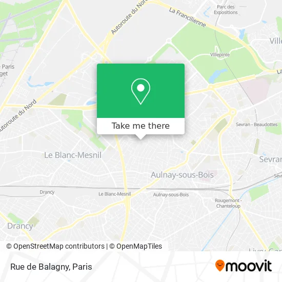
See Rue de Balagny, Aulnay-Sous-Bois, on the map
Public Transit to Rue de Balagny in Aulnay-Sous-Bois
Wondering how to get to Rue de Balagny in Aulnay-Sous-Bois? Moovit helps you find the best way to get to Rue de Balagny with step-by-step directions from the nearest public transit station.
Moovit provides free maps and live directions to help you navigate through your city. View schedules, routes, timetables, and find out how long does it take to get to Rue de Balagny in real time.
Looking for the nearest stop or station to Rue de Balagny? Check out this list of stops closest to your destination: Lefèvre; Balagny; Aulnay-Sous-Bois.
Train: K.RER: B, K, T4.Bus: 607, 610, 616, FILÉO RS.
Want to see if there’s another route that gets you there at an earlier time? Moovit helps you find alternative routes or times. Get directions from and directions to Rue de Balagny easily from the Moovit App or Website.
We make riding to Rue de Balagny easy, which is why over 1.5 million users, including users in Aulnay-Sous-Bois, trust Moovit as the best app for public transit. You don’t need to download an individual bus app or train app, Moovit is your all-in-one transit app that helps you find the best bus time or train time available.
For information on prices of bus, metro, RER, train and light rail, costs and ride fares to Rue de Balagny, please check the Moovit app.
Use the app to navigate to popular places including to the airport, hospital, stadium, grocery store, mall, coffee shop, school, college, and university.
Rue de Balagny Address: Rue de Balagny, 93600 Aulnay-sous-Bois, France street in Aulnay-Sous-Bois
- By Taxi,
- 24 Rue Jean Chaptal,
- 12 Rue Henri Matisse,
- Asiamarche,
- 1-13 Rue Edouard Branly,
- Rue Edouard Branly,
- Soyi Adiyo Marceline,
- Centre Aqualudique l'Odyssée,
- Maison de Cure Médicale,
- Esat Toulouse Lautrec,
- Office Pub Habitat Aulnay sous Bois,
- Sarl Nahil,
- Supermarché Diagonal,
- GUERBET,
- Joulin Jennifer Rolande Helene,
- 10 Rue Nicolas Robert,
- Loxam Aulnay sous Bois,
- Ajc Médias,
- Loxam Access Paris Nord,
- Eco Chauffe
Places Near Rue de Balagny (Aulnay-Sous-Bois)
- Créteil Soleil, Creteil,
- Gare Routière Flixbus, Paris,
- Fondation Louis Vuitton, Paris,
- Hopital Lariboisière, Paris,
- Galeries Lafayette, Paris,
- Hôpital de la Pitié-Salpêtrière, Paris,
- Centre Hospitalier des 15/20, Paris,
- Hôpital Beaujon, Clichy,
- Hôpital Saint-Joseph, Paris,
- Galeries Lafayette Haussmann, Paris,
- Hopital Foch, Suresnes,
- Beaugrenelle, Paris,
- Atelier Des Lumieres, Paris,
- 29 Rue Manin, Paris,
- Hôpital Henri Mondor, Creteil,
- Hôpital Pitié Salpêtrière, Paris,
- Théâtre Mogador, Paris,
- Marché Saint-Pierre, Paris,
- Hôpital Cochin, Paris,
- Hôpital Necker, Paris
How to get to popular places in Paris with public transit
Get around Aulnay-Sous-Bois by public transit!
Traveling around Aulnay-Sous-Bois has never been so easy. See step by step directions as you travel to any attraction, street or major public transit station. View bus and train schedules, arrival times, service alerts and detailed routes on a map, so you know exactly how to get to anywhere in Aulnay-Sous-Bois.
When traveling to any destination around Aulnay-Sous-Bois use Moovit's Live Directions with Get Off Notifications to know exactly where and how far to walk, how long to wait for your line, and how many stops are left. Moovit will alert you when it's time to get off — no need to constantly re-check whether yours is the next stop.
Wondering how to use public transit in Aulnay-Sous-Bois or how to pay for public transit in Aulnay-Sous-Bois? Moovit public transit app can help you navigate your way with public transit easily, and at minimum cost. It includes public transit fees, ticket prices, and costs. Looking for a map of Aulnay-Sous-Bois public transit lines? Moovit public transit app shows all public transit maps in Aulnay-Sous-Bois with all Bus, Train, Metro, Light Rail, RER, Funicular and Gondola routes and stops on an interactive map.
Paris has 7 transit type(s), including: Bus, Train, Metro, Light Rail, RER, Funicular and Gondola, operated by several transit agencies, including RATP, RER, RER Bus de remplacement, Train, Train Bus de remplacement, Tramway Bus de remplacement, TER, ADP, Magical Shuttle, Argenteuil - Boucles de Seine, Autocars Dominique, Bièvre, Brie et 2 Morin, Le Bus - C.C. du Clermontois and Cœur d’Essonne