How to get to Rue de Londres by bus?
Click on the bus route to see step by step directions with maps, line arrival times and updated time schedules.
From Rue Charlot, Paris
59 minFrom Rambouillet, Paris
48 minFrom Gare de L'Est, Paris
64 minFrom Boulevard de Sébastopol, Paris
62 minFrom Marché d'Aligre, Paris
45 minFrom Rue de Crimée, Paris
54 minFrom Théâtre de L'Atelier, Paris
73 minFrom Église Saint-Nicolas-des-Champs, Paris
69 minFrom Cirque Pinder, Paris
70 minFrom Théâtre du Gymnase, Paris
72 min
Bus stops near Rue de Londres in Bondy
RER station near Rue de Londres in Bondy
- Noisy-Le-Sec, 25 min walk,VIEW
Bus lines to Rue de Londres in Bondy
What are the closest stations to Rue de Londres?
The closest stations to Rue de Londres are:
- Place de L'Europe is 115 meters away, 2 min walk.
- Etienne Dolet is 141 meters away, 2 min walk.
- Ambroise Paré is 372 meters away, 5 min walk.
- Avenue Marcelle is 467 meters away, 6 min walk.
- Pont de Bondy is 583 meters away, 8 min walk.
- Noisy-Le-Sec is 1874 meters away, 25 min walk.
Which bus lines stop near Rue de Londres?
These bus lines stop near Rue de Londres: 234, 351.
What’s the nearest bus station to Rue de Londres in Bondy?
The nearest bus stations to Rue de Londres in Bondy are Place de L'Europe and Etienne Dolet. The closest one is a 2 min walk away.
What’s the nearest RER station to Rue de Londres in Bondy?
The nearest RER station to Rue de Londres in Bondy is Noisy-Le-Sec. It’s a 25 min walk away.
What time is the first light rail to Rue de Londres in Bondy?
The T1 is the first light rail that goes to Rue de Londres in Bondy. It stops nearby at 6:16 AM.
What time is the last light rail to Rue de Londres in Bondy?
The T1 is the last light rail that goes to Rue de Londres in Bondy. It stops nearby at 1:40 AM.
What time is the first bus to Rue de Londres in Bondy?
The 615 is the first bus that goes to Rue de Londres in Bondy. It stops nearby at 5:44 AM.
What time is the last bus to Rue de Londres in Bondy?
The 615 is the last bus that goes to Rue de Londres in Bondy. It stops nearby at 1:27 AM.
What time is the first RER to Rue de Londres in Bondy?
The E is the first RER that goes to Rue de Londres in Bondy. It stops nearby at 5:19 AM.
What time is the last RER to Rue de Londres in Bondy?
The E is the last RER that goes to Rue de Londres in Bondy. It stops nearby at 11:18 PM.
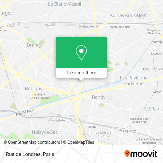
See Rue de Londres, Bondy, on the map
Public Transit to Rue de Londres in Bondy
Wondering how to get to Rue de Londres in Bondy? Moovit helps you find the best way to get to Rue de Londres with step-by-step directions from the nearest public transit station.
Moovit provides free maps and live directions to help you navigate through your city. View schedules, routes, timetables, and find out how long does it take to get to Rue de Londres in real time.
Looking for the nearest stop or station to Rue de Londres? Check out this list of stops closest to your destination: Place de L'Europe; Etienne Dolet; Ambroise Paré; Avenue Marcelle; Pont de Bondy; Noisy-Le-Sec.
RER: E.Bus: 234, 351, 615, TUB, 143, T1.
Want to see if there’s another route that gets you there at an earlier time? Moovit helps you find alternative routes or times. Get directions from and directions to Rue de Londres easily from the Moovit App or Website.
We make riding to Rue de Londres easy, which is why over 1.5 million users, including users in Bondy, trust Moovit as the best app for public transit. You don’t need to download an individual bus app or train app, Moovit is your all-in-one transit app that helps you find the best bus time or train time available.
For information on prices of bus and metro, costs and ride fares to Rue de Londres, please check the Moovit app.
Use the app to navigate to popular places including to the airport, hospital, stadium, grocery store, mall, coffee shop, school, college, and university.
Rue de Londres Address: Rue de Londres, 93000 Bobigny, France street in Bondy
- 114 Rue Jules Vallès,
- Rue Etienne Dolet,
- 29 Rue de Varsovie,
- Mosquée De Bondy,
- 16 Rue d'Athènes,
- 43 Rue Georges Tarral,
- 1 Avenue Jean Moulin,
- Église Notre-Dame-De-Bon-Secours,
- Clinique Ambroise Pare Bondy,
- 12 Rue Paul Renaud,
- Tax,
- 60 Avenue Edouard Vaillant,
- 11 Rue Robespierre,
- 11 Rue Lucie Aubrac,
- 5 Place Nations Unies,
- Abattoir de Bondy,
- 33 Rue de Vienne,
- 93000,
- Salwa,
- La Noue Caillet
Places Near Rue de Londres (Bondy)
- Hôpital de la Pitié-Salpêtrière, Paris,
- Hôpital Henri Mondor, Creteil,
- 29 Rue Manin, Paris,
- Galeries Lafayette Haussmann, Paris,
- Hopital Lariboisière, Paris,
- Théâtre Mogador, Paris,
- Atelier Des Lumieres, Paris,
- Fondation Louis Vuitton, Paris,
- Beaugrenelle, Paris,
- Hôpital Cochin, Paris,
- Hôpital Beaujon, Clichy,
- Marché Saint-Pierre, Paris,
- Hôpital Pitié Salpêtrière, Paris,
- Centre Hospitalier des 15/20, Paris,
- Hôpital Necker, Paris,
- Gare Routière Flixbus, Paris,
- Hôpital Saint-Joseph, Paris,
- Hopital Foch, Suresnes,
- Galeries Lafayette, Paris,
- Créteil Soleil, Creteil
How to get to popular places in Paris with public transit
Get around Bondy by public transit!
Traveling around Bondy has never been so easy. See step by step directions as you travel to any attraction, street or major public transit station. View bus and train schedules, arrival times, service alerts and detailed routes on a map, so you know exactly how to get to anywhere in Bondy.
When traveling to any destination around Bondy use Moovit's Live Directions with Get Off Notifications to know exactly where and how far to walk, how long to wait for your line, and how many stops are left. Moovit will alert you when it's time to get off — no need to constantly re-check whether yours is the next stop.
Wondering how to use public transit in Bondy or how to pay for public transit in Bondy? Moovit public transit app can help you navigate your way with public transit easily, and at minimum cost. It includes public transit fees, ticket prices, and costs. Looking for a map of Bondy public transit lines? Moovit public transit app shows all public transit maps in Bondy with all Bus, Train, Metro, Light Rail, RER, Funicular and Gondola routes and stops on an interactive map.
Paris has 7 transit type(s), including: Bus, Train, Metro, Light Rail, RER, Funicular and Gondola, operated by several transit agencies, including RATP, RER, RER Bus de remplacement, Train, Train Bus de remplacement, Tramway Bus de remplacement, TER, ADP, Magical Shuttle, Argenteuil - Boucles de Seine, Autocars Dominique, Bièvre, Brie et 2 Morin, Le Bus - C.C. du Clermontois and Cœur d’Essonne