How to get to Rue de Rosny by bus?
Click on the bus route to see step by step directions with maps, line arrival times and updated time schedules.
From OiiO, Paris
56 minFrom 21 Rue Truffaut, Paris
82 minFrom Rue Eugène Carrière, Paris
93 minFrom 6 Avenue César Caire, Paris
69 minFrom Cité Universitaire, Paris
76 minFrom Quartier Chinois, Paris
72 minFrom Forum-104, Paris
70 minFrom Mairie du 17e arrondissement, Paris
78 minFrom Quinze-Vingts, Paris
57 minFrom Grande Halle de la Villette, Paris
48 min
How to get to Rue de Rosny by metro?
Click on the metro route to see step by step directions with maps, line arrival times and updated time schedules.
From OiiO, Paris
42 minFrom 21 Rue Truffaut, Paris
60 minFrom Rue Eugène Carrière, Paris
61 minFrom 6 Avenue César Caire, Paris
52 minFrom Cité Universitaire, Paris
75 minFrom Quartier Chinois, Paris
66 minFrom Forum-104, Paris
58 minFrom Mairie du 17e arrondissement, Paris
59 minFrom Quinze-Vingts, Paris
44 minFrom Grande Halle de la Villette, Paris
56 min
Bus stops near Rue de Rosny in Montreuil
Metro stations near Rue de Rosny in Montreuil
Bus lines to Rue de Rosny in Montreuil
What are the closest stations to Rue de Rosny?
The closest stations to Rue de Rosny are:
- Edouard Branly is 46 meters away, 1 min walk.
- Paul Signac - Carrefour du 8 Mai 1945 is 673 meters away, 9 min walk.
- Saint-Just is 719 meters away, 10 min walk.
- La Dhuys is 1335 meters away, 17 min walk.
- Croix de Chavaux is 1397 meters away, 18 min walk.
Which bus lines stop near Rue de Rosny?
These bus lines stop near Rue de Rosny: 102, 116, 121, 202.
Which metro lines stop near Rue de Rosny?
These metro lines stop near Rue de Rosny: 11, 9.
What’s the nearest metro station to Rue de Rosny in Montreuil?
The nearest metro station to Rue de Rosny in Montreuil is La Dhuys. It’s a 17 min walk away.
What’s the nearest bus station to Rue de Rosny in Montreuil?
The nearest bus station to Rue de Rosny in Montreuil is Edouard Branly. It’s a 1 min walk away.
What time is the first metro to Rue de Rosny in Montreuil?
The 9 is the first metro that goes to Rue de Rosny in Montreuil. It stops nearby at 5:30 AM.
What time is the last metro to Rue de Rosny in Montreuil?
The 9 is the last metro that goes to Rue de Rosny in Montreuil. It stops nearby at 1:15 AM.
What time is the first bus to Rue de Rosny in Montreuil?
The N34 is the first bus that goes to Rue de Rosny in Montreuil. It stops nearby at 3:08 AM.
What time is the last bus to Rue de Rosny in Montreuil?
The N34 is the last bus that goes to Rue de Rosny in Montreuil. It stops nearby at 3:53 AM.
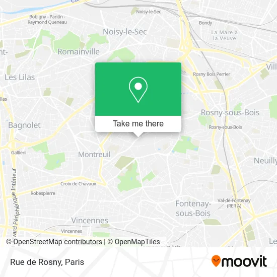
See Rue de Rosny, Montreuil, on the map
Public Transit to Rue de Rosny in Montreuil
Wondering how to get to Rue de Rosny in Montreuil? Moovit helps you find the best way to get to Rue de Rosny with step-by-step directions from the nearest public transit station.
Moovit provides free maps and live directions to help you navigate through your city. View schedules, routes, timetables, and find out how long does it take to get to Rue de Rosny in real time.
Looking for the nearest stop or station to Rue de Rosny? Check out this list of stops closest to your destination: Edouard Branly; Paul Signac - Carrefour du 8 Mai 1945; Saint-Just; La Dhuys; Croix de Chavaux.
Bus: 102, 116, 121, 202, N34, 129, 122.Metro: 11, 9.
Want to see if there’s another route that gets you there at an earlier time? Moovit helps you find alternative routes or times. Get directions from and directions to Rue de Rosny easily from the Moovit App or Website.
We make riding to Rue de Rosny easy, which is why over 1.5 million users, including users in Montreuil, trust Moovit as the best app for public transit. You don’t need to download an individual bus app or train app, Moovit is your all-in-one transit app that helps you find the best bus time or train time available.
For information on prices of metro, bus, RER and light rail, costs and ride fares to Rue de Rosny, please check the Moovit app.
Use the app to navigate to popular places including to the airport, hospital, stadium, grocery store, mall, coffee shop, school, college, and university.
Rue de Rosny Address: Rue de Rosny, 93100 Montreuil, France street in Montreuil
- Mozinor,
- 36 Avenue du Président Salvador Allende,
- 25 Avenue Paul Signac,
- Les Murs à Pêches,
- 9 Rue Didier Daurat,
- 29 Rue Dombasle,
- Brasserie de la Croix de Chavaux,
- 11 Rue Désiré Charton,
- Emmaus Alternatives,
- Mosquée De Montreuil,
- Rue Danton,
- 14 Rue Emile Beaufils,
- Place Jules Verne,
- Rue Saint-Denis [102],
- Résidence Paul Doumer,
- 73 Rue Edouard Branly,
- 11 Rue Pierre de Montreuil,
- 86 N302,
- Marché U Montreuil,
- 31 Rue Lenain de Tillemont
Places Near Rue de Rosny (Montreuil)
- Atelier Des Lumieres, Paris,
- Hôpital Beaujon, Clichy,
- Hôpital Cochin, Paris,
- Galeries Lafayette, Paris,
- Marché Saint-Pierre, Paris,
- 29 Rue Manin, Paris,
- Créteil Soleil, Creteil,
- Hopital Foch, Suresnes,
- Hôpital Pitié Salpêtrière, Paris,
- Fondation Louis Vuitton, Paris,
- Hôpital de la Pitié-Salpêtrière, Paris,
- Hôpital Henri Mondor, Creteil,
- Théâtre Mogador, Paris,
- Galeries Lafayette Haussmann, Paris,
- Centre Hospitalier des 15/20, Paris,
- Hopital Lariboisière, Paris,
- Beaugrenelle, Paris,
- Hôpital Saint-Joseph, Paris,
- Hôpital Necker, Paris,
- Gare Routière Flixbus, Paris
How to get to popular places in Paris with public transit
Get around Montreuil by public transit!
Traveling around Montreuil has never been so easy. See step by step directions as you travel to any attraction, street or major public transit station. View bus and train schedules, arrival times, service alerts and detailed routes on a map, so you know exactly how to get to anywhere in Montreuil.
When traveling to any destination around Montreuil use Moovit's Live Directions with Get Off Notifications to know exactly where and how far to walk, how long to wait for your line, and how many stops are left. Moovit will alert you when it's time to get off — no need to constantly re-check whether yours is the next stop.
Wondering how to use public transit in Montreuil or how to pay for public transit in Montreuil? Moovit public transit app can help you navigate your way with public transit easily, and at minimum cost. It includes public transit fees, ticket prices, and costs. Looking for a map of Montreuil public transit lines? Moovit public transit app shows all public transit maps in Montreuil with all Bus, Train, Metro, Light Rail, RER, Funicular and Gondola routes and stops on an interactive map.
Paris has 7 transit type(s), including: Bus, Train, Metro, Light Rail, RER, Funicular and Gondola, operated by several transit agencies, including RATP, RER, RER Bus de remplacement, Train, Train Bus de remplacement, Tramway Bus de remplacement, TER, ADP, Magical Shuttle, Argenteuil - Boucles de Seine, Autocars Dominique, Bièvre, Brie et 2 Morin, Le Bus - C.C. du Clermontois and Cœur d’Essonne