How to get to Rue de Sèvres by bus?
Click on the bus route to see step by step directions with maps, line arrival times and updated time schedules.
From Flixbus France, Levallois-Perret
43 minFrom Boulevard Macdonald, Paris
57 minFrom Comédie Oberkampf, Paris
49 minFrom Rue Eugénie Eboué, Paris
37 minFrom 29 Rue Manin, Paris
41 minFrom 2-4-6 Rue du Fort de l'Est, Saint-Denis
80 minFrom Vélizy 2, Velizy-Villacoublay
78 minFrom Marché de Saint-Denis, Saint-Denis
72 minFrom Hippodrome de Vincennes, Paris
85 minFrom Hôpital Privé d'Antony, Antony
58 min
How to get to Rue de Sèvres by train?
Click on the train route to see step by step directions with maps, line arrival times and updated time schedules.
How to get to Rue de Sèvres by metro?
Click on the metro route to see step by step directions with maps, line arrival times and updated time schedules.
Metro station near Rue de Sèvres in Paris
- Duroc, 1 min walk,VIEW
Bus stops near Rue de Sèvres in Paris
Bus lines to Rue de Sèvres in Paris
What are the closest stations to Rue de Sèvres?
The closest stations to Rue de Sèvres are:
- Duroc is 33 meters away, 1 min walk.
- Hôpital Des Enfants Malades / Duroc is 59 meters away, 1 min walk.
- Sèvres-Lecourbe is 484 meters away, 7 min walk.
Which train line stops near Rue de Sèvres?
N (Paris-Montparnasse)
Which metro lines stop near Rue de Sèvres?
These metro lines stop near Rue de Sèvres: 10, 13.
Which bus lines stop near Rue de Sèvres?
These bus lines stop near Rue de Sèvres: 82, 86, 89, 92, 96.
What’s the nearest metro station to Rue de Sèvres in Paris?
The nearest metro station to Rue de Sèvres in Paris is Duroc. It’s a 1 min walk away.
What’s the nearest bus station to Rue de Sèvres in Paris?
The nearest bus stations to Rue de Sèvres in Paris are Hôpital Des Enfants Malades / Duroc and Duroc. The closest one is a 1 min walk away.
What time is the first metro to Rue de Sèvres in Paris?
The 6 is the first metro that goes to Rue de Sèvres in Paris. It stops nearby at 5:31 AM.
What time is the last metro to Rue de Sèvres in Paris?
The 10 is the last metro that goes to Rue de Sèvres in Paris. It stops nearby at 1:04 AM.
What time is the first bus to Rue de Sèvres in Paris?
The N61 is the first bus that goes to Rue de Sèvres in Paris. It stops nearby at 3:02 AM.
What time is the last bus to Rue de Sèvres in Paris?
The N12 is the last bus that goes to Rue de Sèvres in Paris. It stops nearby at 3:33 AM.
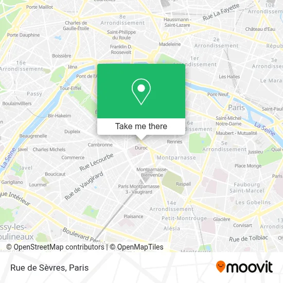
See Rue de Sèvres, Paris, on the map
Public Transit to Rue de Sèvres in Paris
Wondering how to get to Rue de Sèvres in Paris? Moovit helps you find the best way to get to Rue de Sèvres with step-by-step directions from the nearest public transit station.
Moovit provides free maps and live directions to help you navigate through your city. View schedules, routes, timetables, and find out how long does it take to get to Rue de Sèvres in real time.
Looking for the nearest stop or station to Rue de Sèvres? Check out this list of stops closest to your destination: Duroc; Hôpital Des Enfants Malades / Duroc; Sèvres-Lecourbe.
Train: N.Metro: 10, 13.Bus: 82, 86, 89, 92, 96, 28, 70, N12, N61.
Want to see if there’s another route that gets you there at an earlier time? Moovit helps you find alternative routes or times. Get directions from and directions to Rue de Sèvres easily from the Moovit App or Website.
We make riding to Rue de Sèvres easy, which is why over 1.5 million users, including users in Paris, trust Moovit as the best app for public transit. You don’t need to download an individual bus app or train app, Moovit is your all-in-one transit app that helps you find the best bus time or train time available.
For information on prices of metro, bus, RER, light rail and train, costs and ride fares to Rue de Sèvres, please check the Moovit app.
Use the app to navigate to popular places including to the airport, hospital, stadium, grocery store, mall, coffee shop, school, college, and university.
Rue de Sèvres Address: Rue de Sèvres, Paris, France street in Paris
- Mirabelle,
- L'Orangerie de Paris,
- Bus 92 Duroc,
- 5 Boulevard du Montparnasse,
- Institut National Des Jeunes Aveugles,
- Centre d'Echographie Duroc,
- La Pâtisserie by Cyril Lignac,
- 6 Rue Mayet,
- Crédit Agricole,
- 59 Rue de Varenne,
- 78 A Rue de Sèvres,
- Pôle Mère-Enfants Laennec,
- Rue De Sevres,
- 9ter - 5 - 7 Boulevard du Montparnasse,
- Hôtel Mayet Paris,
- Arrêt Hôpital des Enfants Malades [28,39,70,89],
- Bernachon,
- Ministère des Affaires Étrangères,
- Hammam Pacha,
- Institut Imagine
Places Near Rue de Sèvres (Paris)
- Gare Routière Flixbus, Paris,
- Hôpital Beaujon, Clichy,
- Beaugrenelle, Paris,
- Hôpital Necker, Paris,
- Hopital Foch, Suresnes,
- Créteil Soleil, Creteil,
- Hôpital Saint-Joseph, Paris,
- Marché Saint-Pierre, Paris,
- 29 Rue Manin, Paris,
- Hopital Lariboisière, Paris,
- Théâtre Mogador, Paris,
- Atelier Des Lumieres, Paris,
- Hôpital Cochin, Paris,
- Hôpital Pitié Salpêtrière, Paris,
- Fondation Louis Vuitton, Paris,
- Hôpital de la Pitié-Salpêtrière, Paris,
- Galeries Lafayette Haussmann, Paris,
- Galeries Lafayette, Paris,
- Hôpital Henri Mondor, Creteil,
- Centre Hospitalier des 15/20, Paris
How to get to popular places in Paris with public transit
Get around Paris by public transit!
Traveling around Paris has never been so easy. See step by step directions as you travel to any attraction, street or major public transit station. View bus and train schedules, arrival times, service alerts and detailed routes on a map, so you know exactly how to get to anywhere in Paris.
When traveling to any destination around Paris use Moovit's Live Directions with Get Off Notifications to know exactly where and how far to walk, how long to wait for your line, and how many stops are left. Moovit will alert you when it's time to get off — no need to constantly re-check whether yours is the next stop.
Wondering how to use public transit in Paris or how to pay for public transit in Paris? Moovit public transit app can help you navigate your way with public transit easily, and at minimum cost. It includes public transit fees, ticket prices, and costs. Looking for a map of Paris public transit lines? Moovit public transit app shows all public transit maps in Paris with all Bus, Train, Metro, Light Rail, RER, Funicular and Gondola routes and stops on an interactive map.
Paris has 7 transit type(s), including: Bus, Train, Metro, Light Rail, RER, Funicular and Gondola, operated by several transit agencies, including RATP, RER, RER Bus de remplacement, Train, Train Bus de remplacement, Tramway Bus de remplacement, TER, ADP, Magical Shuttle, Argenteuil - Boucles de Seine, Autocars Dominique, Bièvre, Brie et 2 Morin, Le Bus - C.C. du Clermontois and Cœur d’Essonne