How to get to Rue du Safran by bus?
Click on the bus route to see step by step directions with maps, line arrival times and updated time schedules.
From IKEA Evry, Lisses
77 minFrom Fleury-Mérogis, Fleury-Merogis
81 minFrom Draveil, Draveil
163 minFrom Safran, Reau
62 minFrom Viry-Châtillon, Viry-Chatillon
82 minFrom Brie-Comte-Robert, Brie-Comte-Robert
126 minFrom Bondoufle, Bondoufle
76 minFrom Clinique du Mousseau, Evry
49 minFrom Évry, Evry
51 minFrom Lisses, Lisses
70 min
Bus stops near Rue du Safran in Saint-Pierre-Du-Perray
Bus lines to Rue du Safran in Saint-Pierre-Du-Perray
What are the closest stations to Rue du Safran?
The closest stations to Rue du Safran are:
- Fernand Sastre is 36 meters away, 1 min walk.
- Groupe Scolaire Manureva is 416 meters away, 6 min walk.
- Collège Camille Claudel is 1002 meters away, 13 min walk.
- Rue Des Chèvres is 1037 meters away, 14 min walk.
Which bus line stops near Rue du Safran?
TZEN1 (Gare de Lieusaint - Moissy)
What’s the nearest bus station to Rue du Safran in Saint-Pierre-Du-Perray?
The nearest bus station to Rue du Safran in Saint-Pierre-Du-Perray is Fernand Sastre. It’s a 1 min walk away.
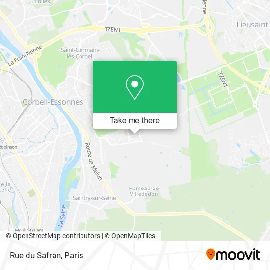
See Rue du Safran, Saint-Pierre-Du-Perray, on the map
Public Transit to Rue du Safran in Saint-Pierre-Du-Perray
Wondering how to get to Rue du Safran in Saint-Pierre-Du-Perray? Moovit helps you find the best way to get to Rue du Safran with step-by-step directions from the nearest public transit station.
Moovit provides free maps and live directions to help you navigate through your city. View schedules, routes, timetables, and find out how long does it take to get to Rue du Safran in real time.
Looking for the nearest stop or station to Rue du Safran? Check out this list of stops closest to your destination: Fernand Sastre; Groupe Scolaire Manureva; Collège Camille Claudel; Rue Des Chèvres.
Bus: TZEN1, 3753, 3779, 4271, 4231, 4275.
Want to see if there’s another route that gets you there at an earlier time? Moovit helps you find alternative routes or times. Get directions from and directions to Rue du Safran easily from the Moovit App or Website.
We make riding to Rue du Safran easy, which is why over 1.5 million users, including users in Saint-Pierre-Du-Perray, trust Moovit as the best app for public transit. You don’t need to download an individual bus app or train app, Moovit is your all-in-one transit app that helps you find the best bus time or train time available.
For information on prices of bus and RER, costs and ride fares to Rue du Safran, please check the Moovit app.
Use the app to navigate to popular places including to the airport, hospital, stadium, grocery store, mall, coffee shop, school, college, and university.
Rue du Safran Address: Rue du Safran, 91280 Saint-Pierre-du-Perray, France street in Saint-Pierre-Du-Perray
- Derambure Isabelle,
- Love Moustach,
- Bnp Logement Social,
- Babyland-Amiland,
- L Instant Cart,
- Association Sportive du Golf de Villeray,
- Tribunes - Stade Just Fontaine,
- 12 Rue Antonio Vivaldi,
- Association des Paralysés de France,
- Jeunesse Zoom Partenaires,
- Sipej,
- Parc Intercommunal des Sports,
- 5 Rue Antonio Vivaldi,
- Association Culturelle et Sportive,
- Lac Des Tritons,
- So Tanning,
- A K D Mi Footgolf Nancy Pulnoy,
- 91280,
- Station de recharge pour véhicules électriques,
- Ecole Élémentaire Quatre Saisons
Places Near Rue du Safran (Saint-Pierre-Du-Perray)
- 29 Rue Manin, Paris,
- Hôpital Pitié Salpêtrière, Paris,
- Gare Routière Flixbus, Paris,
- Hôpital de la Pitié-Salpêtrière, Paris,
- Hôpital Cochin, Paris,
- Hôpital Henri Mondor, Creteil,
- Hopital Lariboisière, Paris,
- Théâtre Mogador, Paris,
- Hôpital Necker, Paris,
- Atelier Des Lumieres, Paris,
- Créteil Soleil, Creteil,
- Hopital Foch, Suresnes,
- Galeries Lafayette, Paris,
- Centre Hospitalier des 15/20, Paris,
- Marché Saint-Pierre, Paris,
- Hôpital Saint-Joseph, Paris,
- Beaugrenelle, Paris,
- Hôpital Beaujon, Clichy,
- Galeries Lafayette Haussmann, Paris,
- Fondation Louis Vuitton, Paris
How to get to popular places in Paris with public transit
Get around Saint-Pierre-Du-Perray by public transit!
Traveling around Saint-Pierre-Du-Perray has never been so easy. See step by step directions as you travel to any attraction, street or major public transit station. View bus and train schedules, arrival times, service alerts and detailed routes on a map, so you know exactly how to get to anywhere in Saint-Pierre-Du-Perray.
When traveling to any destination around Saint-Pierre-Du-Perray use Moovit's Live Directions with Get Off Notifications to know exactly where and how far to walk, how long to wait for your line, and how many stops are left. Moovit will alert you when it's time to get off — no need to constantly re-check whether yours is the next stop.
Wondering how to use public transit in Saint-Pierre-Du-Perray or how to pay for public transit in Saint-Pierre-Du-Perray? Moovit public transit app can help you navigate your way with public transit easily, and at minimum cost. It includes public transit fees, ticket prices, and costs. Looking for a map of Saint-Pierre-Du-Perray public transit lines? Moovit public transit app shows all public transit maps in Saint-Pierre-Du-Perray with all Bus, Train, Metro, Light Rail, RER, Funicular and Gondola routes and stops on an interactive map.
Paris has 7 transit type(s), including: Bus, Train, Metro, Light Rail, RER, Funicular and Gondola, operated by several transit agencies, including RATP, RER, RER Bus de remplacement, Train, Train Bus de remplacement, Tramway Bus de remplacement, TER, ADP, Magical Shuttle, Argenteuil - Boucles de Seine, Autocars Dominique, Bièvre, Brie et 2 Morin, Le Bus - C.C. du Clermontois and Cœur d’Essonne