How to get to Rueda Adan Francisco Raul by bus?
Click on the bus route to see step by step directions with maps, line arrival times and updated time schedules.
From Loranca, Área Metropolitana De Madrid Y Corredor Del Henares
48 minFrom Centro Logístico El Corte Inglés, Valdemoro
104 minFrom FABRIK, Humanes De Madrid
96 minFrom Recinto Ferial de Fuenlabrada, Fuenlabrada
102 minFrom Hospital Infanta Cristina., Área Metropolitana De Madrid Y Corredor Del Henares
37 minFrom Parla, Madrid, Parla
32 minFrom Balneario Thermas De Griñón, Comarca Sur
90 minFrom Desguaces La Torre, Comarca Sur
29 minFrom Universidad Rey Juan Carlos (Campus Fuenlabrada), Fuenlabrada
81 minFrom Hospital Universitario Infanta Elena, Valdemoro
131 min
Bus stops near Rueda Adan Francisco Raul in Illescas
Bus lines to Rueda Adan Francisco Raul in Illescas
What are the closest stations to Rueda Adan Francisco Raul?
The closest stations to Rueda Adan Francisco Raul are:
- Illescas - Huerta is 254 meters away, 4 min walk.
- Av. Castilla La Mancha - Gasolinera (Illescas) is 435 meters away, 6 min walk.
- Illescas - Gasolinera is 435 meters away, 6 min walk.
Which bus lines stop near Rueda Adan Francisco Raul?
These bus lines stop near Rueda Adan Francisco Raul: 464, VAC023, VAC152.
What’s the nearest bus station to Rueda Adan Francisco Raul in Illescas?
The nearest bus station to Rueda Adan Francisco Raul in Illescas is Illescas - Huerta. It’s a 4 min walk away.
What time is the first bus to Rueda Adan Francisco Raul in Illescas?
The VAC023 is the first bus that goes to Rueda Adan Francisco Raul in Illescas. It stops nearby at 6:40 AM.
What time is the last bus to Rueda Adan Francisco Raul in Illescas?
The VAC023 is the last bus that goes to Rueda Adan Francisco Raul in Illescas. It stops nearby at 12:41 AM.
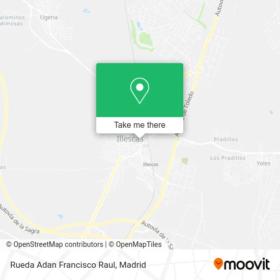
See Rueda Adan Francisco Raul, Illescas, on the map
Public Transit to Rueda Adan Francisco Raul in Illescas
Wondering how to get to Rueda Adan Francisco Raul in Illescas? Moovit helps you find the best way to get to Rueda Adan Francisco Raul with step-by-step directions from the nearest public transit station.
Moovit provides free maps and live directions to help you navigate through your city. View schedules, routes, timetables, and find out how long does it take to get to Rueda Adan Francisco Raul in real time.
Looking for the nearest stop or station to Rueda Adan Francisco Raul? Check out this list of stops closest to your destination: Illescas - Huerta; Av. Castilla La Mancha - Gasolinera (Illescas); Illescas - Gasolinera.
Bus: 464, VAC023, VAC152, VCM-044, BUS, VCM-629.
Want to see if there’s another route that gets you there at an earlier time? Moovit helps you find alternative routes or times. Get directions from and directions to Rueda Adan Francisco Raul easily from the Moovit App or Website.
We make riding to Rueda Adan Francisco Raul easy, which is why over 1.5 million users, including users in Illescas, trust Moovit as the best app for public transit. You don’t need to download an individual bus app or train app, Moovit is your all-in-one transit app that helps you find the best bus time or train time available.
For information on prices of bus and metro, costs and ride fares to Rueda Adan Francisco Raul, please check the Moovit app.
Use the app to navigate to popular places including to the airport, hospital, stadium, grocery store, mall, coffee shop, school, college, and university.
Rueda Adan Francisco Raul Address: Avenida Castilla La Mancha, 45200 Illescas street in Illescas
- Bar Restaurante El Lido,
- Restaurante El Bohio S.l.,
- Galeria Castilla,
- El Bohío,
- Pasteleria Panaderia Los Alvaritos,
- Panaderia Y Pasteleria Martin Y Ana,
- Naturgy- Lowi Illescas,
- La Terracita,
- Centro de Estética Calma,
- Manali,
- Bazar El Corte Chino,
- Vodafone,
- Discoteca Son Latino,
- Hiper Office Illescas,
- Son Latino,
- IES Juan De Padilla,
- Huarapo Disco Bar,
- Tejidos 11,
- Fegomer Inversiones,
- Elema 2015
Places Near Rueda Adan Francisco Raul (Illescas)
- Mercadillo de Majadahonda, Majadahonda,
- Rastro De Madrid, Área Metropolitana De Madrid Y Corredor Del Henares,
- Centro Comercial Islazul, Área Metropolitana De Madrid Y Corredor Del Henares,
- Plaza Mayor, Madrid,
- Hospital Universitario Ramón y Cajal, Madrid,
- Mendez Alvaro, Madrid,
- Centro Comercial La Vaguada, Área Metropolitana De Madrid Y Corredor Del Henares,
- Sala La Riviera, Madrid,
- Calle de López de Hoyos 169, Madrid,
- Hospital Universitario La Paz, Madrid,
- Tres Aguas, Alcorcón,
- Palacio De Vistalegre, Área Metropolitana De Madrid Y Corredor Del Henares,
- Centro Comercial La Gavia, Área Metropolitana De Madrid Y Corredor Del Henares,
- Estadio Wanda Metropolitano, Área Metropolitana De Madrid Y Corredor Del Henares,
- Plenilunio, Área Metropolitana De Madrid Y Corredor Del Henares,
- Hospital Clínico Universitario San Carlos, Madrid,
- Nassica, Área Metropolitana De Madrid Y Corredor Del Henares,
- Centro Comercial Oasiz Madrid, Área Metropolitana De Madrid Y Corredor Del Henares,
- Wizink Center, Madrid,
- Estacion de Chamartin, Madrid
How to get to popular places in Madrid with public transit
Get around Illescas by public transit!
Traveling around Illescas has never been so easy. See step by step directions as you travel to any attraction, street or major public transit station. View bus and train schedules, arrival times, service alerts and detailed routes on a map, so you know exactly how to get to anywhere in Illescas.
When traveling to any destination around Illescas use Moovit's Live Directions with Get Off Notifications to know exactly where and how far to walk, how long to wait for your line, and how many stops are left. Moovit will alert you when it's time to get off — no need to constantly re-check whether yours is the next stop.
Wondering how to use public transit in Illescas or how to pay for public transit in Illescas? Moovit public transit app can help you navigate your way with public transit easily, and at minimum cost. It includes public transit fees, ticket prices, and costs. Looking for a map of Illescas public transit lines? Moovit public transit app shows all public transit maps in Illescas with all Bus, Train, Metro and Light Rail routes and stops on an interactive map.
Madrid has 4 transit type(s), including: Bus, Train, Metro and Light Rail, operated by several transit agencies, including Metro de Madrid, Metro Ligero, Tranvía de Parla, Renfe Cercanías - Servicios de Autobús especiales, Renfe Cercanias, Renfe Cercanías, EMT, Interurbanos, Urbanos de Alcalá de Henares, Urbanos de Alcobendas, Urbanos de Alcorcón, Urbanos de Algete, Urbanos de Aranjuez, Urbanos de Arganda del Rey and Urbanos de Arroyomolinos