Directions to Ruff Ryders Radio (Yonkers) with public transportation
The following transit lines have routes that pass near Ruff Ryders Radio
 Bus: 1, 2, 4, 7, BXM3.
- Train: 1, ADIRONDACK, BERKSHIRE FLYER, EMPIRE SERVICE, ETHAN ALLEN EXPRESS.
How to get to Ruff Ryders Radio by bus?
Click on the bus route to see step by step directions with maps, line arrival times and updated time schedules.
From 1910 monterey avenue, Bronx
64 minFrom Calvary Hospital, Bronx
78 minFrom 177th Fort Washington Ave, Manhattan
59 minFrom George Washington Bridge, Manhattan
67 minFrom Armory (Track), Manhattan
68 minFrom Columbia Presbyterian Hospital, Manhattan
40 minFrom Washington Heights, Manhattan
54 minFrom Montefiore Hospital, Bronx
29 minFrom New Rochelle, NY, New Rochelle
51 minFrom Crotona Park, Bronx
77 min
How to get to Ruff Ryders Radio by train?
Click on the train route to see step by step directions with maps, line arrival times and updated time schedules.
Bus stops near Ruff Ryders Radio in Yonkers
Bus lines to Ruff Ryders Radio in Yonkers
- 1, Dobbs Ferry,VIEW
- 2, 242nd Street Subway Station,VIEW
- 4, Bedford Park,VIEW
- BXM3, Yonkers Getty Sq Via Sedgwick Av Via Broadway,VIEW
- 3, Centre at Purchase 2,VIEW
- 7, Nepperhan St @ Buena Vista Ave,VIEW
- 8, Mount Saint Vincent,VIEW
- 9, Westchester Circular,VIEW
- 32, Nepperhan St @ Buena Vista Ave,VIEW
- 5, Yonkers,VIEW
- 78, Getty Square,VIEW
What are the closest stations to Ruff Ryders Radio?
The closest stations to Ruff Ryders Radio are:
- S Broadway @ Cacace Justice Center is 78 yards away, 2 min walk.
- S Broadway/Prospect Av is 89 yards away, 2 min walk.
- Prospect St @ Riverdale Ave is 232 yards away, 3 min walk.
- Nepperhan Ave @ New Main St is 444 yards away, 6 min walk.
- Ludlow is 1830 yards away, 22 min walk.
- Yonkers is 3144 yards away, 37 min walk.
Which bus lines stop near Ruff Ryders Radio?
These bus lines stop near Ruff Ryders Radio: 1, 2, 4, 7.
Which train line stops near Ruff Ryders Radio?
1 (715#| Croton-Harmon)
What’s the nearest train station to Ruff Ryders Radio in Yonkers?
The nearest train station to Ruff Ryders Radio in Yonkers is Ludlow. It’s a 22 min walk away.
What’s the nearest bus station to Ruff Ryders Radio in Yonkers?
The nearest bus stations to Ruff Ryders Radio in Yonkers are S Broadway @ Cacace Justice Center and S Broadway/Prospect Av. The closest one is a 2 min walk away.
What time is the first train to Ruff Ryders Radio in Yonkers?
The 1 is the first train that goes to Ruff Ryders Radio in Yonkers. It stops nearby at 5:10 AM.
What time is the last train to Ruff Ryders Radio in Yonkers?
The 1 is the last train that goes to Ruff Ryders Radio in Yonkers. It stops nearby at 2:27 AM.
What time is the first bus to Ruff Ryders Radio in Yonkers?
The 4 is the first bus that goes to Ruff Ryders Radio in Yonkers. It stops nearby at 4:45 AM.
What time is the last bus to Ruff Ryders Radio in Yonkers?
The BXM3 is the last bus that goes to Ruff Ryders Radio in Yonkers. It stops nearby at 1:04 AM.
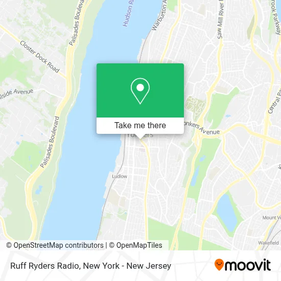
See Ruff Ryders Radio, Yonkers, on the map
Public Transit to Ruff Ryders Radio in Yonkers
Wondering how to get to Ruff Ryders Radio in Yonkers? Moovit helps you find the best way to get to Ruff Ryders Radio with step-by-step directions from the nearest public transit station.
Moovit provides free maps and live directions to help you navigate through your city. View schedules, routes, timetables, and find out how long does it take to get to Ruff Ryders Radio in real time.
Looking for the nearest stop or station to Ruff Ryders Radio? Check out this list of stops closest to your destination: S Broadway @ Cacace Justice Center; S Broadway/Prospect Av; Prospect St @ Riverdale Ave; Nepperhan Ave @ New Main St; Ludlow; Yonkers.
Bus: 1, 2, 4, 7, BXM3, 3, 8, 9, 32.Train: 1, ADIRONDACK, BERKSHIRE FLYER, EMPIRE SERVICE, ETHAN ALLEN EXPRESS, MAPLE LEAF.
Want to see if there’s another route that gets you there at an earlier time? Moovit helps you find alternative routes or times. Get directions from and directions to Ruff Ryders Radio easily from the Moovit App or Website.
We make riding to Ruff Ryders Radio easy, which is why over 1.5 million users, including users in Yonkers, trust Moovit as the best app for public transit. You don’t need to download an individual bus app or train app, Moovit is your all-in-one transit app that helps you find the best bus time or train time available.
For information on prices of bus, subway and train, costs and ride fares to Ruff Ryders Radio, please check the Moovit app.
Use the app to navigate to popular places including to the airport, hospital, stadium, grocery store, mall, coffee shop, school, college, and university.
Ruff Ryders Radio Address: S. Broadway street in Yonkers
- Ywca Of Yonkers,
- Legion De Maria Saint Mary's Yonkers NY 10701,
- Good Shepherd Arabic Catholic Community,
- St. Mary School, Yonkers,
- Dr. Caroline J. Jones,
- Streaming-The Good Shepherd Church,
- RJ's Broadway Bar & Grill,
- Sawyer Place,
- Yonkers Center Adult Day Program,
- Al-Husaini Plastic and Reconstructive Surgery Pc,
- Good Neighbor Pharmacy,
- Yesenny Permanent Makeup,
- Dr. Richard Khalil,
- Dentistry For Children, Yonkers,
- St. Joseph's Medical Practice, Pc,
- Police Captains, Lieutenants, and Sergeants Association Of Yonkers, Inc.,
- Yonkers, NY,
- St Joseph's Hospital Nursing,
- Julie MS Kuhn Icsw,
- Yonkers Gardens Center for Nursing and Rehabilitation
Places Near Ruff Ryders Radio (Yonkers)
- Hudson Yards, Manhattan,
- 1 Police Plaza, Manhattan,
- Rockefeller Center, Manhattan,
- SoHo, Manhattan,
- Chinatown, Manhattan,
- 3 Stone St, Manhattan,
- Mountainside Hospital, Glen Ridge,
- Pier 83, Manhattan,
- Katz's Deli, Manhattan,
- Bellevue Hospital, Manhattan,
- 111 Centre New York City Supreme Court, Manhattan,
- 26 Federal Plaza, Manhattan,
- 376 Hudson Street, Manhattan,
- 911 Memorial, Manhattan,
- Queens Center Mall, Queens,
- Times Square, Manhattan,
- qqqq, Manhattan,
- Wall Street, Manhattan,
- 66 John Street, Manhattan,
- San Gennaro Feast, Manhattan
How to get to popular places in New York - New Jersey with public transit
Get around Yonkers by public transit!
Traveling around Yonkers has never been so easy. See step by step directions as you travel to any attraction, street or major public transit station. View bus and train schedules, arrival times, service alerts and detailed routes on a map, so you know exactly how to get to anywhere in Yonkers.
When traveling to any destination around Yonkers use Moovit's Live Directions with Get Off Notifications to know exactly where and how far to walk, how long to wait for your line, and how many stops are left. Moovit will alert you when it's time to get off — no need to constantly re-check whether yours is the next stop.
Wondering how to use public transit in Yonkers or how to pay for public transit in Yonkers? Moovit public transit app can help you navigate your way with public transit easily, and at minimum cost. It includes public transit fees, ticket prices, and costs. Looking for a map of Yonkers public transit lines? Moovit public transit app shows all public transit maps in Yonkers with all Bus, Train, Subway, Light Rail, Ferry and Cable Car routes and stops on an interactive map.
New York - New Jersey has 6 transit type(s), including: Bus, Train, Subway, Light Rail, Ferry and Cable Car, operated by several transit agencies, including MTA Subway, Metro-North Railroad, LIRR, PATH, MTA New York City Transit - Express routes, MTA Bus, NJ Transit, NYC Ferry, NICE bus, Bee-Line Bus, NJ Transit Rail, Norwalk Transit District, Hartford Line, River Valley Transit and HART