How to get to Ruffian by bus?
Click on the bus route to see step by step directions with maps, line arrival times and updated time schedules.
From Astoria, NY, Queens
80 minFrom Costco, Queens
52 minFrom Beacon Theater, Manhattan
59 minFrom Mall del Sol Guayaquil,Ecuador, Queens
73 minFrom Frick Collection, Manhattan
45 minFrom North Bergen, NJ, North Bergen
78 minFrom West New York, NJ, West New York
65 minFrom Mitsuwa Marketplace, Edgewater
68 minFrom Mitsuwa Shuttle Bus Stop, Edgewater
68 min
How to get to Ruffian by subway?
Click on the subway route to see step by step directions with maps, line arrival times and updated time schedules.
Bus stops near Ruffian in Manhattan
Subway stations near Ruffian in Manhattan
Bus lines to Ruffian in Manhattan
What are the closest stations to Ruffian?
The closest stations to Ruffian are:
- Saint Marks Pl/Avenue A is 138 yards away, 2 min walk.
- Avenue A/E 5 St is 207 yards away, 3 min walk.
- Astor Pl is 255 yards away, 4 min walk.
- 1 Av/Saint Marks Pl is 262 yards away, 4 min walk.
- 8 St-Nyu is 434 yards away, 6 min walk.
- 3 Av is 719 yards away, 9 min walk.
- 2 Av is 761 yards away, 10 min walk.
Which bus lines stop near Ruffian?
These bus lines stop near Ruffian: M101, M103, M14A-SBS, M15, M8.
Which subway lines stop near Ruffian?
These subway lines stop near Ruffian: 6, F, L, W.
What’s the nearest subway station to Ruffian in Manhattan?
The nearest subway station to Ruffian in Manhattan is Astor Pl. It’s a 4 min walk away.
What’s the nearest bus station to Ruffian in Manhattan?
The nearest bus station to Ruffian in Manhattan is Saint Marks Pl/Avenue A. It’s a 2 min walk away.
What time is the first subway to Ruffian in Manhattan?
The F is the first subway that goes to Ruffian in Manhattan. It stops nearby at 3:02 AM.
What time is the last subway to Ruffian in Manhattan?
The F is the last subway that goes to Ruffian in Manhattan. It stops nearby at 3:56 AM.
What time is the first bus to Ruffian in Manhattan?
The M14A-SBS is the first bus that goes to Ruffian in Manhattan. It stops nearby at 3:13 AM.
What time is the last bus to Ruffian in Manhattan?
The M15 is the last bus that goes to Ruffian in Manhattan. It stops nearby at 2:46 AM.
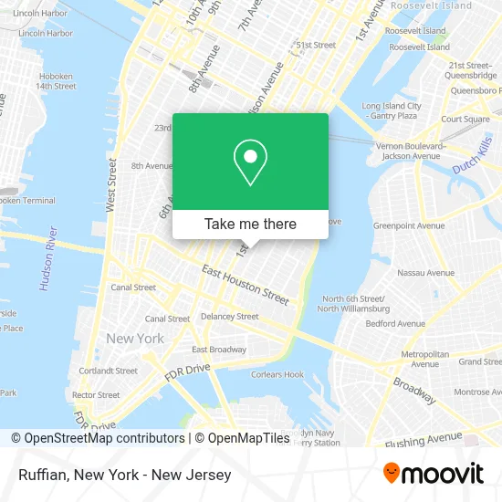
See Ruffian, Manhattan, on the map
Public Transit to Ruffian in Manhattan
Wondering how to get to Ruffian in Manhattan? Moovit helps you find the best way to get to Ruffian with step-by-step directions from the nearest public transit station.
Moovit provides free maps and live directions to help you navigate through your city. View schedules, routes, timetables, and find out how long does it take to get to Ruffian in real time.
Looking for the nearest stop or station to Ruffian? Check out this list of stops closest to your destination: Saint Marks Pl/Avenue A; Avenue A/E 5 St; Astor Pl; 1 Av/Saint Marks Pl; 8 St-Nyu; 3 Av; 2 Av.
Bus: M101, M103, M14A-SBS, M15, M8.Subway: 6, F, L, W, 4, 6X, N, Q, R, FX.
Want to see if there’s another route that gets you there at an earlier time? Moovit helps you find alternative routes or times. Get directions from and directions to Ruffian easily from the Moovit App or Website.
We make riding to Ruffian easy, which is why over 1.5 million users, including users in Manhattan, trust Moovit as the best app for public transit. You don’t need to download an individual bus app or train app, Moovit is your all-in-one transit app that helps you find the best bus time or train time available.
For information on prices of bus and subway, costs and ride fares to Ruffian, please check the Moovit app.
Use the app to navigate to popular places including to the airport, hospital, stadium, grocery store, mall, coffee shop, school, college, and university.
Ruffian Address: 125 E 7th St street in Manhattan
- Desnuda,
- Oaxaca Taqueria,
- The Fragile Flour,
- Jones Street Wine Bar,
- Rena Reborn,
- Cadence,
- Rubdiva Spa -Asian Massage Spa,
- Yuca Bar,
- Volavida Gallery,
- Bua,
- Occulture Nyc,
- Romeos,
- Maza,
- Dishwithdina,
- Mr Bing,
- Starchildny,
- London Planetree Playground,
- New York Laundry Service,
- Holla App Me Now,
- Gin Palace
Places Near Ruffian (Manhattan)
- Mountainside Hospital, Glen Ridge,
- Hudson Yards, Manhattan,
- 376 Hudson Street, Manhattan,
- qqqq, Manhattan,
- 1 Police Plaza, Manhattan,
- Times Square, Manhattan,
- 66 John Street, Manhattan,
- 3 Stone St, Manhattan,
- Rockefeller Center, Manhattan,
- Queens Center Mall, Queens,
- Chinatown, Manhattan,
- 26 Federal Plaza, Manhattan,
- Wall Street, Manhattan,
- SoHo, Manhattan,
- Pier 83, Manhattan,
- Bellevue Hospital, Manhattan,
- Katz's Deli, Manhattan,
- San Gennaro Feast, Manhattan,
- 911 Memorial, Manhattan,
- 111 Centre New York City Supreme Court, Manhattan
How to get to popular places in New York - New Jersey with public transit
Get around Manhattan by public transit!
Traveling around Manhattan has never been so easy. See step by step directions as you travel to any attraction, street or major public transit station. View bus and train schedules, arrival times, service alerts and detailed routes on a map, so you know exactly how to get to anywhere in Manhattan.
When traveling to any destination around Manhattan use Moovit's Live Directions with Get Off Notifications to know exactly where and how far to walk, how long to wait for your line, and how many stops are left. Moovit will alert you when it's time to get off — no need to constantly re-check whether yours is the next stop.
Wondering how to use public transit in Manhattan or how to pay for public transit in Manhattan? Moovit public transit app can help you navigate your way with public transit easily, and at minimum cost. It includes public transit fees, ticket prices, and costs. Looking for a map of Manhattan public transit lines? Moovit public transit app shows all public transit maps in Manhattan with all Bus, Train, Subway, Light Rail, Ferry and Cable Car routes and stops on an interactive map.
New York - New Jersey has 6 transit type(s), including: Bus, Train, Subway, Light Rail, Ferry and Cable Car, operated by several transit agencies, including MTA Subway, Metro-North Railroad, LIRR, PATH, MTA New York City Transit - Express routes, MTA Bus, NJ Transit, NYC Ferry, NICE bus, Bee-Line Bus, NJ Transit Rail, Norwalk Transit District, Hartford Line, River Valley Transit and HART