Directions to Rugs.Net (Freeport) with public transportation
The following transit lines have routes that pass near Rugs.Net
 Bus: N4, N40X, N19.
- Train: BABYLON BRANCH.
How to get to Rugs.Net by bus?
Click on the bus route to see step by step directions with maps, line arrival times and updated time schedules.
From Garden City, NY, Garden City
45 minFrom Green Acres Mall, South Valley Stream
73 minFrom Mercy Hospital, Rockville Centre
76 minFrom Roosevelt Field Mall Bus Terminal, East Garden City
52 minFrom Plattduetsche Park, Franklin Square
69 minFrom Uniondale, NY, Uniondale
44 minFrom Walmart, Valley Stream
67 minFrom Valley Stream, NY, Valley Stream
57 minFrom Westbury, NY, Westbury
58 minFrom East Meadow, NY, East Meadow
58 min
How to get to Rugs.Net by train?
Click on the train route to see step by step directions with maps, line arrival times and updated time schedules.
From Garden City, NY, Garden City
77 minFrom Green Acres Mall, South Valley Stream
75 minFrom Roosevelt Field Mall Bus Terminal, East Garden City
90 minFrom Plattduetsche Park, Franklin Square
85 minFrom Walmart, Valley Stream
68 minFrom Valley Stream, NY, Valley Stream
67 minFrom Westbury, NY, Westbury
72 min
Bus stops near Rugs.Net in Freeport
Train station near Rugs.Net in Freeport
- Merrick, 23 min walk,VIEW
What are the closest stations to Rugs.Net?
The closest stations to Rugs.Net are:
- Sportsmans Av / Atlantic is 118 yards away, 2 min walk.
- S Main St / Merrick is 168 yards away, 3 min walk.
- Merrick Rd + Henry St is 346 yards away, 5 min walk.
- Merrick is 1894 yards away, 23 min walk.
Which bus lines stop near Rugs.Net?
These bus lines stop near Rugs.Net: N4, N40X.
Which train line stops near Rugs.Net?
BABYLON BRANCH (Babylon)
What’s the nearest train station to Rugs.Net in Freeport?
The nearest train station to Rugs.Net in Freeport is Merrick. It’s a 23 min walk away.
What’s the nearest bus station to Rugs.Net in Freeport?
The nearest bus station to Rugs.Net in Freeport is Sportsmans Av / Atlantic. It’s a 2 min walk away.
What time is the first train to Rugs.Net in Freeport?
The BABYLON BRANCH is the first train that goes to Rugs.Net in Freeport. It stops nearby at 3:26 AM.
What time is the last train to Rugs.Net in Freeport?
The BABYLON BRANCH is the last train that goes to Rugs.Net in Freeport. It stops nearby at 3:32 AM.
What time is the first bus to Rugs.Net in Freeport?
The N4 is the first bus that goes to Rugs.Net in Freeport. It stops nearby at 3:25 AM.
What time is the last bus to Rugs.Net in Freeport?
The N4 is the last bus that goes to Rugs.Net in Freeport. It stops nearby at 3:25 AM.
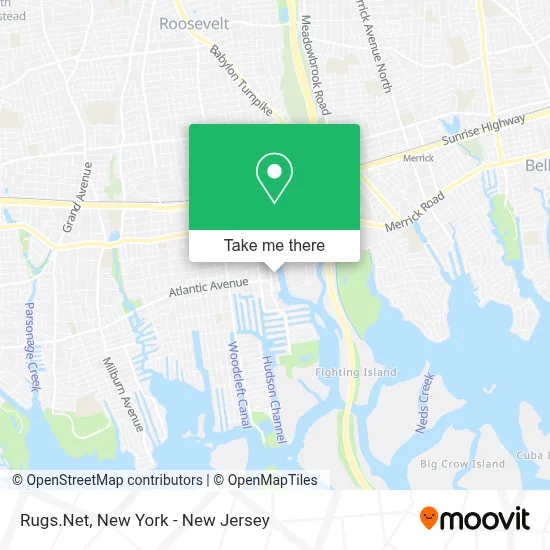
See Rugs.Net, Freeport, on the map
Public Transit to Rugs.Net in Freeport
Wondering how to get to Rugs.Net in Freeport? Moovit helps you find the best way to get to Rugs.Net with step-by-step directions from the nearest public transit station.
Moovit provides free maps and live directions to help you navigate through your city. View schedules, routes, timetables, and find out how long does it take to get to Rugs.Net in real time.
Looking for the nearest stop or station to Rugs.Net? Check out this list of stops closest to your destination: Sportsmans Av / Atlantic; S Main St / Merrick; Merrick Rd + Henry St; Merrick.
Bus: N4, N40X, N19.Train: BABYLON BRANCH.
Want to see if there’s another route that gets you there at an earlier time? Moovit helps you find alternative routes or times. Get directions from and directions to Rugs.Net easily from the Moovit App or Website.
We make riding to Rugs.Net easy, which is why over 1.5 million users, including users in Freeport, trust Moovit as the best app for public transit. You don’t need to download an individual bus app or train app, Moovit is your all-in-one transit app that helps you find the best bus time or train time available.
For information on prices of bus and train, costs and ride fares to Rugs.Net, please check the Moovit app.
Use the app to navigate to popular places including to the airport, hospital, stadium, grocery store, mall, coffee shop, school, college, and university.
Rugs.Net Address: 371 S Main St street in Freeport
- Dart Restoration,
- Mdt Performance,
- The Garden Freeport,
- Freedom Boat Club,
- Dart Restoration Corp.,
- Kevin Gallagher Plumbing Nassau,
- No Rush Cafe,
- 99c and Up Empire,
- Davita Freeport Kidney Center,
- Ups Access Point Location,
- Primelite Mfg. Corp.,
- The Baddie Works,
- Freeport Creek Marina,
- Atlantic Avenue Deli & Catering,
- Legacy Charters,
- Poopheads Pet Spa,
- Healthmart,
- Laser Nail Therapy Clinic,
- Kings House,
- Abc Supply Co. Inc.
Places Near Rugs.Net (Freeport)
- 376 Hudson Street, Manhattan,
- 26 Federal Plaza, Manhattan,
- Rockefeller Center, Manhattan,
- 1 Police Plaza, Manhattan,
- Chinatown, Manhattan,
- Wall Street, Manhattan,
- Pier 83, Manhattan,
- Mountainside Hospital, Glen Ridge,
- Bellevue Hospital, Manhattan,
- SoHo, Manhattan,
- 3 Stone St, Manhattan,
- Times Square, Manhattan,
- Queens Center Mall, Queens,
- Katz's Deli, Manhattan,
- 111 Centre New York City Supreme Court, Manhattan,
- 66 John Street, Manhattan,
- 911 Memorial, Manhattan,
- Hudson Yards, Manhattan,
- San Gennaro Feast, Manhattan,
- qqqq, Manhattan
How to get to popular places in New York - New Jersey with public transit
Get around Freeport by public transit!
Traveling around Freeport has never been so easy. See step by step directions as you travel to any attraction, street or major public transit station. View bus and train schedules, arrival times, service alerts and detailed routes on a map, so you know exactly how to get to anywhere in Freeport.
When traveling to any destination around Freeport use Moovit's Live Directions with Get Off Notifications to know exactly where and how far to walk, how long to wait for your line, and how many stops are left. Moovit will alert you when it's time to get off — no need to constantly re-check whether yours is the next stop.
Wondering how to use public transit in Freeport or how to pay for public transit in Freeport? Moovit public transit app can help you navigate your way with public transit easily, and at minimum cost. It includes public transit fees, ticket prices, and costs. Looking for a map of Freeport public transit lines? Moovit public transit app shows all public transit maps in Freeport with all Bus, Train, Subway, Light Rail, Ferry and Cable Car routes and stops on an interactive map.
New York - New Jersey has 6 transit type(s), including: Bus, Train, Subway, Light Rail, Ferry and Cable Car, operated by several transit agencies, including MTA Subway, Metro-North Railroad, LIRR, PATH, MTA New York City Transit - Express routes, MTA Bus, NJ Transit, NYC Ferry, NICE bus, Bee-Line Bus, NJ Transit Rail, Norwalk Transit District, Hartford Line, River Valley Transit and HART