Directions to Rui Claudir Bohneberger (Pinhais) with public transportation
The following transit lines have routes that pass near Rui Claudir Bohneberger
How to get to Rui Claudir Bohneberger by bus?
Click on the bus route to see step by step directions with maps, line arrival times and updated time schedules.
From Rua Castro 417, Água Verde
65 minFrom INSS - São José dos Pinhais, São José Dos Pinhais
83 minFrom Tribunal Regional Eleitoral do Paraná, Prado Velho
58 minFrom Hospital de Olhos do Paraná, Centro
50 minFrom Avenida Água Verde, Água Verde
69 minFrom Av Vicente Machado, Centro
53 minFrom Avenida São José 300, Cristo Rei
46 minFrom RENAULT do Brasil-Portaria 5, São José Dos Pinhais
59 minFrom Alameda Augusto Stellfeld, Centro
50 minFrom Rua Baltazar Carrasco dos Reis, Rebouças
61 min
Bus stops near Rui Claudir Bohneberger in Pinhais
Bus lines to Rui Claudir Bohneberger in Pinhais
- I20 MARACANÃ / AFONSO PENA, Terminal Afonso Pena → Terminal Maracanã,VIEW
- C15 WEISSÓPOLIS, Sentido Horário (após 09:00),VIEW
- C39 WEISSÓPOLIS / VILA MARIA ANTONIETA, Terminal Pinhais ↺ Weissópolis (Circular Anti-Horário),VIEW
- C36 CENTENÁRIO / BAIRRO ALTO (PINHAIS), Terminal Bairro Alto → Terminal Centenário,VIEW
- C38 PINHAIS / CENTENÁRIO (JARDIM TROPICAL VIA VARGEM GRANDE), Terminal Pinhais → Terminal Centenário,VIEW
What are the closest stations to Rui Claudir Bohneberger?
The closest stations to Rui Claudir Bohneberger are:
- R. Rio Paraná, 642 is 160 meters away, 3 min walk.
- Rua Rio Solimões, 1124-1178 is 303 meters away, 5 min walk.
- R. Rio Paraná, 1171 is 501 meters away, 7 min walk.
Which bus lines stop near Rui Claudir Bohneberger?
These bus lines stop near Rui Claudir Bohneberger: C15 WEISSÓPOLIS, C36 CENTENÁRIO / BAIRRO ALTO (PINHAIS), I20 MARACANÃ / AFONSO PENA.
What’s the nearest bus station to Rui Claudir Bohneberger in Pinhais?
The nearest bus station to Rui Claudir Bohneberger in Pinhais is R. Rio Paraná, 642. It’s a 3 min walk away.
What time is the first bus to Rui Claudir Bohneberger in Pinhais?
The C15 WEISSÓPOLIS is the first bus that goes to Rui Claudir Bohneberger in Pinhais. It stops nearby at 4:56 AM.
What time is the last bus to Rui Claudir Bohneberger in Pinhais?
The C15 WEISSÓPOLIS is the last bus that goes to Rui Claudir Bohneberger in Pinhais. It stops nearby at 12:48 AM.
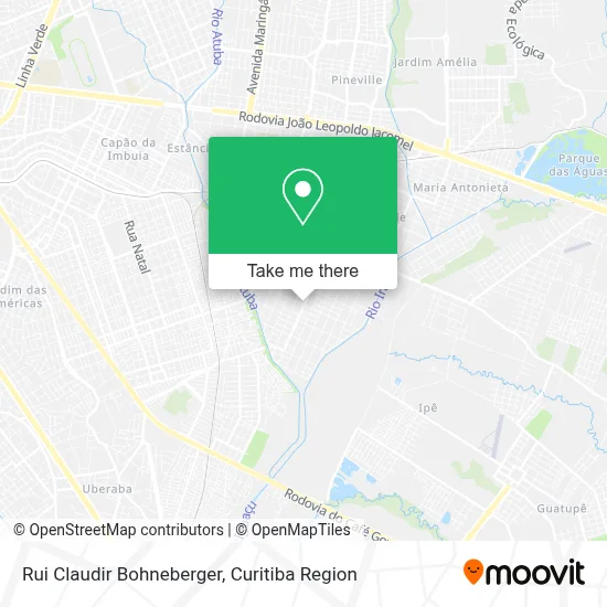
See Rui Claudir Bohneberger, Pinhais, on the map
Public Transit to Rui Claudir Bohneberger in Pinhais
Wondering how to get to Rui Claudir Bohneberger in Pinhais? Moovit helps you find the best way to get to Rui Claudir Bohneberger with step-by-step directions from the nearest public transit station.
Moovit provides free maps and live directions to help you navigate through your city. View schedules, routes, timetables, and find out how long does it take to get to Rui Claudir Bohneberger in real time.
Looking for the nearest stop or station to Rui Claudir Bohneberger? Check out this list of stops closest to your destination: R. Rio Paraná; Rua Rio Solimões; R. Rio Paraná.
Bus: C15 WEISSÓPOLIS, C36 CENTENÁRIO / BAIRRO ALTO (PINHAIS), I20 MARACANÃ / AFONSO PENA, C39 WEISSÓPOLIS / VILA MARIA ANTONIETA, C38 PINHAIS / CENTENÁRIO (JARDIM TROPICAL VIA VARGEM GRANDE).
Want to see if there’s another route that gets you there at an earlier time? Moovit helps you find alternative routes or times. Get directions from and directions to Rui Claudir Bohneberger easily from the Moovit App or Website.
We make riding to Rui Claudir Bohneberger easy, which is why over 1.5 million users, including users in Pinhais, trust Moovit as the best app for public transit. You don’t need to download an individual bus app or train app, Moovit is your all-in-one transit app that helps you find the best bus time or train time available.
For information on prices of bus, costs and ride fares to Rui Claudir Bohneberger, please check the Moovit app.
Use the app to navigate to popular places including to the airport, hospital, stadium, grocery store, mall, coffee shop, school, college, and university.
Rui Claudir Bohneberger Address: Rua Rio Solimões, 962 Weissópolis Pinhais-PR 83322-150 street in Pinhais
- Arte Pura Decoracoes,
- Rua Rio Solimões,
- Rua Rio Trombetas,
- Doutor Brinquedos,
- Emerson Maia,
- Paiol Distribuidora,
- d'Italia,
- Italia Presentes,
- Studio Liliane,
- M T P Paula & Cia,
- Marta Garcia Beauty & Hair,
- Citera Modas,
- Salao Sheyla de Paula,
- Dogão do Vieira,
- Cmei Tia Marlene,
- Posto de Saúde Weissópolis,
- Ajitel Manufatura Componentes Eletro Eletrônicos,
- Avenida Juscelino Kubitschek de Oliveira 13300,
- Rua Rio Paraná 1054,
- Flexcar Oficina de Lataria e Pintura Automotiva
Places Near Rui Claudir Bohneberger (Pinhais)
- Jockey Plaza Shopping Center, Tarumã,
- Campo Largo, Campo,
- Hospital Erasto Gaertner, Jardim Das Américas,
- Shopping Estação, Rebouças,
- Hhhhh, Fazendinha,
- Hospital Madalena Sofia, Bairro Alto,
- Jardim Botânico de Curitiba PR, Centro,
- Hospital Nossa Senhora Das Graças, Mercês,
- Pontifícia Universidade Católica do Paraná (PUCPR), Prado Velho,
- Hospital de Clínicas (HC - UFPR), Centro,
- Parque Barigui, Mercês,
- Rua Martim Afonso 558, Mercês,
- Hospital do Rocio, Campo,
- Hospital Angelina Caron, Campina Grande Do Sul,
- Rua General Mário Tourinho, Campina Do Siqueira,
- Shopping Palladium, Portão,
- Arena Da Baixada - Curitiba,
- Park Shopping Barigüi, Mossunguê,
- Hospital Da Cruz Vermelha, Batel,
- Hospital Universitário Evangélico de Curitiba, Bigorrilho
How to get to popular places in Curitiba Region with public transit
Get around Pinhais by public transit!
Traveling around Pinhais has never been so easy. See step by step directions as you travel to any attraction, street or major public transit station. View bus and train schedules, arrival times, service alerts and detailed routes on a map, so you know exactly how to get to anywhere in Pinhais.
When traveling to any destination around Pinhais use Moovit's Live Directions with Get Off Notifications to know exactly where and how far to walk, how long to wait for your line, and how many stops are left. Moovit will alert you when it's time to get off — no need to constantly re-check whether yours is the next stop.
Wondering how to use public transit in Pinhais or how to pay for public transit in Pinhais? Moovit public transit app can help you navigate your way with public transit easily, and at minimum cost. It includes public transit fees, ticket prices, and costs. Looking for a map of Pinhais public transit lines? Moovit public transit app shows all public transit maps in Pinhais with all Bus and Cable Car routes and stops on an interactive map.
Curitiba Region has 2 transit type(s), including: Bus and Cable Car, operated by several transit agencies, including Sistema Integrado de Mobilidade (URBS), Sistema Integrado de Mobilidade (AMEP), URBS (Cartões bancários e Dinheiro), URBS (Cartões bancários / Cartão URBS), AMEP (Cartões bancários / Cartão MetroCard), AMEP (Cartões bancários / Cartão MetroCard / Dinheiro), Viação Colombo (Dinheiro), TRIAR (Cartão TRIAR / Dinheiro), Empresa Curitiba Cerro Azul (Dinheiro), Expresso Nossa Senhora da Penha (Dinheiro), Empresa Campo Alto Tijucas (Dinheiro), Auto Viação São José (Cartão VEM / Dinheiro), BRT S/A (Cartão VEM / Dinheiro), TransPiedade (Cartão Cidadão / Dinheiro) and Oceânica Sul (Cartão Transporte / Dinheiro)