How to get to Ruine Niedergundelfingen by bus?
Click on the bus route to see step by step directions with maps, line arrival times and updated time schedules.
From Uracher Wasserfall, Gemeindeverwaltungsverband Bad Urach
109 minFrom 72793, Pfullingen
127 minFrom M&I Fachkliniken Hohenurach, Gemeindeverwaltungsverband Bad Urach
116 minFrom Achalm Hotel Restaurant, Reutlingen
144 minFrom Kloster Untermarchtal, Verwaltungsgemeinschaft Munderkingen
120 minFrom Alb Thermen Bad Urach, Gemeindeverwaltungsverband Bad Urach
111 minFrom Reha-klinik Schwäbische Alb, Gemeindeverwaltungsverband Bad Urach
115 minFrom Freibad Pfullingen, Pfullingen
115 minFrom I&M Fachkliniken Hohenurach Haus 2, Gemeindeverwaltungsverband Bad Urach
113 minFrom Kaufland, Pfullingen
125 min
Bus stop near Ruine Niedergundelfingen in Gemeindeverwaltungsverband Münsingen
- Gundelfingen Ack, 5 min walk,VIEW
Bus lines to Ruine Niedergundelfingen in Gemeindeverwaltungsverband Münsingen
What are the closest stations to Ruine Niedergundelfingen?
The closest stations to Ruine Niedergundelfingen are:
- Gundelfingen Ack is 390 meters away, 5 min walk.
Which bus line stops near Ruine Niedergundelfingen?
265 (Riedlingen Zob/Bahnhof)
What’s the nearest bus station to Ruine Niedergundelfingen in Gemeindeverwaltungsverband Münsingen?
The nearest bus station to Ruine Niedergundelfingen in Gemeindeverwaltungsverband Münsingen is Gundelfingen Ack. It’s a 5 min walk away.
What time is the first bus to Ruine Niedergundelfingen in Gemeindeverwaltungsverband Münsingen?
The 265 is the first bus that goes to Ruine Niedergundelfingen in Gemeindeverwaltungsverband Münsingen. It stops nearby at 5:19 AM.
What time is the last bus to Ruine Niedergundelfingen in Gemeindeverwaltungsverband Münsingen?
The A27 is the last bus that goes to Ruine Niedergundelfingen in Gemeindeverwaltungsverband Münsingen. It stops nearby at 11:28 PM.
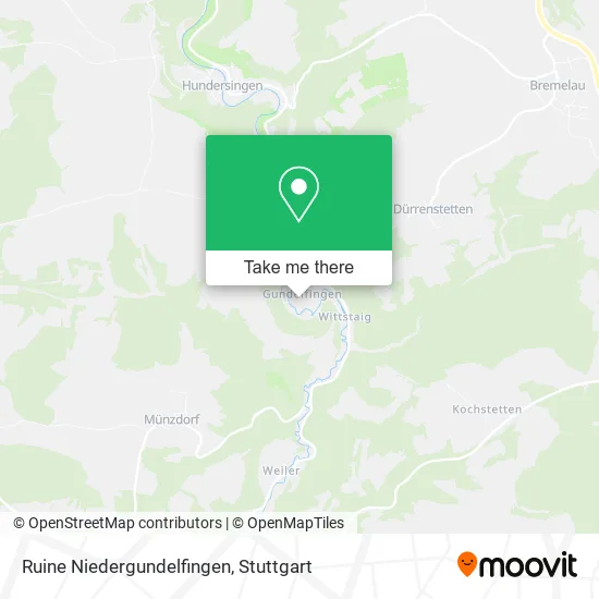
See Ruine Niedergundelfingen, Gemeindeverwaltungsverband Münsingen, on the map
Public Transit to Ruine Niedergundelfingen in Gemeindeverwaltungsverband Münsingen
Wondering how to get to Ruine Niedergundelfingen in Gemeindeverwaltungsverband Münsingen? Moovit helps you find the best way to get to Ruine Niedergundelfingen with step-by-step directions from the nearest public transit station.
Moovit provides free maps and live directions to help you navigate through your city. View schedules, routes, timetables, and find out how long does it take to get to Ruine Niedergundelfingen in real time.
Looking for the nearest stop or station to Ruine Niedergundelfingen? Check out this list of stops closest to your destination: Gundelfingen Ack.
Bus: 265, A27.
Want to see if there’s another route that gets you there at an earlier time? Moovit helps you find alternative routes or times. Get directions from and directions to Ruine Niedergundelfingen easily from the Moovit App or Website.
We make riding to Ruine Niedergundelfingen easy, which is why over 1.5 million users, including users in Gemeindeverwaltungsverband Münsingen, trust Moovit as the best app for public transit. You don’t need to download an individual bus app or train app, Moovit is your all-in-one transit app that helps you find the best bus time or train time available.
For information on prices of bus and train, costs and ride fares to Ruine Niedergundelfingen, please check the Moovit app.
Use the app to navigate to popular places including to the airport, hospital, stadium, grocery store, mall, coffee shop, school, college, and university.
Ruine Niedergundelfingen Address: Niedergundelfingen Gundelfingen, 72525 Münsingen street in Gemeindeverwaltungsverband Münsingen
- Sankt-Michaels-Kapelle,
- Gundelfingen,
- M.-Erzberger-Str. Gundelfingen,
- Wellpool24,
- Burg Gundelfingen,
- Lautertal-Idylle,
- Peter Koreng Jun,
- Auf Der Au Gundelfingen,
- Pro Münsingen,
- Bauhof Stueble,
- Ferienwohnungen Erzberger,
- Feuerwehr Münsingen,
- An Der Dölle Gundelfingen,
- Bauhof-Stüble,
- M.-Erzberger-Str. Gundelfingen,
- Burgblick,
- Antoniuskapelle,
- Geiselhardt GmbH & Co. KG Anton,
- Ack,
- Bernd Fiedler Flaschnerei
Places Near Ruine Niedergundelfingen (Gemeindeverwaltungsverband Münsingen)
- Hanns-Martin-Schleyer-Halle (Stuttgart Hans-Martin-Schleyerhalle), Bad Cannstatt,
- Klinikum Stuttgart - Katharinenhospital, Stuttgart-Mitte,
- Waldfriedhof, Degerloch,
- SI-Centrum, Möhringen,
- Gasometer Pforzheim, Pforzheim,
- Schleyerhalle, Bad Cannstatt,
- Mercedes-Benz Museum (Mercedes Museum Stuttgart), Bad Cannstatt,
- Im Wizemann (Halle), Bad Cannstatt,
- Hanns-Martin-Schleyer-Halle, Bad Cannstatt,
- Mettingen Eros-Center Puff Laufhaus, Esslingen Am Neckar,
- Wilhelma (U-Bahn Wilhelma), Bad Cannstatt,
- Gleis 101/102 (tief), Stuttgart-Mitte,
- Pariser Platz Stuttgart, Stuttgart-Mitte,
- FlixBus Haltestelle, Stuttgart,
- Hauptbahnhof Stuttgart, Stuttgart-Mitte,
- Porsche-Arena, Bad Cannstatt,
- Marmorsaal Im Weissenburgpark, Stuttgart-Süd,
- Geilhaus Haus 33a, Reutlingen-Betzingen,
- Mercedes-Benz Museum, Bad Cannstatt,
- Porsche Museum, Zuffenhausen
How to get to popular places in Stuttgart with public transit
Get around Gemeindeverwaltungsverband Münsingen by public transit!
Traveling around Gemeindeverwaltungsverband Münsingen has never been so easy. See step by step directions as you travel to any attraction, street or major public transit station. View bus and train schedules, arrival times, service alerts and detailed routes on a map, so you know exactly how to get to anywhere in Gemeindeverwaltungsverband Münsingen.
When traveling to any destination around Gemeindeverwaltungsverband Münsingen use Moovit's Live Directions with Get Off Notifications to know exactly where and how far to walk, how long to wait for your line, and how many stops are left. Moovit will alert you when it's time to get off — no need to constantly re-check whether yours is the next stop.
Wondering how to use public transit in Gemeindeverwaltungsverband Münsingen or how to pay for public transit in Gemeindeverwaltungsverband Münsingen? Moovit public transit app can help you navigate your way with public transit easily, and at minimum cost. It includes public transit fees, ticket prices, and costs. Looking for a map of Gemeindeverwaltungsverband Münsingen public transit lines? Moovit public transit app shows all public transit maps in Gemeindeverwaltungsverband Münsingen with all Bus, Train, Subway, Light Rail, Ferry, S-Bahn and Funicular routes and stops on an interactive map.
Stuttgart has 7 transit type(s), including: Bus, Train, Subway, Light Rail, Ferry, S-Bahn and Funicular, operated by several transit agencies, including SSB - Stadtbahn, SSB, SSB - Seilbahn / Zacke, S-Bahn Stuttgart, Rhein-Neckar-Verkehr GmbH (rnv), Karlsruher Verkehrsverbund, DB AG, DB Regiobus BW, Arverio Baden-Württemberg GmbH, DB RegioNetz Verkehrs GmbH Westfrankenbahn, DB Regio AG Baden-Württemberg, Südwestdeutsche Verkehrs-AG, DB Regio AG Mitte Region Hessen, DB and Bodensee-Oberschwaben-Bahn