How to get to Rujak Rojok by bus?
Click on the bus route to see step by step directions with maps, line arrival times and updated time schedules.
From Alun-alun Ujung Berung, Kota Bandung
48 minFrom Jl. Cihanjuang Cibaligo, Parompong, Bandung, Bandung
65 minFrom Pengobatan Sinshe Ling, Kota Bandung
35 minFrom Ujung Berung, Kota Bandung
52 minFrom Pusat Pendidikan Polisi Militer (PUSDIKPOM), Cimahi
50 minFrom Gedebage, Kota Bandung
55 minFrom Lembang, Bandung
59 minFrom Jl.Cihanjuang, Cimahi
39 minFrom Klinik Medika Pratama (Dokter jaga 24 Jam), Kota Bandung
52 minFrom Gunung Papandayan, Garut
39 min
How to get to Rujak Rojok by train?
Click on the train route to see step by step directions with maps, line arrival times and updated time schedules.
Bus stops near Rujak Rojok in Kota Bandung
Train station near Rujak Rojok in Kota Bandung
- Stasiun Bandung (Lokal), 32 min walk,VIEW
Bus lines to Rujak Rojok in Kota Bandung
- 03, Ledeng,VIEW
- 14, Stasiun Hall,VIEW
- 17, Pasar Induk Caringin,VIEW
- 31, Ciroyom,VIEW
- 34, Caringin,VIEW
- TMP 3D, Baleendah,VIEW
- 09, Dago,VIEW
- 15, Ledeng,VIEW
- 18, Panghegar Permai,VIEW
- DAMRI KBP, Kota Baru Parahyangan,VIEW
- TMP 4D, Leuwipanjang,VIEW
- 02, Dago,VIEW
- BS 02, Leuwipanjang,VIEW
- BS 01, Terminal Antapani,VIEW
- 10, Ciroyom,VIEW
- TMB K5, Stasiun Hall,VIEW
- 11B, Ciumbeuleuit,VIEW
- TMB F1, Stasiun Hall,VIEW
- 22, Kalapa,VIEW
- 26, Tegalega,VIEW
What are the closest stations to Rujak Rojok?
The closest stations to Rujak Rojok are:
- Bec (Bandung Electronic Center) is 122 meters away, 2 min walk.
- Riau XL is 133 meters away, 2 min walk.
- Hotel the One-O-One A is 304 meters away, 4 min walk.
- Halte Riau Junction is 367 meters away, 5 min walk.
- Riau Junction 1 is 382 meters away, 6 min walk.
- Jalan Wastukancana, 45 is 420 meters away, 6 min walk.
- Pasar Bunga Wastu Kencana is 432 meters away, 6 min walk.
- Balaikota Bandung is 492 meters away, 7 min walk.
- Stasiun Bandung (Lokal) is 2466 meters away, 32 min walk.
Which bus lines stop near Rujak Rojok?
These bus lines stop near Rujak Rojok: 12, 15, 17, 18, TMP 3D.
Which train line stops near Rujak Rojok?
B (Padalarang—Cicalengka)
What’s the nearest bus station to Rujak Rojok in Kota Bandung?
The nearest bus stations to Rujak Rojok in Kota Bandung are Bec (Bandung Electronic Center) and Riau XL. The closest one is a 2 min walk away.
What time is the first train to Rujak Rojok in Kota Bandung?
The B is the first train that goes to Rujak Rojok in Kota Bandung. It stops nearby at 5:16 AM.
What time is the last train to Rujak Rojok in Kota Bandung?
The B is the last train that goes to Rujak Rojok in Kota Bandung. It stops nearby at 1:05 AM.
What time is the first bus to Rujak Rojok in Kota Bandung?
The TMP 3D is the first bus that goes to Rujak Rojok in Kota Bandung. It stops nearby at 4:30 AM.
What time is the last bus to Rujak Rojok in Kota Bandung?
The 02 is the last bus that goes to Rujak Rojok in Kota Bandung. It stops nearby at 11:11 PM.
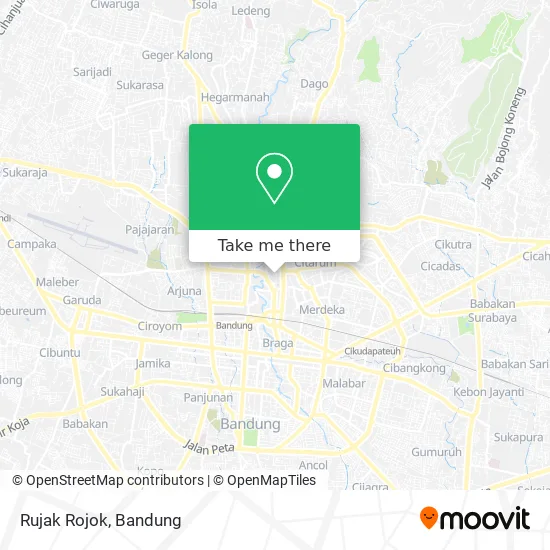
See Rujak Rojok, Kota Bandung, on the map
Public Transit to Rujak Rojok in Kota Bandung
Wondering how to get to Rujak Rojok in Kota Bandung? Moovit helps you find the best way to get to Rujak Rojok with step-by-step directions from the nearest public transit station.
Moovit provides free maps and live directions to help you navigate through your city. View schedules, routes, timetables, and find out how long does it take to get to Rujak Rojok in real time.
Looking for the nearest stop or station to Rujak Rojok? Check out this list of stops closest to your destination: Bec (Bandung Electronic Center); Riau XL; Hotel the One-O-One A; Halte Riau Junction; Riau Junction 1; Jalan Wastukancana; Pasar Bunga Wastu Kencana; Balaikota Bandung; Stasiun Bandung (Lokal).
Bus: 12, 15, 17, 18, TMP 3D, 03, 14, 31, 34, 09, DAMRI KBP, TMP 4D, 02, BS 02, BS 01, 10, TMB K5.Train: B, C.
Want to see if there’s another route that gets you there at an earlier time? Moovit helps you find alternative routes or times. Get directions from and directions to Rujak Rojok easily from the Moovit App or Website.
We make riding to Rujak Rojok easy, which is why over 1.5 million users, including users in Kota Bandung, trust Moovit as the best app for public transit. You don’t need to download an individual bus app or train app, Moovit is your all-in-one transit app that helps you find the best bus time or train time available.
For information on prices of bus and train, costs and ride fares to Rujak Rojok, please check the Moovit app.
Use the app to navigate to popular places including to the airport, hospital, stadium, grocery store, mall, coffee shop, school, college, and university.
Rujak Rojok Address: Jalan Purnawarman Bandung Kota 40113 street in Kota Bandung
- Ketapang Cd,
- Omega,
- Gober Cell,
- Maybank,
- Kwalitas Agung Sejati. PT,
- Ace Digiband,
- Center Poin,
- Infinity F-08,
- Junita Komunita,
- Haka Cell,
- Focus Security,
- Tridaya Dinamika Artha,
- Top Cell,
- King Kong e-20,
- Stone Cell,
- Diamond Computindo Perkasa,
- Parkiran Motor BEC™,
- Mall Bec Bandung Electronik Center,
- Tahu Gejrot Pa Deden,
- Podjok Kopi
Places Near Rujak Rojok (Kota Bandung)
- Braga, Kota Bandung,
- Cililin, Kab. Bandung Barat, Bandung,
- 23 Paskal Shopping Mall, Kota Bandung,
- Pantai Santolo - Pameungpeuk Garut, Bandung,
- Warung bokep, Bandung,
- Trans Studio Mall (TSM), Kota Bandung,
- YYY, Kota Bandung,
- bus damri “Dago - Leuwi panjang”, Kota Bandung,
- Summarecon Mall Bandung, Kota Bandung,
- Batujajar, Bandung,
- Rumah Sakit Hasan Sadikin, Kota Bandung,
- Taman Hutan Raya (TAHURA), Kota Bandung,
- Subang, Kota Bandung,
- Bus Damri Dipati Ukur-Jatinangor, Bandung,
- Stadion Gelora Bandung Lautan Api (GBLA), Kota Bandung,
- Rs Hasan Sadikin, Kota Bandung,
- Universitas Pendidikan Indonesia (UPI), Kota Bandung,
- RSUP Dr. Hasan Sadikin (RSHS), Kota Bandung,
- Pasteur, Kota Bandung,
- Jl.L.L.R.E.Martadinata no.47,Bandung Regency, Bandung
How to get to popular places in Bandung with public transit
Get around Kota Bandung by public transit!
Traveling around Kota Bandung has never been so easy. See step by step directions as you travel to any attraction, street or major public transit station. View bus and train schedules, arrival times, service alerts and detailed routes on a map, so you know exactly how to get to anywhere in Kota Bandung.
When traveling to any destination around Kota Bandung use Moovit's Live Directions with Get Off Notifications to know exactly where and how far to walk, how long to wait for your line, and how many stops are left. Moovit will alert you when it's time to get off — no need to constantly re-check whether yours is the next stop.
Wondering how to use public transit in Kota Bandung or how to pay for public transit in Kota Bandung? Moovit public transit app can help you navigate your way with public transit easily, and at minimum cost. It includes public transit fees, ticket prices, and costs. Looking for a map of Kota Bandung public transit lines? Moovit public transit app shows all public transit maps in Kota Bandung with all Bus and Train routes and stops on an interactive map.
Bandung has 2 transit type(s), including: Bus and Train, operated by several transit agencies, including Trans Metro Bandung, Trans Metro Pasundan - Teman Bus, Angkutan Antarkota Dalam Provinsi, DAMRI, KAI Commuter, Angkutan Kota Bandung, Angkutan Kabupaten Bandung, Kobanter Baru, Bus Wisata DISHUB Kota Bandung, Bus Sekolah DISHUB Kota Bandung and Dinas Perhubungan Provinsi Jawa Barat