How to get to Ruko Pengampon Square by bus?
Click on the bus route to see step by step directions with maps, line arrival times and updated time schedules.
From RS. Islam Jemursari Surabaya, Wonokromo
40 minFrom Bus Akas Patas Surabaya-Sumenep, Semolowaru
64 minFrom Jl. Sarono Jiwo, Panjangjiwo
56 minFrom Jl Raya Bukit Darmo Golf, Surabaya
55 minFrom Jl pulosari 3a no 2 , surabaya, Sawunggaling
47 minFrom Kanwil Kemenkumham Jatim, Embong Kaliasin
36 minFrom Jl Dukuh Karangan, Wiyung - Surabaya, Babatan
66 minFrom Stadion Kanjuruhan Malang, Ngagelrejo
58 minFrom JX International (Jatim Expo), Ketintang
46 minFrom The Alana Hotel Surabaya, Ketintang
51 min
Bus stops near Ruko Pengampon Square in Surabaya
Bus lines to Ruko Pengampon Square in Surabaya
What are the closest stations to Ruko Pengampon Square?
The closest stations to Ruko Pengampon Square are:
- Klinik Bafar is 754 meters away, 11 min walk.
- Spil is 832 meters away, 12 min walk.
- Hotel Berlian International is 905 meters away, 12 min walk.
- Jalan Gresik Gadukan Timur 45 is 952 meters away, 13 min walk.
Which bus lines stop near Ruko Pengampon Square?
These bus lines stop near Ruko Pengampon Square: C, P2, R1, Z1.
What’s the nearest bus station to Ruko Pengampon Square in Surabaya?
The nearest bus station to Ruko Pengampon Square in Surabaya is Klinik Bafar. It’s a 11 min walk away.
What time is the first bus to Ruko Pengampon Square in Surabaya?
The Z is the first bus that goes to Ruko Pengampon Square in Surabaya. It stops nearby at 5:05 AM.
What time is the last bus to Ruko Pengampon Square in Surabaya?
The Z1 is the last bus that goes to Ruko Pengampon Square in Surabaya. It stops nearby at 10:24 PM.
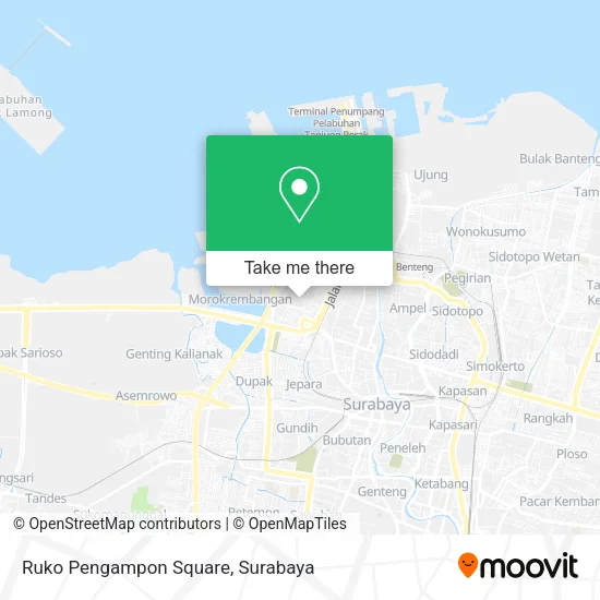
See Ruko Pengampon Square, Surabaya, on the map
Public Transit to Ruko Pengampon Square in Surabaya
Wondering how to get to Ruko Pengampon Square in Surabaya? Moovit helps you find the best way to get to Ruko Pengampon Square with step-by-step directions from the nearest public transit station.
Moovit provides free maps and live directions to help you navigate through your city. View schedules, routes, timetables, and find out how long does it take to get to Ruko Pengampon Square in real time.
Looking for the nearest stop or station to Ruko Pengampon Square? Check out this list of stops closest to your destination: Klinik Bafar; Spil; Hotel Berlian International; Jalan Gresik Gadukan Timur 45.
Bus: C, P2, R1, Z1, K, WL, Z, L.
Want to see if there’s another route that gets you there at an earlier time? Moovit helps you find alternative routes or times. Get directions from and directions to Ruko Pengampon Square easily from the Moovit App or Website.
We make riding to Ruko Pengampon Square easy, which is why over 1.5 million users, including users in Surabaya, trust Moovit as the best app for public transit. You don’t need to download an individual bus app or train app, Moovit is your all-in-one transit app that helps you find the best bus time or train time available.
For information on prices of bus, costs and ride fares to Ruko Pengampon Square, please check the Moovit app.
Use the app to navigate to popular places including to the airport, hospital, stadium, grocery store, mall, coffee shop, school, college, and university.
Ruko Pengampon Square Address: Semut Baru street in Surabaya
- PT Tunas Berkat Indo Pratama,
- Dapur Ummi,
- PT Maharani Daya Semesta,
- PT. Solusi Cipta Sarana (aka PT. Tankindo Adhiraksa),
- Ari Design,
- CV Harta Alam Jaya,
- Cahaya Makmur Mungsing Elektronik,
- Toko Lestari Jaya,
- PT Jonemmo Java Indo,
- PT Cempaka Putih Nusantara,
- Yoga,
- PT Alam Mekar Tunggal,
- Mako Lantamal V Tanjung Perak,
- Soto & Sate Banjar Bu Erlina FF Pakuwon City,
- Cafe Mey,
- Pt. Sumber Alfaria Trijaya,
- Bank Rakyat Indonesia,
- Bengkel Sepeda Motor,
- Serunting Sriwijaya .Pt,
- Yakult Center Tanjung Perak
Places Near Ruko Pengampon Square (Surabaya)
- BG Junction Mall, Bubutan,
- Halte Bis Royal Plaza, Wonokromo,
- PTC, Surabaya,
- Bg Junction, Bubutan,
- Pakuwon City Mall, Keputih,
- Smoking Room Terminal Domestik Juanda International Airport, Sidoarjo,
- Grand City Mall, Surabaya, Gubeng,
- UPN Veteran Jawa Timur, Gunung Anyar,
- Taman Harmoni, Keputih,
- Galaxy Mall Surabaya, Mulyorejo,
- Stadion gelora bung tomo(surabaya,jawa timur), Surabaya,
- Pelabuhan Tanjung Perak,
- Masjid Al-Akbar, Surabaya,
- Kebun Binatang Surabaya, Darmo,
- Kantor Regional II BKN Surabaya, Sidoarjo,
- Pakuwon Mall, Lontar,
- Graha Pena, Ketintang,
- Universitas Negeri Surabaya (UNESA), Lidah Wetan,
- Bis Damri P1 (Perak-Bungurasih PP), Krembangan Selatan,
- GBT (Gelora Bung Tomo) Surabaya, Benowo
How to get to popular places in Surabaya with public transit
Get around Surabaya by public transit!
Traveling around Surabaya has never been so easy. See step by step directions as you travel to any attraction, street or major public transit station. View bus and train schedules, arrival times, service alerts and detailed routes on a map, so you know exactly how to get to anywhere in Surabaya.
When traveling to any destination around Surabaya use Moovit's Live Directions with Get Off Notifications to know exactly where and how far to walk, how long to wait for your line, and how many stops are left. Moovit will alert you when it's time to get off — no need to constantly re-check whether yours is the next stop.
Wondering how to use public transit in Surabaya or how to pay for public transit in Surabaya? Moovit public transit app can help you navigate your way with public transit easily, and at minimum cost. It includes public transit fees, ticket prices, and costs. Looking for a map of Surabaya public transit lines? Moovit public transit app shows all public transit maps in Surabaya with all Bus and Train routes and stops on an interactive map.
Surabaya has 2 transit type(s), including: Bus and Train, operated by several transit agencies, including KAI Commuter, Angkutan Surabaya, Trans Semanggi Suroboyo, Suroboyo Bus, Feeder Wira Wiri Suroboyo, Trans Jatim and DAMRI