Directions to Ruling Skin (Manhattan) with public transportation
The following transit lines have routes that pass near Ruling Skin
 Bus: BM5, BXM4, M103, M2, M42.
- Train: 2, BABYLON BRANCH, YEL, CITY TERMINAL ZONE, FAR ROCKAWAY BRANCH.
- Subway: 4, 5, 6, 6X, S.
How to get to Ruling Skin by bus?
Click on the bus route to see step by step directions with maps, line arrival times and updated time schedules.
From Aaaaa Aaaa, Bronx
99 minFrom 120 Wall Street, Manhattan
43 minFrom 250 Greenwich St, Manhattan
46 minFrom 23rd Street & 6th Ave., Manhattan
56 minFrom Rego Park, Queens
38 minFrom 1231 Lafayette Avenue, Bronx
84 minFrom 225 Broadway, Manhattan
42 minFrom The Bronx, NY, Bronx
67 minFrom American Dream, East Rutherford
54 min
How to get to Ruling Skin by train?
Click on the train route to see step by step directions with maps, line arrival times and updated time schedules.
How to get to Ruling Skin by subway?
Click on the subway route to see step by step directions with maps, line arrival times and updated time schedules.
Bus stops near Ruling Skin in Manhattan
Train stations near Ruling Skin in Manhattan
Subway stations near Ruling Skin in Manhattan
Bus lines to Ruling Skin in Manhattan
- M42, East Side U N-1 Av Crosstown,VIEW
- NEWARK AIRPORT EXPRESS, New York,VIEW
- 42ND ST, E 42nd St & 3rd Ave,VIEW
- M101, Limited East Village 3 Av-6 St Via Lex,VIEW
- M102, East Village 6 St Via Lex Av,VIEW
- M103, City Hall Via Lex Av,VIEW
- SIM6, Midtown Via 23 St Via Madison Av,VIEW
- SIM11, New Dorp Via Hylan Bl,VIEW
- BXM1, East Midtown 34 St Via Lex Av,VIEW
- BM1, Mill Basin - Downtown/Midtown,VIEW
- M1, Harlem - East Village,VIEW
- BM2, Canarsie/Spring Creek - Downtown/Midtown,VIEW
- M2, Washington Heights - East Village,VIEW
- BM3, Sheepshead Bay - Downtown/Midtown,VIEW
- BM4, Gerritsen Beach - Downtown/Midtown,VIEW
- BM5, Spring Creek - Midtown,VIEW
- SIM4C, Midtown Via Church St Via Madison Av,VIEW
- SIM31, Midtown Via 23 St Via Madison Av,VIEW
- SIM33C, Midtown Via Church Via Madison Av,VIEW
- M3, St Nich A 193 St Via Madison Via St Nich,VIEW
What are the closest stations to Ruling Skin?
The closest stations to Ruling Skin are:
- E 42 St/Park Av is 97 yards away, 2 min walk.
- Grand Central is 100 yards away, 2 min walk.
- Grand Central Madison is 107 yards away, 2 min walk.
- E 42nd St & Park Ave is 112 yards away, 2 min walk.
- Grand Central-42 St is 141 yards away, 2 min walk.
- Lexington Av/E 42 St is 142 yards away, 2 min walk.
- Lexington Ave & E 41st Ave is 143 yards away, 2 min walk.
- Madison Av/E 41 St is 202 yards away, 3 min walk.
- Madison Av/E 40 St is 242 yards away, 3 min walk.
- 42 St-Bryant Pk is 287 yards away, 4 min walk.
Which bus lines stop near Ruling Skin?
These bus lines stop near Ruling Skin: BM5, BXM4, M103, M2, M42, QM34.
Which train lines stop near Ruling Skin?
These train lines stop near Ruling Skin: 2, BABYLON BRANCH, YEL.
Which subway lines stop near Ruling Skin?
These subway lines stop near Ruling Skin: 4, 5, 6, 6X, S.
What’s the nearest subway station to Ruling Skin in Manhattan?
The nearest subway station to Ruling Skin in Manhattan is Grand Central-42 St. It’s a 2 min walk away.
What’s the nearest train station to Ruling Skin in Manhattan?
The nearest train stations to Ruling Skin in Manhattan are Grand Central Madison and Grand Central. The closest one is a 2 min walk away.
What’s the nearest bus station to Ruling Skin in Manhattan?
The nearest bus stations to Ruling Skin in Manhattan are E 42 St/Park Av, Grand Central, E 42nd St & Park Ave, Lexington Av/E 42 St and Lexington Ave & E 41st Ave. The closest one is a 2 min walk away.
What time is the first subway to Ruling Skin in Manhattan?
The D is the first subway that goes to Ruling Skin in Manhattan. It stops nearby at 3:00 AM.
What time is the last subway to Ruling Skin in Manhattan?
The D is the last subway that goes to Ruling Skin in Manhattan. It stops nearby at 3:52 AM.
What time is the first train to Ruling Skin in Manhattan?
The 3 is the first train that goes to Ruling Skin in Manhattan. It stops nearby at 5:28 AM.
What time is the last train to Ruling Skin in Manhattan?
The 1 is the last train that goes to Ruling Skin in Manhattan. It stops nearby at 2:12 AM.
What time is the first bus to Ruling Skin in Manhattan?
The M101 is the first bus that goes to Ruling Skin in Manhattan. It stops nearby at 3:05 AM.
What time is the last bus to Ruling Skin in Manhattan?
The M103 is the last bus that goes to Ruling Skin in Manhattan. It stops nearby at 3:15 AM.
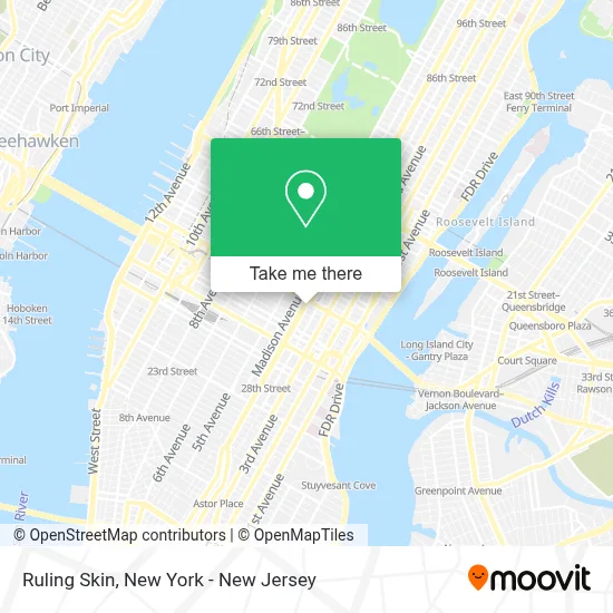
See Ruling Skin, Manhattan, on the map
Public Transit to Ruling Skin in Manhattan
Wondering how to get to Ruling Skin in Manhattan? Moovit helps you find the best way to get to Ruling Skin with step-by-step directions from the nearest public transit station.
Moovit provides free maps and live directions to help you navigate through your city. View schedules, routes, timetables, and find out how long does it take to get to Ruling Skin in real time.
Looking for the nearest stop or station to Ruling Skin? Check out this list of stops closest to your destination: E 42 St/Park Av; Grand Central; Grand Central Madison; E 42nd St & Park Ave; Grand Central-42 St; Lexington Av/E 42 St; Lexington Ave & E 41st Ave; Madison Av/E 41 St; Madison Av/E 40 St; 42 St-Bryant Pk.
Bus: BM5, BXM4, M103, M2, M42, QM34, NEWARK AIRPORT EXPRESS.Train: 2, BABYLON BRANCH, YEL, CITY TERMINAL ZONE, FAR ROCKAWAY BRANCH, HEMPSTEAD BRANCH, LONG BEACH BRANCH, 1, 3, 4, 5.Subway: 4, 5, 6, 6X, S, B, D, F, FX, M.
Want to see if there’s another route that gets you there at an earlier time? Moovit helps you find alternative routes or times. Get directions from and directions to Ruling Skin easily from the Moovit App or Website.
We make riding to Ruling Skin easy, which is why over 1.5 million users, including users in Manhattan, trust Moovit as the best app for public transit. You don’t need to download an individual bus app or train app, Moovit is your all-in-one transit app that helps you find the best bus time or train time available.
For information on prices of subway, bus and train, costs and ride fares to Ruling Skin, please check the Moovit app.
Use the app to navigate to popular places including to the airport, hospital, stadium, grocery store, mall, coffee shop, school, college, and university.
Ruling Skin Address: 123 Park Ave street in Manhattan
- Glotrek Advisors,
- Tiger Global Management,
- Norman Calvo, Mortgage Loan Office, Nmls # 10339,
- Golosi,
- Berlandi Nussbaum & Reitzas,
- Alex L Sanchez,
- Sincetes,
- Nester Wallace Kyle,
- WPP,
- Elias World Media,
- Bittylab,
- Emerge212,
- Canon Solutions America,
- Los Tacos No. 1,
- Little Beet,
- The Little Beet,
- Chocolate Milk and Co.,
- Hotaling Insurance Services,
- Sp+ Parking,
- Buzz Bar
Places Near Ruling Skin (Manhattan)
- SoHo, Manhattan,
- San Gennaro Feast, Manhattan,
- 66 John Street, Manhattan,
- 911 Memorial, Manhattan,
- Wall Street, Manhattan,
- Times Square, Manhattan,
- Hudson Yards, Manhattan,
- 1 Police Plaza, Manhattan,
- Queens Center Mall, Queens,
- qqqq, Manhattan,
- 376 Hudson Street, Manhattan,
- Mountainside Hospital, Glen Ridge,
- Rockefeller Center, Manhattan,
- 3 Stone St, Manhattan,
- 26 Federal Plaza, Manhattan,
- 111 Centre New York City Supreme Court, Manhattan,
- Katz's Deli, Manhattan,
- Chinatown, Manhattan,
- Bellevue Hospital, Manhattan,
- Pier 83, Manhattan
How to get to popular places in New York - New Jersey with public transit
Get around Manhattan by public transit!
Traveling around Manhattan has never been so easy. See step by step directions as you travel to any attraction, street or major public transit station. View bus and train schedules, arrival times, service alerts and detailed routes on a map, so you know exactly how to get to anywhere in Manhattan.
When traveling to any destination around Manhattan use Moovit's Live Directions with Get Off Notifications to know exactly where and how far to walk, how long to wait for your line, and how many stops are left. Moovit will alert you when it's time to get off — no need to constantly re-check whether yours is the next stop.
Wondering how to use public transit in Manhattan or how to pay for public transit in Manhattan? Moovit public transit app can help you navigate your way with public transit easily, and at minimum cost. It includes public transit fees, ticket prices, and costs. Looking for a map of Manhattan public transit lines? Moovit public transit app shows all public transit maps in Manhattan with all Bus, Train, Subway, Light Rail, Ferry and Cable Car routes and stops on an interactive map.
New York - New Jersey has 6 transit type(s), including: Bus, Train, Subway, Light Rail, Ferry and Cable Car, operated by several transit agencies, including MTA Subway, Metro-North Railroad, LIRR, PATH, MTA New York City Transit - Express routes, MTA Bus, NJ Transit, NYC Ferry, NICE bus, Bee-Line Bus, NJ Transit Rail, Norwalk Transit District, Hartford Line, River Valley Transit and HART