How to get to Rumah Jahit Chyfa by bus?
Click on the bus route to see step by step directions with maps, line arrival times and updated time schedules.
From Terminal Penumpang Pelabuhan Tanjung Perak, Perak Utara
61 minFrom Surabaya North Quay, Perak Utara
55 minFrom Pelabuhan Penyeberangan Ujung-Kamal, Perak Utara
57 minFrom Pelabuhan Tanjung Perak, Perak Utara
53 minFrom Agen Tiket Kapal Laut Surabaya, Perak Utara
56 minFrom PT. ASDP Indonesia Ferry (Persero) Cabang Surabaya, Perak Utara
56 minFrom RKB-E Universitas Trunojoyo Madura, Bangkalan
24 min
Bus stops near Rumah Jahit Chyfa in Bangkalan
What are the closest stations to Rumah Jahit Chyfa?
The closest stations to Rumah Jahit Chyfa are:
- Pdam is 260 meters away, 4 min walk.
- Jalan Trunojoyo 63 is 761 meters away, 10 min walk.
Which bus lines stop near Rumah Jahit Chyfa?
These bus lines stop near Rumah Jahit Chyfa: K5, KAMAL.
What’s the nearest bus station to Rumah Jahit Chyfa in Bangkalan?
The nearest bus station to Rumah Jahit Chyfa in Bangkalan is Pdam. It’s a 4 min walk away.
What time is the first bus to Rumah Jahit Chyfa in Bangkalan?
The K5 is the first bus that goes to Rumah Jahit Chyfa in Bangkalan. It stops nearby at 5:12 AM.
What time is the last bus to Rumah Jahit Chyfa in Bangkalan?
The K5 is the last bus that goes to Rumah Jahit Chyfa in Bangkalan. It stops nearby at 8:01 PM.
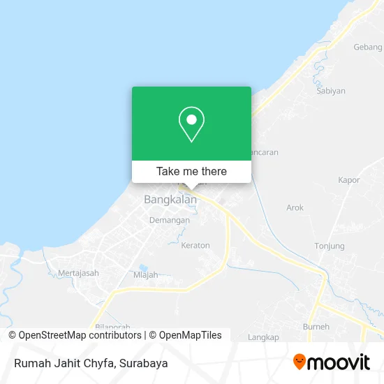
See Rumah Jahit Chyfa, Bangkalan, on the map
Public Transit to Rumah Jahit Chyfa in Bangkalan
Wondering how to get to Rumah Jahit Chyfa in Bangkalan? Moovit helps you find the best way to get to Rumah Jahit Chyfa with step-by-step directions from the nearest public transit station.
Moovit provides free maps and live directions to help you navigate through your city. View schedules, routes, timetables, and find out how long does it take to get to Rumah Jahit Chyfa in real time.
Looking for the nearest stop or station to Rumah Jahit Chyfa? Check out this list of stops closest to your destination: Pdam; Jalan Trunojoyo 63.
Bus: K5, KAMAL.
Want to see if there’s another route that gets you there at an earlier time? Moovit helps you find alternative routes or times. Get directions from and directions to Rumah Jahit Chyfa easily from the Moovit App or Website.
We make riding to Rumah Jahit Chyfa easy, which is why over 1.5 million users, including users in Bangkalan, trust Moovit as the best app for public transit. You don’t need to download an individual bus app or train app, Moovit is your all-in-one transit app that helps you find the best bus time or train time available.
For information on prices of bus, costs and ride fares to Rumah Jahit Chyfa, please check the Moovit app.
Use the app to navigate to popular places including to the airport, hospital, stadium, grocery store, mall, coffee shop, school, college, and university.
Rumah Jahit Chyfa Address: Jalan Trunojoyo Bangkalan 69112 street in Bangkalan
- Graha Rental,
- Waduk Gajah Mungkur,
- Kutipang Khaysa Kukus Roti Pa,
- UD Banghs Depo Ice Cream Aic,
- Rotijohn Dhomez,
- Bank Central Asia,
- Pikopi Cafe N Music,
- Trunojoyo Motor,
- Galeri Sepeda,
- Edzy Galeri,
- Warung Bakso Pelangi4d,
- Fokus Computer,
- Istana Durian,
- Toko Vika Jaya,
- BCA Prioritas,
- Bank Muamalat,
- Nabila. CV,
- Toko Faradis,
- Western Union,
- Lezap Electric CV
Places Near Rumah Jahit Chyfa (Bangkalan)
- GBT (Gelora Bung Tomo) Surabaya, Benowo,
- Pelabuhan Tanjung Perak,
- Galaxy Mall Surabaya, Mulyorejo,
- BG Junction Mall, Bubutan,
- Bg Junction, Bubutan,
- Pakuwon Mall, Lontar,
- Pakuwon City Mall, Keputih,
- Grand City Mall, Surabaya, Gubeng,
- Graha Pena, Ketintang,
- Smoking Room Terminal Domestik Juanda International Airport, Sidoarjo,
- Bis Damri P1 (Perak-Bungurasih PP), Krembangan Selatan,
- Taman Harmoni, Keputih,
- Kebun Binatang Surabaya, Darmo,
- UPN Veteran Jawa Timur, Gunung Anyar,
- Stadion gelora bung tomo(surabaya,jawa timur), Surabaya,
- Universitas Negeri Surabaya (UNESA), Lidah Wetan,
- Halte Bis Royal Plaza, Wonokromo,
- PTC, Surabaya,
- Masjid Al-Akbar, Surabaya,
- Kantor Regional II BKN Surabaya, Sidoarjo
How to get to popular places in Surabaya with public transit
Get around Bangkalan by public transit!
Traveling around Bangkalan has never been so easy. See step by step directions as you travel to any attraction, street or major public transit station. View bus and train schedules, arrival times, service alerts and detailed routes on a map, so you know exactly how to get to anywhere in Bangkalan.
When traveling to any destination around Bangkalan use Moovit's Live Directions with Get Off Notifications to know exactly where and how far to walk, how long to wait for your line, and how many stops are left. Moovit will alert you when it's time to get off — no need to constantly re-check whether yours is the next stop.
Wondering how to use public transit in Bangkalan or how to pay for public transit in Bangkalan? Moovit public transit app can help you navigate your way with public transit easily, and at minimum cost. It includes public transit fees, ticket prices, and costs. Looking for a map of Bangkalan public transit lines? Moovit public transit app shows all public transit maps in Bangkalan with all Bus and Train routes and stops on an interactive map.
Surabaya has 2 transit type(s), including: Bus and Train, operated by several transit agencies, including KAI Commuter, Angkutan Surabaya, Trans Semanggi Suroboyo, Suroboyo Bus, Feeder Wira Wiri Suroboyo, Trans Jatim and DAMRI