How to get to Rumba Cubana by bus?
Click on the bus route to see step by step directions with maps, line arrival times and updated time schedules.
From Walmart, Secaucus
60 minFrom Hotel Riu Plaza New York Times Square, Manhattan
57 minFrom MetLife Stadium, East Rutherford
81 minFrom East 90th Street Ferry Terminal, Manhattan
113 minFrom East 93rd Street, Manhattan
103 minFrom Gracie Mansion, Manhattan
112 minFrom Sheraton New York Times Square Hotel, Manhattan
63 minFrom West New York, NJ, West New York
64 minFrom Trump Tower, Manhattan
74 min
How to get to Rumba Cubana by train?
Click on the train route to see step by step directions with maps, line arrival times and updated time schedules.
Bus stops near Rumba Cubana in Jersey City
Train stations near Rumba Cubana in Jersey City
Light Rail stations near Rumba Cubana in Jersey City
- Newport Light Rail Station, 4 min walk,VIEW
Bus lines to Rumba Cubana in Jersey City
What are the closest stations to Rumba Cubana?
The closest stations to Rumba Cubana are:
- Newark Ave at Jersey Ave is 157 yards away, 2 min walk.
- Hamilton Park is 214 yards away, 3 min walk.
- Newport is 319 yards away, 4 min walk.
- Newport Light Rail Station is 330 yards away, 4 min walk.
- Newport Centre Mall is 569 yards away, 7 min walk.
- Grove Street is 1892 yards away, 23 min walk.
Which bus lines stop near Rumba Cubana?
These bus lines stop near Rumba Cubana: 123, 126, 85, 86.
Which train lines stop near Rumba Cubana?
These train lines stop near Rumba Cubana: RED, YEL.
Which light rail line stops near Rumba Cubana?
HBLR (Liberty State Park-Ride Light Rail Sta)
What’s the nearest light rail station to Rumba Cubana in Jersey City?
The nearest light rail station to Rumba Cubana in Jersey City is Newport Light Rail Station. It’s a 4 min walk away.
What’s the nearest train station to Rumba Cubana in Jersey City?
The nearest train station to Rumba Cubana in Jersey City is Newport. It’s a 4 min walk away.
What’s the nearest bus station to Rumba Cubana in Jersey City?
The nearest bus station to Rumba Cubana in Jersey City is Newark Ave at Jersey Ave. It’s a 2 min walk away.
What time is the first light rail to Rumba Cubana in Jersey City?
The HBLR is the first light rail that goes to Rumba Cubana in Jersey City. It stops nearby at 4:47 AM.
What time is the last light rail to Rumba Cubana in Jersey City?
The HBLR is the last light rail that goes to Rumba Cubana in Jersey City. It stops nearby at 2:12 AM.
What time is the first train to Rumba Cubana in Jersey City?
The ATW is the first train that goes to Rumba Cubana in Jersey City. It stops nearby at 3:10 AM.
What time is the last train to Rumba Cubana in Jersey City?
The ATW is the last train that goes to Rumba Cubana in Jersey City. It stops nearby at 3:14 AM.
What time is the first bus to Rumba Cubana in Jersey City?
The 80 is the first bus that goes to Rumba Cubana in Jersey City. It stops nearby at 4:39 AM.
What time is the last bus to Rumba Cubana in Jersey City?
The 80 is the last bus that goes to Rumba Cubana in Jersey City. It stops nearby at 12:52 AM.
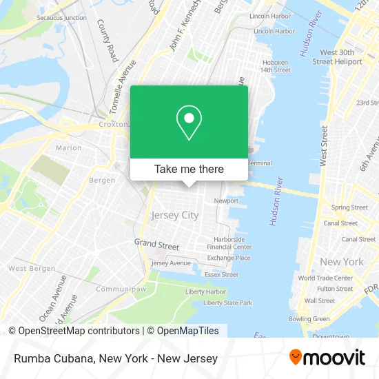
See Rumba Cubana, Jersey City, on the map
Public Transit to Rumba Cubana in Jersey City
Wondering how to get to Rumba Cubana in Jersey City? Moovit helps you find the best way to get to Rumba Cubana with step-by-step directions from the nearest public transit station.
Moovit provides free maps and live directions to help you navigate through your city. View schedules, routes, timetables, and find out how long does it take to get to Rumba Cubana in real time.
Looking for the nearest stop or station to Rumba Cubana? Check out this list of stops closest to your destination: Newark Ave at Jersey Ave; Hamilton Park; Newport; Newport Light Rail Station; Newport Centre Mall; Grove Street.
Bus: 123, 126, 85, 86, 80, 82, 9, 16.Train: RED, YEL, ATW, GRE.Light Rail: HBLR.
Want to see if there’s another route that gets you there at an earlier time? Moovit helps you find alternative routes or times. Get directions from and directions to Rumba Cubana easily from the Moovit App or Website.
We make riding to Rumba Cubana easy, which is why over 1.5 million users, including users in Jersey City, trust Moovit as the best app for public transit. You don’t need to download an individual bus app or train app, Moovit is your all-in-one transit app that helps you find the best bus time or train time available.
For information on prices of bus, train, subway and light rail, costs and ride fares to Rumba Cubana, please check the Moovit app.
Use the app to navigate to popular places including to the airport, hospital, stadium, grocery store, mall, coffee shop, school, college, and university.
Rumba Cubana Address: 235 Pavonia Ave street in Jersey City
- Hamilton Square North Condos,
- Antheia Flower Shop,
- 6th Borough Market,
- Smith & Chang General Goods,
- Natures Boost,
- Integrative Obstetrics,
- Jersey City Bicycle Co.,
- Hound About Town,
- O Kafe - Hamilton Park,
- Hamilton Park Fitness,
- Miss Yvonne Swim School,
- Pregnancy & Parenting,
- James Cornell Architect,
- Milk Sugar Love,
- Hamilton Square Condo Association,
- Lovecita,
- Jc Print Room,
- Love the Clutter,
- Medical Waste Pros,
- Tiaplanta
Places Near Rumba Cubana (Jersey City)
- 3 Stone St, Manhattan,
- San Gennaro Feast, Manhattan,
- 376 Hudson Street, Manhattan,
- Chinatown, Manhattan,
- 911 Memorial, Manhattan,
- Pier 83, Manhattan,
- Rockefeller Center, Manhattan,
- Queens Center Mall, Queens,
- 111 Centre New York City Supreme Court, Manhattan,
- Wall Street, Manhattan,
- SoHo, Manhattan,
- Mountainside Hospital, Glen Ridge,
- Times Square, Manhattan,
- qqqq, Manhattan,
- Hudson Yards, Manhattan,
- Katz's Deli, Manhattan,
- 1 Police Plaza, Manhattan,
- 66 John Street, Manhattan,
- Bellevue Hospital, Manhattan,
- 26 Federal Plaza, Manhattan
How to get to popular places in New York - New Jersey with public transit
Get around Jersey City by public transit!
Traveling around Jersey City has never been so easy. See step by step directions as you travel to any attraction, street or major public transit station. View bus and train schedules, arrival times, service alerts and detailed routes on a map, so you know exactly how to get to anywhere in Jersey City.
When traveling to any destination around Jersey City use Moovit's Live Directions with Get Off Notifications to know exactly where and how far to walk, how long to wait for your line, and how many stops are left. Moovit will alert you when it's time to get off — no need to constantly re-check whether yours is the next stop.
Wondering how to use public transit in Jersey City or how to pay for public transit in Jersey City? Moovit public transit app can help you navigate your way with public transit easily, and at minimum cost. It includes public transit fees, ticket prices, and costs. Looking for a map of Jersey City public transit lines? Moovit public transit app shows all public transit maps in Jersey City with all Bus, Train, Subway, Light Rail, Ferry and Cable Car routes and stops on an interactive map.
New York - New Jersey has 6 transit type(s), including: Bus, Train, Subway, Light Rail, Ferry and Cable Car, operated by several transit agencies, including MTA Subway, Metro-North Railroad, LIRR, PATH, MTA New York City Transit - Express routes, MTA Bus, NJ Transit, NYC Ferry, NICE bus, Bee-Line Bus, NJ Transit Rail, Norwalk Transit District, Hartford Line, River Valley Transit and HART