How to get to Rumble by bus?
Click on the bus route to see step by step directions with maps, line arrival times and updated time schedules.
From 103rd Street, Manhattan
45 minFrom Consulado Ecuatoriano en Queens, Queens
62 minFrom Aaaaa Aaaa, Bronx
99 minFrom The Bronx, NY, Bronx
64 minFrom Harlem Hospital, Manhattan
59 minFrom Costco, Queens
39 minFrom Pier 12 Brooklyn, Manhattan
110 minFrom Sylvia's Restaurant, Manhattan
53 minFrom MetLife Stadium, East Rutherford
46 minFrom Hudson Mall, Jersey City
78 min
How to get to Rumble by train?
Click on the train route to see step by step directions with maps, line arrival times and updated time schedules.
How to get to Rumble by subway?
Click on the subway route to see step by step directions with maps, line arrival times and updated time schedules.
Bus stops near Rumble in Manhattan
- 6 Av/W 40 St, 2 min walk,VIEW
- 37th St & 6th Ave Westsider, 3 min walk,VIEW
- 6 Av/W 37 St, 3 min walk,VIEW
- Avenue Of the Americas/W 41 St, 3 min walk,VIEW
- 6 Av/W 38 St, 3 min walk,VIEW
- 6 Av/W 42 St, 3 min walk,VIEW
- 5 Av/W 40 St, 4 min walk,VIEW
- W 42 St/6 Av, 4 min walk,VIEW
- Bryant Park (From Ewr), 5 min walk,VIEW
- W 40th St & 6th Ave, 5 min walk,VIEW
- Bryant Park, 5 min walk,VIEW
- 6th Ave & W 40th St, 5 min walk,VIEW
Subway stations near Rumble in Manhattan
Bus lines to Rumble in Manhattan
- M5, Limited Washington Heights Gw Bridge,VIEW
- M7, Harlem 147 St Via 6 Av Via Amsterdam,VIEW
- M55, 44 St 6 Av,VIEW
- BXM2, Riverdale 263 St Via H. Hudson Pky,VIEW
- HAMPTON JITNEY MONTAUK, Amagansett,VIEW
- QM10, Lefrak City - Midtown Express,VIEW
- QM12, Forest Hills - Midtown Express,VIEW
- QM24, Glendale - Midtown Express,VIEW
- SIM1C, Eltingville - Manhattan Express,VIEW
- SIM3, Pt. Richmond - Midtown Manhattan Express,VIEW
- SIM3C, Pt. Richmond - Manhattan Express,VIEW
- SIM10, Eltingville - Midtown Manhattan Express,VIEW
- QM15, Arverne Beach 54 St Via Woodhaven Bl Via Cross Bay Bl,VIEW
- QM16, Neponsit Riis Park Via Cross Bay Bl Via Rock Bch Bl,VIEW
- QM17, Midtown 57 St Via 6 Av,VIEW
- QM18, S. Ozone Pk 130 St Via Lefferts Bl,VIEW
- QM2, Bay Terrace Bell Bl Via Whitestone Exy,VIEW
- QM4, Electchester 164 St Via Jewel Av,VIEW
- QM20, Bay Terrace 211 St Via Willets Pt Bl,VIEW
- BXM3, Yonkers - Midtown,VIEW
What are the closest stations to Rumble?
The closest stations to Rumble are:
- 6 Av/W 40 St is 116 yards away, 2 min walk.
- 37th St & 6th Ave Westsider is 166 yards away, 3 min walk.
- 6 Av/W 37 St is 184 yards away, 3 min walk.
- Avenue Of the Americas/W 41 St is 194 yards away, 3 min walk.
- 6 Av/W 38 St is 222 yards away, 3 min walk.
- 6 Av/W 42 St is 223 yards away, 3 min walk.
- 34 St-Herald Sq is 224 yards away, 3 min walk.
- Grand Central is 244 yards away, 3 min walk.
- Times Sq-42 St is 246 yards away, 4 min walk.
- 5 Av/W 40 St is 249 yards away, 4 min walk.
- W 42 St/6 Av is 320 yards away, 4 min walk.
- Bryant Park (From Ewr) is 374 yards away, 5 min walk.
- W 40th St & 6th Ave is 383 yards away, 5 min walk.
- Bryant Park is 384 yards away, 5 min walk.
- 6th Ave & W 40th St is 393 yards away, 5 min walk.
- 33rd Street is 425 yards away, 6 min walk.
Which bus lines stop near Rumble?
These bus lines stop near Rumble: 119, 160, BM2, BXM4, M1, M2, Q32, QM18.
Which train lines stop near Rumble?
These train lines stop near Rumble: 1, 2, PORT WASHINGTON BRANCH.
Which subway lines stop near Rumble?
These subway lines stop near Rumble: 2, 6, 7, B, F, M.
What’s the nearest subway station to Rumble in Manhattan?
The nearest subway station to Rumble in Manhattan is 34 St-Herald Sq. It’s a 3 min walk away.
What’s the nearest train station to Rumble in Manhattan?
The nearest train station to Rumble in Manhattan is Grand Central. It’s a 3 min walk away.
What’s the nearest bus station to Rumble in Manhattan?
The nearest bus station to Rumble in Manhattan is 6 Av/W 40 St. It’s a 2 min walk away.
What time is the first subway to Rumble in Manhattan?
The D is the first subway that goes to Rumble in Manhattan. It stops nearby at 3:00 AM.
What time is the last subway to Rumble in Manhattan?
The N is the last subway that goes to Rumble in Manhattan. It stops nearby at 4:01 AM.
What time is the first train to Rumble in Manhattan?
The ATW is the first train that goes to Rumble in Manhattan. It stops nearby at 3:21 AM.
What time is the last train to Rumble in Manhattan?
The ATW is the last train that goes to Rumble in Manhattan. It stops nearby at 3:21 AM.
What time is the first bus to Rumble in Manhattan?
The SIM1C is the first bus that goes to Rumble in Manhattan. It stops nearby at 3:00 AM.
What time is the last bus to Rumble in Manhattan?
The SIM1C is the last bus that goes to Rumble in Manhattan. It stops nearby at 3:00 AM.
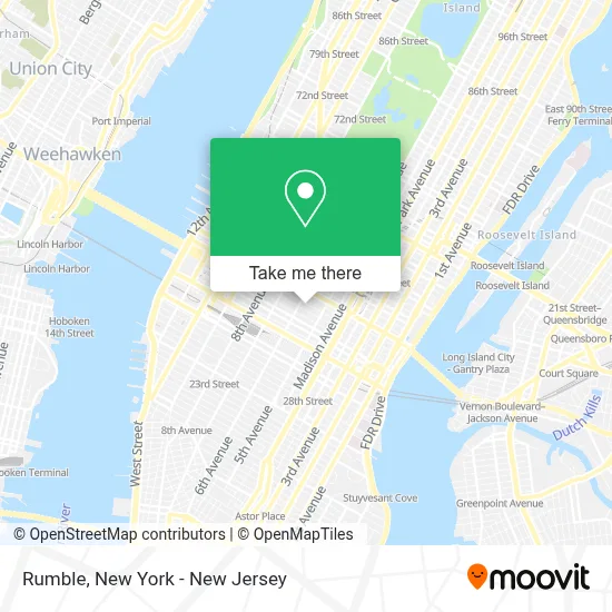
See Rumble, Manhattan, on the map
Public Transit to Rumble in Manhattan
Wondering how to get to Rumble in Manhattan? Moovit helps you find the best way to get to Rumble with step-by-step directions from the nearest public transit station.
Moovit provides free maps and live directions to help you navigate through your city. View schedules, routes, timetables, and find out how long does it take to get to Rumble in real time.
Looking for the nearest stop or station to Rumble? Check out this list of stops closest to your destination: 6 Av/W 40 St; 37th St & 6th Ave Westsider; 6 Av/W 37 St; Avenue Of the Americas/W 41 St; 6 Av/W 38 St; 6 Av/W 42 St; 34 St-Herald Sq; Grand Central; Times Sq-42 St; 5 Av/W 40 St; W 42 St/6 Av; Bryant Park (From Ewr); W 40th St & 6th Ave; Bryant Park; 6th Ave & W 40th St; 33rd Street.
Bus: 119, 160, BM2, BXM4, M1, M2, Q32, QM18, M5, M7, M55, BXM2.Train: 1, 2, PORT WASHINGTON BRANCH, 3, 4, 5, ATW, BLU, YEL.Subway: 2, 6, 7, B, F, M, D, FX, S, 1, 3.
Want to see if there’s another route that gets you there at an earlier time? Moovit helps you find alternative routes or times. Get directions from and directions to Rumble easily from the Moovit App or Website.
We make riding to Rumble easy, which is why over 1.5 million users, including users in Manhattan, trust Moovit as the best app for public transit. You don’t need to download an individual bus app or train app, Moovit is your all-in-one transit app that helps you find the best bus time or train time available.
For information on prices of subway, bus and train, costs and ride fares to Rumble, please check the Moovit app.
Use the app to navigate to popular places including to the airport, hospital, stadium, grocery store, mall, coffee shop, school, college, and university.
Location: Manhattan, New York - New Jersey
- Fido Foods,
- Gh on the Park,
- You & Mr Jones,
- Lloyd Personnel Consultants,
- Epic Systems Audio Video Control Systems Company,
- Collectors Club Of New York,
- Qalam Travels,
- Womens World,
- Haas Crea,
- Roi Influencer,
- Rock Paper Team, Llc,
- Plus Career,
- Rockstone Media Group,
- New Balance NY,
- Ink Hospitality,
- Breezy Hill Orchards,
- Guttman Community College,
- Commercial Mortgage,
- The Best Sichuan,
- Newsmax Tv
Places Near Rumble (Manhattan)
- Queens Center Mall, Queens,
- qqqq, Manhattan,
- San Gennaro Feast, Manhattan,
- Katz's Deli, Manhattan,
- Hudson Yards, Manhattan,
- 66 John Street, Manhattan,
- 3 Stone St, Manhattan,
- 26 Federal Plaza, Manhattan,
- 1 Police Plaza, Manhattan,
- Wall Street, Manhattan,
- Mountainside Hospital, Glen Ridge,
- 376 Hudson Street, Manhattan,
- 911 Memorial, Manhattan,
- Chinatown, Manhattan,
- Times Square, Manhattan,
- Bellevue Hospital, Manhattan,
- Rockefeller Center, Manhattan,
- Pier 83, Manhattan,
- SoHo, Manhattan,
- 111 Centre New York City Supreme Court, Manhattan
How to get to popular places in New York - New Jersey with public transit
Get around Manhattan by public transit!
Traveling around Manhattan has never been so easy. See step by step directions as you travel to any attraction, street or major public transit station. View bus and train schedules, arrival times, service alerts and detailed routes on a map, so you know exactly how to get to anywhere in Manhattan.
When traveling to any destination around Manhattan use Moovit's Live Directions with Get Off Notifications to know exactly where and how far to walk, how long to wait for your line, and how many stops are left. Moovit will alert you when it's time to get off — no need to constantly re-check whether yours is the next stop.
Wondering how to use public transit in Manhattan or how to pay for public transit in Manhattan? Moovit public transit app can help you navigate your way with public transit easily, and at minimum cost. It includes public transit fees, ticket prices, and costs. Looking for a map of Manhattan public transit lines? Moovit public transit app shows all public transit maps in Manhattan with all Bus, Train, Subway, Light Rail, Ferry and Cable Car routes and stops on an interactive map.
New York - New Jersey has 6 transit type(s), including: Bus, Train, Subway, Light Rail, Ferry and Cable Car, operated by several transit agencies, including MTA Subway, Metro-North Railroad, LIRR, PATH, MTA New York City Transit - Express routes, MTA Bus, NJ Transit, NYC Ferry, NICE bus, Bee-Line Bus, NJ Transit Rail, Norwalk Transit District, Hartford Line, River Valley Transit and HART