Directions to Rumble Boxing (Livingston, Nj) with public transportation
The following transit lines have routes that pass near Rumble Boxing
 Bus: 73, COMMUNITY COACH.
How to get to Rumble Boxing by bus?
Click on the bus route to see step by step directions with maps, line arrival times and updated time schedules.
From Orange, NJ, City Of Orange, Nj
29 minFrom Fairfield, Fairfield, Nj
66 minFrom West Orange, NJ, West Orange, Nj
42 minFrom Irvington, NJ, Irvington, Nj
66 minFrom Community Coach Bus 77, West Orange, Nj
35 minFrom Verona, NJ, Verona, Nj
47 minFrom Parsippany, NJ, Parsippany-Troy Hills, Nj
81 minFrom Montclair, NJ, Montclair, Nj
52 min
Bus stops near Rumble Boxing in Livingston, Nj
Bus lines to Rumble Boxing in Livingston, Nj
What are the closest stations to Rumble Boxing?
The closest stations to Rumble Boxing are:
- Eisenhower Parkway at Executive Parkway is 221 yards away, 3 min walk.
- Route 10 - Livingston Circle W is 471 yards away, 6 min walk.
Which bus line stops near Rumble Boxing?
73 (I-280 Express Livingston Ml I-280 Express Via Florham Pk-)
What’s the nearest bus station to Rumble Boxing in Livingston, Nj?
The nearest bus station to Rumble Boxing in Livingston, Nj is Eisenhower Parkway at Executive Parkway. It’s a 3 min walk away.
What time is the first bus to Rumble Boxing in Livingston, Nj?
The COMMUNITY COACH is the first bus that goes to Rumble Boxing in Livingston, Nj. It stops nearby at 5:36 AM.
What time is the last bus to Rumble Boxing in Livingston, Nj?
The 73 is the last bus that goes to Rumble Boxing in Livingston, Nj. It stops nearby at 10:54 PM.
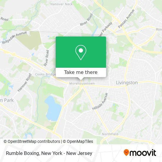
See Rumble Boxing, Livingston, Nj, on the map
Public Transit to Rumble Boxing in Livingston, Nj
Wondering how to get to Rumble Boxing in Livingston, Nj? Moovit helps you find the best way to get to Rumble Boxing with step-by-step directions from the nearest public transit station.
Moovit provides free maps and live directions to help you navigate through your city. View schedules, routes, timetables, and find out how long does it take to get to Rumble Boxing in real time.
Looking for the nearest stop or station to Rumble Boxing? Check out this list of stops closest to your destination: Eisenhower Parkway at Executive Parkway; Route 10 - Livingston Circle W.
Bus: 73, COMMUNITY COACH.
Want to see if there’s another route that gets you there at an earlier time? Moovit helps you find alternative routes or times. Get directions from and directions to Rumble Boxing easily from the Moovit App or Website.
We make riding to Rumble Boxing easy, which is why over 1.5 million users, including users in Livingston, Nj, trust Moovit as the best app for public transit. You don’t need to download an individual bus app or train app, Moovit is your all-in-one transit app that helps you find the best bus time or train time available.
For information on prices of bus, costs and ride fares to Rumble Boxing, please check the Moovit app.
Use the app to navigate to popular places including to the airport, hospital, stadium, grocery store, mall, coffee shop, school, college, and university.
Rumble Boxing Address: 277 Eisenhower Pkwy Livingston, NJ 07039 street in Livingston, Nj
- Gari Software,
- Garbanzo Mediterranean Fresh,
- Choice Pet Supply,
- Safavieh Carpets of Isfahar,
- ChargePoint,
- Irs Forms,
- Judge David,
- Newfinity Group,
- Cla,
- Build Your Firm,
- Advance Auto Parts,
- Falcon Dumpster,
- Knights of Columbus,
- Amorosi's Mixed Martial Arts,
- Boccone South,
- JSDD's Wae Center,
- Barbara Lauer Listhaus, Psyd,
- Squiretown School,
- NORDSTROM rack,
- Glaucoma and Cataract
Places Near Rumble Boxing (Livingston, Nj)
- qqqq, Manhattan,
- SoHo, Manhattan,
- Mountainside Hospital, Glen Ridge,
- Katz's Deli, Manhattan,
- 376 Hudson Street, Manhattan,
- 111 Centre New York City Supreme Court, Manhattan,
- Bellevue Hospital, Manhattan,
- Queens Center Mall, Queens,
- Rockefeller Center, Manhattan,
- Times Square, Manhattan,
- San Gennaro Feast, Manhattan,
- 911 Memorial, Manhattan,
- Wall Street, Manhattan,
- 66 John Street, Manhattan,
- Chinatown, Manhattan,
- 3 Stone St, Manhattan,
- Pier 83, Manhattan,
- Hudson Yards, Manhattan,
- 26 Federal Plaza, Manhattan,
- 1 Police Plaza, Manhattan
How to get to popular places in New York - New Jersey with public transit
Get around Livingston, Nj by public transit!
Traveling around Livingston, Nj has never been so easy. See step by step directions as you travel to any attraction, street or major public transit station. View bus and train schedules, arrival times, service alerts and detailed routes on a map, so you know exactly how to get to anywhere in Livingston, Nj.
When traveling to any destination around Livingston, Nj use Moovit's Live Directions with Get Off Notifications to know exactly where and how far to walk, how long to wait for your line, and how many stops are left. Moovit will alert you when it's time to get off — no need to constantly re-check whether yours is the next stop.
Wondering how to use public transit in Livingston, Nj or how to pay for public transit in Livingston, Nj? Moovit public transit app can help you navigate your way with public transit easily, and at minimum cost. It includes public transit fees, ticket prices, and costs. Looking for a map of Livingston, Nj public transit lines? Moovit public transit app shows all public transit maps in Livingston, Nj with all Bus, Train, Subway, Light Rail, Ferry and Cable Car routes and stops on an interactive map.
New York - New Jersey has 6 transit type(s), including: Bus, Train, Subway, Light Rail, Ferry and Cable Car, operated by several transit agencies, including MTA Subway, Metro-North Railroad, LIRR, PATH, MTA New York City Transit - Express routes, MTA Bus, NJ Transit, NYC Ferry, NICE bus, Bee-Line Bus, NJ Transit Rail, Norwalk Transit District, Hartford Line, River Valley Transit and HART