Directions to Rumo A Praia (Sítio Cercado) with public transportation
The following transit lines have routes that pass near Rumo A Praia
How to get to Rumo A Praia by bus?
Click on the bus route to see step by step directions with maps, line arrival times and updated time schedules.
From Rua Imaculada Conceição 1155, Prado Velho
76 minFrom Shopping Palladium Curitiba, Portão
58 minFrom Cemitério Padre Pedro Fuss, São José Dos Pinhais
74 minFrom Rua Rockfeller 1450, Prado Velho
67 minFrom Pontifícia Universidade Católica Do Paraná Pucpr, Prado Velho
76 minFrom UPA 24h - Unidade De Pronto Atendimento Barigui, Cic
73 minFrom Rua Chile, Rebouças
66 minFrom Avenida Rocha Pombo, São José Dos Pinhais
54 minFrom Rua Professor João Soares Barcelos, Boqueirão
48 minFrom Rua Paulino de Siqueira Cortês, São José Dos Pinhais
49 min
Bus stops near Rumo A Praia in Sítio Cercado
Bus lines to Rumo A Praia in Sítio Cercado
What are the closest stations to Rumo A Praia?
The closest stations to Rumo A Praia are:
- Rua David Tows, 3403 is 99 meters away, 2 min walk.
- R. Ourizona, 3014 is 532 meters away, 7 min walk.
- Rua Expedicionario Francisco Alves De Oliveira, 830-898 is 782 meters away, 10 min walk.
Which bus lines stop near Rumo A Praia?
These bus lines stop near Rumo A Praia: 528 BOQUEIRÃO / PINHEIRINHO, 531 SANTA INÊS, 541 BAIRRO NOVO A.
What’s the nearest bus station to Rumo A Praia in Sítio Cercado?
The nearest bus station to Rumo A Praia in Sítio Cercado is Rua David Tows, 3403. It’s a 2 min walk away.
What time is the first bus to Rumo A Praia in Sítio Cercado?
The 541 BAIRRO NOVO A is the first bus that goes to Rumo A Praia in Sítio Cercado. It stops nearby at 4:48 AM.
What time is the last bus to Rumo A Praia in Sítio Cercado?
The 528 BOQUEIRÃO / PINHEIRINHO is the last bus that goes to Rumo A Praia in Sítio Cercado. It stops nearby at 1:08 AM.
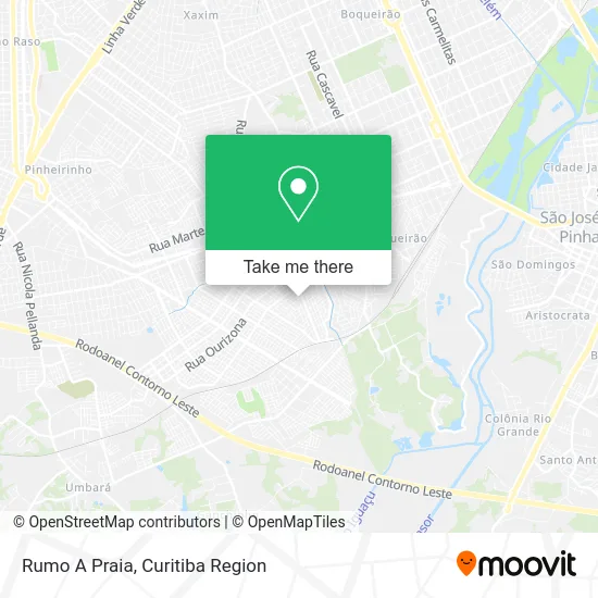
See Rumo A Praia, Sítio Cercado, on the map
Public Transit to Rumo A Praia in Sítio Cercado
Wondering how to get to Rumo A Praia in Sítio Cercado? Moovit helps you find the best way to get to Rumo A Praia with step-by-step directions from the nearest public transit station.
Moovit provides free maps and live directions to help you navigate through your city. View schedules, routes, timetables, and find out how long does it take to get to Rumo A Praia in real time.
Looking for the nearest stop or station to Rumo A Praia? Check out this list of stops closest to your destination: Rua David Tows; R. Ourizona; Rua Expedicionario Francisco Alves De Oliveira.
Bus: 528 BOQUEIRÃO / PINHEIRINHO, 531 SANTA INÊS, 541 BAIRRO NOVO A.
Want to see if there’s another route that gets you there at an earlier time? Moovit helps you find alternative routes or times. Get directions from and directions to Rumo A Praia easily from the Moovit App or Website.
We make riding to Rumo A Praia easy, which is why over 1.5 million users, including users in Sítio Cercado, trust Moovit as the best app for public transit. You don’t need to download an individual bus app or train app, Moovit is your all-in-one transit app that helps you find the best bus time or train time available.
For information on prices of bus, costs and ride fares to Rumo A Praia, please check the Moovit app.
Use the app to navigate to popular places including to the airport, hospital, stadium, grocery store, mall, coffee shop, school, college, and university.
Location: Sítio Cercado, Curitiba Region
- Supermercados Goes Sítio Cercado,
- Serralheria Camargo e Figueira,
- Rua Desembargador Carlos Pinheiro Guimarães 1318,
- Rua David Tows 3600,
- Escola Municipal Dona Lulu,
- Churros da Vila Gourmet,
- casa da van,
- CMEI Arnaldo Agenor Bertoni,
- Curitiba Estação da Pizza,
- Comercio Varejista De Racoes Navarro & Navarro,
- Igreja Do Nazareno Bairro Novo,
- Cleber Felberg Bonifacio,
- Hollywood Bar,
- Crazy Hot Dog - Curiti,
- Rua Mário Gasparin 1195,
- Jobox Esquadrias,
- Ig Evangélica Gideões da Fé,
- C. M. E. I. Sitio Cercado IV,
- Mobile Comercial e Logistica,
- Creche Mundo Encatado
Places Near Rumo A Praia (Sítio Cercado)
- Rua Martim Afonso 558, Mercês,
- Pontifícia Universidade Católica do Paraná (PUCPR), Prado Velho,
- Arena Da Baixada - Curitiba,
- Hospital Angelina Caron, Campina Grande Do Sul,
- Hospital Madalena Sofia, Bairro Alto,
- Shopping Palladium, Portão,
- Campo Largo, Campo,
- Hhhhh, Fazendinha,
- Jockey Plaza Shopping Center, Tarumã,
- Parque Barigui, Mercês,
- Hospital Nossa Senhora Das Graças, Mercês,
- Hospital Da Cruz Vermelha, Batel,
- Hospital de Clínicas (HC - UFPR), Centro,
- Hospital Universitário Evangélico de Curitiba, Bigorrilho,
- Jardim Botânico de Curitiba PR, Centro,
- Hospital do Rocio, Campo,
- Shopping Estação, Rebouças,
- Park Shopping Barigüi, Mossunguê,
- Rua General Mário Tourinho, Campina Do Siqueira,
- Hospital Erasto Gaertner, Jardim Das Américas
How to get to popular places in Curitiba Region with public transit
Get around Sítio Cercado by public transit!
Traveling around Sítio Cercado has never been so easy. See step by step directions as you travel to any attraction, street or major public transit station. View bus and train schedules, arrival times, service alerts and detailed routes on a map, so you know exactly how to get to anywhere in Sítio Cercado.
When traveling to any destination around Sítio Cercado use Moovit's Live Directions with Get Off Notifications to know exactly where and how far to walk, how long to wait for your line, and how many stops are left. Moovit will alert you when it's time to get off — no need to constantly re-check whether yours is the next stop.
Wondering how to use public transit in Sítio Cercado or how to pay for public transit in Sítio Cercado? Moovit public transit app can help you navigate your way with public transit easily, and at minimum cost. It includes public transit fees, ticket prices, and costs. Looking for a map of Sítio Cercado public transit lines? Moovit public transit app shows all public transit maps in Sítio Cercado with all Bus and Cable Car routes and stops on an interactive map.
Curitiba Region has 2 transit type(s), including: Bus and Cable Car, operated by several transit agencies, including Sistema Integrado de Mobilidade (URBS), Sistema Integrado de Mobilidade (AMEP), URBS (Cartões bancários e Dinheiro), URBS (Cartões bancários / Cartão URBS), AMEP (Cartões bancários / Cartão MetroCard), AMEP (Cartões bancários / Cartão MetroCard / Dinheiro), Viação Colombo (Dinheiro), TRIAR (Cartão TRIAR / Dinheiro), Empresa Curitiba Cerro Azul (Dinheiro), Expresso Nossa Senhora da Penha (Dinheiro), Empresa Campo Alto Tijucas (Dinheiro), Auto Viação São José (Cartão VEM / Dinheiro), BRT S/A (Cartão VEM / Dinheiro), TransPiedade (Cartão Cidadão / Dinheiro) and Oceânica Sul (Cartão Transporte / Dinheiro)