Directions to Runkle Mark (Indianapolis City (Balance)) with public transportation
The following transit lines have routes that pass near Runkle Mark
 Bus: 31.
How to get to Runkle Mark by bus?
Click on the bus route to see step by step directions with maps, line arrival times and updated time schedules.
From Christel House Academy, Indianapolis City (Balance)
33 minFrom S Keystone Ave / E Troy Ave, Indianapolis City (Balance)
58 minFrom Lilly Hall, Indianapolis City (Balance)
28 minFrom Churchman Hill Plaza Shopping Center, Beech Grove
128 minFrom Darbar Sri Guru Granth Sahib Ji, Indianapolis City (Balance)
29 minFrom Saint Francis Hospital & Health Centers, Beech Grove
98 minFrom 3838 S Rural St, Indianapolis City (Balance)
66 minFrom US 31 and Thompson Rd, Indianapolis City (Balance)
18 minFrom University of Indianapolis (UINDY), Indianapolis City (Balance)
32 min
Bus stop near Runkle Mark in Indianapolis City (Balance)
- County Line Rd & Shelby St, 4 min walk,VIEW
Bus lines to Runkle Mark in Indianapolis City (Balance)
- 31, Transit Center,VIEW
What are the closest stations to Runkle Mark?
The closest stations to Runkle Mark are:
- County Line Rd & Shelby St is 243 yards away, 4 min walk.
Which bus line stops near Runkle Mark?
31
What’s the nearest bus station to Runkle Mark in Indianapolis City (Balance)?
The nearest bus station to Runkle Mark in Indianapolis City (Balance) is County Line Rd & Shelby St. It’s a 4 min walk away.
What time is the first bus to Runkle Mark in Indianapolis City (Balance)?
The 31 is the first bus that goes to Runkle Mark in Indianapolis City (Balance). It stops nearby at 5:28 AM.
What time is the last bus to Runkle Mark in Indianapolis City (Balance)?
The 31 is the last bus that goes to Runkle Mark in Indianapolis City (Balance). It stops nearby at 10:03 PM.
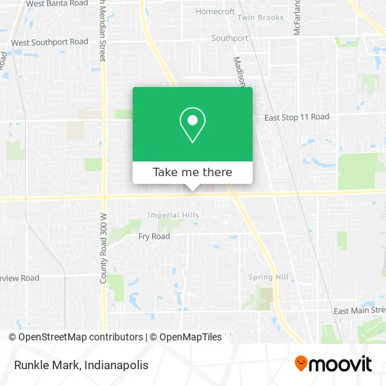
See Runkle Mark, Indianapolis City (Balance), on the map
Public Transit to Runkle Mark in Indianapolis City (Balance)
Wondering how to get to Runkle Mark in Indianapolis City (Balance)? Moovit helps you find the best way to get to Runkle Mark with step-by-step directions from the nearest public transit station.
Moovit provides free maps and live directions to help you navigate through your city. View schedules, routes, timetables, and find out how long does it take to get to Runkle Mark in real time.
Looking for the nearest stop or station to Runkle Mark? Check out this list of stops closest to your destination: County Line Rd & Shelby St.
Bus: 31.
Want to see if there’s another route that gets you there at an earlier time? Moovit helps you find alternative routes or times. Get directions from and directions to Runkle Mark easily from the Moovit App or Website.
We make riding to Runkle Mark easy, which is why over 1.5 million users, including users in Indianapolis City (Balance), trust Moovit as the best app for public transit. You don’t need to download an individual bus app or train app, Moovit is your all-in-one transit app that helps you find the best bus time or train time available.
For information on prices of bus, costs and ride fares to Runkle Mark, please check the Moovit app.
Use the app to navigate to popular places including to the airport, hospital, stadium, grocery store, mall, coffee shop, school, college, and university.
Runkle Mark Address: 1250 E County Line Rd Indianapolis, IN 46227 street in Indianapolis City (Balance)
- Healing Touch Indianapolis,
- Complementary Medicine Center (Indiana Center for Functional Medicine),
- Plumbing Water Leak Detection,
- 1220 E County Line Rd,
- Mary Lou Mayer, MD,
- Shannon M. Romine, LCSW,
- Phumeza Msikinya, MD,
- Cynthia N Ebini, MD,
- Midwest Behavioral Health of Greenwood / Indianapolis,
- Douglas Flint MD,
- Chaitanya Chekkilla, MD,
- Southpointe Gynecology,
- Indiana Neuro Science Assoc,
- Sara Chambers, LMHC,
- Jayender Reddy Chintaparthi,
- Navy Federal Credit Union,
- Community Heart and Vascular Physicians,
- Haverstick, Rebecca L,
- Community Health Network,
- Appliance Repair Hotpoint Repair Service
Places Near Runkle Mark (Indianapolis City (Balance))
- Indiana, Indianapolis City (Balance),
- St. Vincent entrance #1, Indianapolis City (Balance),
- Lilly Corporate Center (Eli Lilly & Co), Indianapolis City (Balance),
- Lucas Oil Stadium, Indianapolis City (Balance),
- Castleton Square Mall, Indianapolis,
- Cotter's Massage Parlor With Happy Endings, Indianapolis City (Balance),
- Indiana Convention Center, Indianapolis City (Balance),
- Methodist Hospital of Indianapolis, Indianapolis City (Balance),
- Gainbridge Fieldhouse, Indianapolis City (Balance),
- Indianapolis Motor Speedway, Speedway,
- St. Vincent Hospital - Indianapolis, Indianapolis City (Balance),
- I-465 / I-65 Interchange, Indianapolis City (Balance),
- Train Ride At Castleton Mall, Indianapolis City (Balance),
- 119 W 19th St Parking, Indianapolis City (Balance),
- Indianapolis Airport Zone 2, Indianapolis City (Balance),
- Jersey Barn, Indianapolis City (Balance),
- Plainfield, IN, Plainfield,
- Eskenazi Hospital, Indianapolis City (Balance),
- THE BALT, Indianapolis City (Balance),
- I U Health Methodist Hospital, Indianapolis City (Balance)
How to get to popular places in Indianapolis with public transit
Get around Indianapolis City (Balance) by public transit!
Traveling around Indianapolis City (Balance) has never been so easy. See step by step directions as you travel to any attraction, street or major public transit station. View bus and train schedules, arrival times, service alerts and detailed routes on a map, so you know exactly how to get to anywhere in Indianapolis City (Balance).
When traveling to any destination around Indianapolis City (Balance) use Moovit's Live Directions with Get Off Notifications to know exactly where and how far to walk, how long to wait for your line, and how many stops are left. Moovit will alert you when it's time to get off — no need to constantly re-check whether yours is the next stop.
Wondering how to use public transit in Indianapolis City (Balance) or how to pay for public transit in Indianapolis City (Balance)? Moovit public transit app can help you navigate your way with public transit easily, and at minimum cost. It includes public transit fees, ticket prices, and costs. Looking for a map of Indianapolis City (Balance) public transit lines? Moovit public transit app shows all public transit maps in Indianapolis City (Balance) with all bus routes and stops on an interactive map.
Indianapolis has 1 transit type(s), including: bus, operated by several transit agencies, including IndyGo, FlixBus-us and Greyhound-us