How to get to Running Springs Farm by bus?
Click on the bus route to see step by step directions with maps, line arrival times and updated time schedules.
From Upper Marlboro Courthouse, Prince George's County
267 minFrom Prince George's Community College, Prince George's County
319 minFrom Motor Vehicle Administration (Mva) Largo, Prince George's County
330 minFrom PGCC, Prince George's County
319 minFrom Largo, Maryland, Prince George's County
180 minFrom Andrews Air Force Base, Prince George's County
209 minFrom Joint Base Andrews, Prince George's County
210 minFrom Marlboro Pike, Prince George's County
202 min
Bus stop near Running Springs Farm in Anne Arundel County
- Pindell P&R Md 4 & Lower Pindell Rd, 7 min walk,VIEW
Bus lines to Running Springs Farm in Anne Arundel County
What are the closest stations to Running Springs Farm?
The closest stations to Running Springs Farm are:
- Pindell P&R Md 4 & Lower Pindell Rd is 493 yards away, 7 min walk.
Which bus line stops near Running Springs Farm?
820 (820/10 Pg Equestrian Center / Anne Arundel / North Beach)
What’s the nearest bus station to Running Springs Farm in Anne Arundel County?
The nearest bus station to Running Springs Farm in Anne Arundel County is Pindell P&R Md 4 & Lower Pindell Rd. It’s a 7 min walk away.
What time is the first bus to Running Springs Farm in Anne Arundel County?
The 810 is the first bus that goes to Running Springs Farm in Anne Arundel County. It stops nearby at 5:05 AM.
What time is the last bus to Running Springs Farm in Anne Arundel County?
The 820 is the last bus that goes to Running Springs Farm in Anne Arundel County. It stops nearby at 7:08 PM.
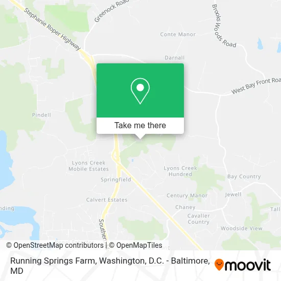
See Running Springs Farm, Anne Arundel County, on the map
Public Transit to Running Springs Farm in Anne Arundel County
Wondering how to get to Running Springs Farm in Anne Arundel County? Moovit helps you find the best way to get to Running Springs Farm with step-by-step directions from the nearest public transit station.
Moovit provides free maps and live directions to help you navigate through your city. View schedules, routes, timetables, and find out how long does it take to get to Running Springs Farm in real time.
Looking for the nearest stop or station to Running Springs Farm? Check out this list of stops closest to your destination: Pindell P&R Md 4 & Lower Pindell Rd.
Bus: 820, 810.
Want to see if there’s another route that gets you there at an earlier time? Moovit helps you find alternative routes or times. Get directions from and directions to Running Springs Farm easily from the Moovit App or Website.
We make riding to Running Springs Farm easy, which is why over 1.7 million users, including users in Anne Arundel County, trust Moovit as the best app for public transit. You don’t need to download an individual bus app or train app, Moovit is your all-in-one transit app that helps you find the best bus time or train time available.
For information on prices of bus and metro, costs and ride fares to Running Springs Farm, please check the Moovit app.
Use the app to navigate to popular places including to the airport, hospital, stadium, grocery store, mall, coffee shop, school, college, and university.
Running Springs Farm Address: Fishers Station Road street in Anne Arundel County
- 6300 Westmont Ct,
- Shawn Watts,
- 6329 Northbrook Dr,
- 400 Wilson Ct,
- 6530 Wilson Rd,
- Sunday Market,
- Brooks Woods Rd,
- Brooks Woods Rd MD-258,
- MD-258,
- 5999 Brooks Woods Rd,
- Stone Rd and Roots and Tides Bywy,
- 75 W Bay Front Rd,
- 75 Bay Front Rd W,
- 102 W Bay Front Rd,
- 102 Bay Front Rd W,
- 5706 Willow Run,
- Tracys Landing,
- Carters United Methodist Church,
- Tracys Landing, Maryland,
- South County Signs and Graphics
Places Near Running Springs Farm (Anne Arundel County)
- Rock Creek Tennis Center, Washington,
- Warner Theatre, Washington,
- PG Mall, Prince George's County,
- National Museum of African American History and Culture, Washington,
- Basilica of the National Shrine, Washington,
- M&T Bank Stadium, Baltimore,
- Amazon Hq2, Arlington County,
- Camden Yards, Baltimore,
- National Zoo, Washington,
- Marriott Marquis Washington, DC, Washington,
- Washington National Cathedral, Washington,
- Sibley Memorial Hospital, Washington,
- National Theatre, Washington,
- Museum Of The Bible, Washington,
- Westfield Montgomery Mall, Montgomery County,
- Pennsylvania Ave NW (3rd st and pennsylvania), Washington,
- Washington DC VA Medical Center, Washington,
- Georgetown, Washington,
- The Anthem, Washington,
- Capital One Arena, Washington
How to get to popular places in Washington, D.C. - Baltimore, MD with public transit
Get around Anne Arundel County by public transit!
Traveling around Anne Arundel County has never been so easy. See step by step directions as you travel to any attraction, street or major public transit station. View bus and train schedules, arrival times, service alerts and detailed routes on a map, so you know exactly how to get to anywhere in Anne Arundel County.
When traveling to any destination around Anne Arundel County use Moovit's Live Directions with Get Off Notifications to know exactly where and how far to walk, how long to wait for your line, and how many stops are left. Moovit will alert you when it's time to get off — no need to constantly re-check whether yours is the next stop.
Wondering how to use public transit in Anne Arundel County or how to pay for public transit in Anne Arundel County? Moovit public transit app can help you navigate your way with public transit easily, and at minimum cost. It includes public transit fees, ticket prices, and costs. Looking for a map of Anne Arundel County public transit lines? Moovit public transit app shows all public transit maps in Anne Arundel County with all Bus, Train, Metro, Light Rail and Ferry routes and stops on an interactive map.
Washington, D.C. - Baltimore, MD has 5 transit type(s), including: Bus, Train, Metro, Light Rail and Ferry, operated by several transit agencies, including WMATA, Montgomery County Ride On, Fairfax Connector, TheBus, PRTC, DASH - Alexandria, Arlington Transit (ART), RTA of Central Maryland, MDOT MTA, MDOT MTA Light RailLink, MDOT MTA Commuter Bus, MDOT MTA Local Bus, FXBGO!, Virginia Railway Express (VRE) and MARC