How to get to Rupeshmehandi09 by bus?
Click on the bus route to see step by step directions with maps, line arrival times and updated time schedules.
How to get to Rupeshmehandi09 by train?
Click on the train route to see step by step directions with maps, line arrival times and updated time schedules.
How to get to Rupeshmehandi09 by subway?
Click on the subway route to see step by step directions with maps, line arrival times and updated time schedules.
Bus stops near Rupeshmehandi09 in Manhattan
Train station near Rupeshmehandi09 in Manhattan
- 14th Street, 5 min walk,VIEW
Subway stations near Rupeshmehandi09 in Manhattan
Bus lines to Rupeshmehandi09 in Manhattan
What are the closest stations to Rupeshmehandi09?
The closest stations to Rupeshmehandi09 are:
- W 14 St/7 Av is 124 yards away, 2 min walk.
- 7 Av/W 14 St is 130 yards away, 2 min walk.
- 8 Av/W 12 St is 242 yards away, 3 min walk.
- Hudson St/W 13 St is 304 yards away, 4 min walk.
- 14th Street is 419 yards away, 5 min walk.
- 14 St / 8 Av is 564 yards away, 7 min walk.
- 18 St is 908 yards away, 11 min walk.
- 14 St is 1042 yards away, 13 min walk.
Which bus lines stop near Rupeshmehandi09?
These bus lines stop near Rupeshmehandi09: M11, M14A-SBS, M14D-SBS, M20, M7.
Which train lines stop near Rupeshmehandi09?
These train lines stop near Rupeshmehandi09: 2, EMPIRE SERVICE, YEL.
Which subway lines stop near Rupeshmehandi09?
These subway lines stop near Rupeshmehandi09: 1, 2, 5, C, E, L.
What’s the nearest subway station to Rupeshmehandi09 in Manhattan?
The nearest subway station to Rupeshmehandi09 in Manhattan is 14 St / 8 Av. It’s a 7 min walk away.
What’s the nearest train station to Rupeshmehandi09 in Manhattan?
The nearest train station to Rupeshmehandi09 in Manhattan is 14th Street. It’s a 5 min walk away.
What’s the nearest bus station to Rupeshmehandi09 in Manhattan?
The nearest bus stations to Rupeshmehandi09 in Manhattan are W 14 St/7 Av and 7 Av/W 14 St. The closest one is a 2 min walk away.
What time is the first subway to Rupeshmehandi09 in Manhattan?
The 2 is the first subway that goes to Rupeshmehandi09 in Manhattan. It stops nearby at 3:00 AM.
What time is the last subway to Rupeshmehandi09 in Manhattan?
The 2 is the last subway that goes to Rupeshmehandi09 in Manhattan. It stops nearby at 4:00 AM.
What time is the first train to Rupeshmehandi09 in Manhattan?
The ATW is the first train that goes to Rupeshmehandi09 in Manhattan. It stops nearby at 3:17 AM.
What time is the last train to Rupeshmehandi09 in Manhattan?
The ATW is the last train that goes to Rupeshmehandi09 in Manhattan. It stops nearby at 3:17 AM.
What time is the first bus to Rupeshmehandi09 in Manhattan?
The M14A-SBS is the first bus that goes to Rupeshmehandi09 in Manhattan. It stops nearby at 3:05 AM.
What time is the last bus to Rupeshmehandi09 in Manhattan?
The M14A-SBS is the last bus that goes to Rupeshmehandi09 in Manhattan. It stops nearby at 2:50 AM.
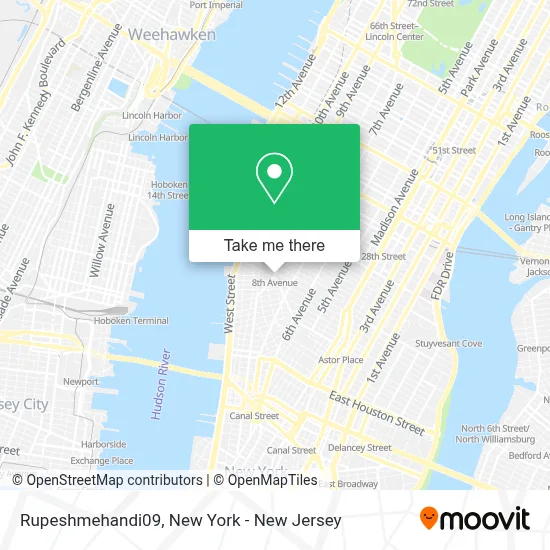
See Rupeshmehandi09, Manhattan, on the map
Public Transit to Rupeshmehandi09 in Manhattan
Wondering how to get to Rupeshmehandi09 in Manhattan? Moovit helps you find the best way to get to Rupeshmehandi09 with step-by-step directions from the nearest public transit station.
Moovit provides free maps and live directions to help you navigate through your city. View schedules, routes, timetables, and find out how long does it take to get to Rupeshmehandi09 in real time.
Looking for the nearest stop or station to Rupeshmehandi09? Check out this list of stops closest to your destination: W 14 St/7 Av; 7 Av/W 14 St; 8 Av/W 12 St; Hudson St/W 13 St; 14th Street; 14 St / 8 Av; 18 St; 14 St.
Bus: M11, M14A-SBS, M14D-SBS, M20, M7.Train: 2, EMPIRE SERVICE, YEL, ATW, BLU.Subway: 1, 2, 5, C, E, L, A, 3.
Want to see if there’s another route that gets you there at an earlier time? Moovit helps you find alternative routes or times. Get directions from and directions to Rupeshmehandi09 easily from the Moovit App or Website.
We make riding to Rupeshmehandi09 easy, which is why over 1.5 million users, including users in Manhattan, trust Moovit as the best app for public transit. You don’t need to download an individual bus app or train app, Moovit is your all-in-one transit app that helps you find the best bus time or train time available.
For information on prices of subway, bus and train, costs and ride fares to Rupeshmehandi09, please check the Moovit app.
Use the app to navigate to popular places including to the airport, hospital, stadium, grocery store, mall, coffee shop, school, college, and university.
Rupeshmehandi09 Address: janakpuri street in Manhattan
- Influencer Marketing Agency - New York,
- 14th Street - 8th Avenue Subway Station,
- Flood Catering,
- Museum Of Illusions,
- The Picnic Day,
- 8th Ave (14th st 8th ave),
- MTA NYCT Signal School,
- 8th Avenue,
- 14th Street Eighth Avenue Station,
- Jackson Square Park,
- Natural Chinese Martial Arts - Authentic Xingyi, Bagua and Tai Chi In Nyc,
- MTA Bus - W. 14th Street & 8th Avenue (M12 / M14A / M14D),
- MTA NYCT - Training Center 14th St & 8th Ave,
- Aesthetic Movement,
- Greenwich Substation,
- Ups Access Point Location,
- Teamsters Joint Council 16,
- Dr. Jason Durant,
- Integrative Psychiatry - Expert Psychiatrists and Psychotherapists - In Manhattan,
- Manhattan Therapy
Places Near Rupeshmehandi09 (Manhattan)
- San Gennaro Feast, Manhattan,
- Rockefeller Center, Manhattan,
- Katz's Deli, Manhattan,
- 111 Centre New York City Supreme Court, Manhattan,
- Hudson Yards, Manhattan,
- SoHo, Manhattan,
- Wall Street, Manhattan,
- Mountainside Hospital, Glen Ridge,
- Queens Center Mall, Queens,
- 26 Federal Plaza, Manhattan,
- 3 Stone St, Manhattan,
- Bellevue Hospital, Manhattan,
- 66 John Street, Manhattan,
- 376 Hudson Street, Manhattan,
- qqqq, Manhattan,
- 1 Police Plaza, Manhattan,
- Times Square, Manhattan,
- 911 Memorial, Manhattan,
- Pier 83, Manhattan,
- Chinatown, Manhattan
How to get to popular places in New York - New Jersey with public transit
Get around Manhattan by public transit!
Traveling around Manhattan has never been so easy. See step by step directions as you travel to any attraction, street or major public transit station. View bus and train schedules, arrival times, service alerts and detailed routes on a map, so you know exactly how to get to anywhere in Manhattan.
When traveling to any destination around Manhattan use Moovit's Live Directions with Get Off Notifications to know exactly where and how far to walk, how long to wait for your line, and how many stops are left. Moovit will alert you when it's time to get off — no need to constantly re-check whether yours is the next stop.
Wondering how to use public transit in Manhattan or how to pay for public transit in Manhattan? Moovit public transit app can help you navigate your way with public transit easily, and at minimum cost. It includes public transit fees, ticket prices, and costs. Looking for a map of Manhattan public transit lines? Moovit public transit app shows all public transit maps in Manhattan with all Bus, Train, Subway, Light Rail, Ferry and Cable Car routes and stops on an interactive map.
New York - New Jersey has 6 transit type(s), including: Bus, Train, Subway, Light Rail, Ferry and Cable Car, operated by several transit agencies, including MTA Subway, Metro-North Railroad, LIRR, PATH, MTA New York City Transit - Express routes, MTA Bus, NJ Transit, NYC Ferry, NICE bus, Bee-Line Bus, NJ Transit Rail, Norwalk Transit District, Hartford Line, River Valley Transit and HART