How to get to Ruppert Stadium by bus?
Click on the bus route to see step by step directions with maps, line arrival times and updated time schedules.
From Medieval Times, Lyndhurst
64 minFrom Wagner Park, Manhattan
103 minFrom Jersey City, NJ, Jersey City
80 minFrom Medieval Times Dinner & Tournament, Lyndhurst
64 minFrom Beth Israel Hospital, Newark
43 minFrom Bloomfield, NJ, Bloomfield
66 minFrom Hudson Street, Jersey City
68 minFrom Staten Island Ferry, Staten Island
176 minFrom Newport Mall Bus, Jersey City
51 minFrom IKEA Elizabeth Shuttle Bus To Manhattan, Elizabeth
46 min
How to get to Ruppert Stadium by train?
Click on the train route to see step by step directions with maps, line arrival times and updated time schedules.
Bus stop near Ruppert Stadium in Newark
- Wilson Ave at Avenue L, 3 min walk,VIEW
Train stations near Ruppert Stadium in Newark
Light Rail stations near Ruppert Stadium in Newark
- Penn Station Light Rail Arrival, 20 min walk,VIEW
Bus lines to Ruppert Stadium in Newark
- 25, Springfield Av Irv Terminal,VIEW
What are the closest stations to Ruppert Stadium?
The closest stations to Ruppert Stadium are:
- Wilson Ave at Avenue L is 189 yards away, 3 min walk.
- Harrison is 796 yards away, 10 min walk.
- Newark Penn Station is 1493 yards away, 18 min walk.
- Penn Station Light Rail Arrival is 1523 yards away, 20 min walk.
Which bus lines stop near Ruppert Stadium?
These bus lines stop near Ruppert Stadium: 108, 25.
Which train lines stop near Ruppert Stadium?
These train lines stop near Ruppert Stadium: NC, NJCL, RED.
What’s the nearest light rail station to Ruppert Stadium in Newark?
The nearest light rail station to Ruppert Stadium in Newark is Penn Station Light Rail Arrival. It’s a 20 min walk away.
What’s the nearest train station to Ruppert Stadium in Newark?
The nearest train station to Ruppert Stadium in Newark is Harrison. It’s a 10 min walk away.
What’s the nearest bus station to Ruppert Stadium in Newark?
The nearest bus station to Ruppert Stadium in Newark is Wilson Ave at Avenue L. It’s a 3 min walk away.
What time is the first light rail to Ruppert Stadium in Newark?
The NLR is the first light rail that goes to Ruppert Stadium in Newark. It stops nearby at 4:30 AM.
What time is the last light rail to Ruppert Stadium in Newark?
The NLR is the last light rail that goes to Ruppert Stadium in Newark. It stops nearby at 1:15 AM.
What time is the first train to Ruppert Stadium in Newark?
The RED is the first train that goes to Ruppert Stadium in Newark. It stops nearby at 3:10 AM.
What time is the last train to Ruppert Stadium in Newark?
The RED is the last train that goes to Ruppert Stadium in Newark. It stops nearby at 2:55 AM.
What time is the first bus to Ruppert Stadium in Newark?
The 25 is the first bus that goes to Ruppert Stadium in Newark. It stops nearby at 3:03 AM.
What time is the last bus to Ruppert Stadium in Newark?
The 25 is the last bus that goes to Ruppert Stadium in Newark. It stops nearby at 3:07 AM.
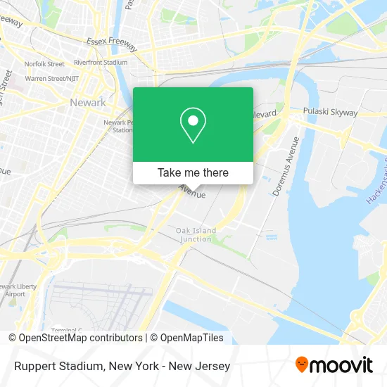
See Ruppert Stadium, Newark, on the map
Public Transit to Ruppert Stadium in Newark
Wondering how to get to Ruppert Stadium in Newark? Moovit helps you find the best way to get to Ruppert Stadium with step-by-step directions from the nearest public transit station.
Moovit provides free maps and live directions to help you navigate through your city. View schedules, routes, timetables, and find out how long does it take to get to Ruppert Stadium in real time.
Looking for the nearest stop or station to Ruppert Stadium? Check out this list of stops closest to your destination: Wilson Ave at Avenue L; Harrison; Newark Penn Station; Penn Station Light Rail Arrival.
Bus: 108, 25.Train: NC, NJCL, RED, ACELA, CARDINAL, CAROLINIAN, CRESCENT, KEYSTONE SERVICE.
Want to see if there’s another route that gets you there at an earlier time? Moovit helps you find alternative routes or times. Get directions from and directions to Ruppert Stadium easily from the Moovit App or Website.
We make riding to Ruppert Stadium easy, which is why over 1.5 million users, including users in Newark, trust Moovit as the best app for public transit. You don’t need to download an individual bus app or train app, Moovit is your all-in-one transit app that helps you find the best bus time or train time available.
For information on prices of bus, train, light rail and ferry, costs and ride fares to Ruppert Stadium, please check the Moovit app.
Use the app to navigate to popular places including to the airport, hospital, stadium, grocery store, mall, coffee shop, school, college, and university.
Location: Newark, New York - New Jersey
- Java Techs,
- Law Coffee,
- Wb Law Coffee Co.,
- Vadilal Global,
- Cruz Contractors Llc,
- Ironbound Cold Brew Coffee,
- Mahadev 01,
- Seko Logistics Newark,
- Jmr Structural Steel Fabricator,
- Def Evolution Truck Repairs Llc,
- Extra Space Storage,
- Have A Good Day,
- 1 and 9 Chrome Shop,
- Usa Truck Center,
- Stockton Tires and Auto Repair,
- Brain Master Repairs,
- Allegiance Trucks,
- New City General Mechanic,
- Downtown Auto Parts,
- Trucker's Gourmet Deli
Places Near Ruppert Stadium (Newark)
- 26 Federal Plaza, Manhattan,
- Rockefeller Center, Manhattan,
- 1 Police Plaza, Manhattan,
- Mountainside Hospital, Glen Ridge,
- Katz's Deli, Manhattan,
- Queens Center Mall, Queens,
- 911 Memorial, Manhattan,
- qqqq, Manhattan,
- SoHo, Manhattan,
- Wall Street, Manhattan,
- Pier 83, Manhattan,
- Bellevue Hospital, Manhattan,
- 66 John Street, Manhattan,
- San Gennaro Feast, Manhattan,
- Hudson Yards, Manhattan,
- 3 Stone St, Manhattan,
- Chinatown, Manhattan,
- Times Square, Manhattan,
- 111 Centre New York City Supreme Court, Manhattan,
- 376 Hudson Street, Manhattan
How to get to popular places in New York - New Jersey with public transit
Get around Newark by public transit!
Traveling around Newark has never been so easy. See step by step directions as you travel to any attraction, street or major public transit station. View bus and train schedules, arrival times, service alerts and detailed routes on a map, so you know exactly how to get to anywhere in Newark.
When traveling to any destination around Newark use Moovit's Live Directions with Get Off Notifications to know exactly where and how far to walk, how long to wait for your line, and how many stops are left. Moovit will alert you when it's time to get off — no need to constantly re-check whether yours is the next stop.
Wondering how to use public transit in Newark or how to pay for public transit in Newark? Moovit public transit app can help you navigate your way with public transit easily, and at minimum cost. It includes public transit fees, ticket prices, and costs. Looking for a map of Newark public transit lines? Moovit public transit app shows all public transit maps in Newark with all Bus, Train, Subway, Light Rail, Ferry and Cable Car routes and stops on an interactive map.
New York - New Jersey has 6 transit type(s), including: Bus, Train, Subway, Light Rail, Ferry and Cable Car, operated by several transit agencies, including MTA Subway, Metro-North Railroad, LIRR, PATH, MTA New York City Transit - Express routes, MTA Bus, NJ Transit, NYC Ferry, NICE bus, Bee-Line Bus, NJ Transit Rail, Norwalk Transit District, Hartford Line, River Valley Transit and HART