How to get to Rural Hospital, Shikrapur by bus?
Click on the bus route to see step by step directions with maps, line arrival times and updated time schedules.
From Ranjangaon Ganpati, Shirur
59 minFrom Jabil India, Shirur
67 minFrom Wagheshwar Temple, Pune & Velhe
61 minFrom Tulapur, Pune & Velhe
78 minFrom Shree Kshetra Theur Chintamani Ganpati, Pune & Velhe
98 minFrom Wagholi, Pune & Velhe
58 minFrom sambhaji maharaj samadhi, tulapur, Pune & Velhe
77 minFrom Wagholi Pmpml Bus Stand, Pune & Velhe
59 minFrom JSPM Group of institutes,wagholi,pune, Pune & Velhe
63 minFrom Art Of Living, Triveni Ashram, Rajgurunagar
152 min
Bus stops near Rural Hospital, Shikrapur in Shirur
Bus lines to Rural Hospital, Shikrapur in Shirur
- 159, Ma.Na.Pa Bhavan - Talegaon Dhamdhere Bazar,VIEW
- 164, Ma.Na.Pa Bhavan - Nhavare,VIEW
- 164A, Nhavare - Shikrapur ST Stand,VIEW
- 353, Shikrapur Phata ,VIEW
- 353A, Bhosari,VIEW
- 159C, Shikrapur ST Stand,VIEW
- 161, Karegaon ZP School - Kesnand Phata Wagholi,VIEW
- 159B, Ma.Na.Pa Bhavan - Loni Dhamani,VIEW
- 161C, Diamond Water Park - Karegaon ZP School,VIEW
- 161D, Diamond Water Park - Shirur Dnyanganga College,VIEW
What are the closest stations to Rural Hospital, Shikrapur?
The closest stations to Rural Hospital, Shikrapur are:
- Kshitij Vihar is 433 meters away, 6 min walk.
- Shikrapur ST Stand is 1057 meters away, 14 min walk.
- Shikrapur Phata is 1368 meters away, 18 min walk.
Which bus lines stop near Rural Hospital, Shikrapur?
These bus lines stop near Rural Hospital, Shikrapur: 159, 353.
What’s the nearest bus station to Rural Hospital, Shikrapur in Shirur?
The nearest bus station to Rural Hospital, Shikrapur in Shirur is Kshitij Vihar. It’s a 6 min walk away.
What time is the first bus to Rural Hospital, Shikrapur in Shirur?
The 161C is the first bus that goes to Rural Hospital, Shikrapur in Shirur. It stops nearby at 5:56 AM.
What time is the last bus to Rural Hospital, Shikrapur in Shirur?
The 159 is the last bus that goes to Rural Hospital, Shikrapur in Shirur. It stops nearby at 11:53 PM.
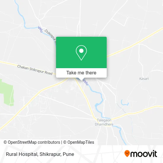
See Rural Hospital, Shikrapur, Shirur, on the map
Public Transit to Rural Hospital, Shikrapur in Shirur
Wondering how to get to Rural Hospital, Shikrapur in Shirur? Moovit helps you find the best way to get to Rural Hospital, Shikrapur with step-by-step directions from the nearest public transit station.
Moovit provides free maps and live directions to help you navigate through your city. View schedules, routes, timetables, and find out how long does it take to get to Rural Hospital, Shikrapur in real time.
Looking for the nearest stop or station to Rural Hospital, Shikrapur? Check out this list of stops closest to your destination: Kshitij Vihar; Shikrapur ST Stand; Shikrapur Phata.
Bus: 159, 353, 164, 164A, 353A, 159C, 161, 159B, 161C, 161D.
Want to see if there’s another route that gets you there at an earlier time? Moovit helps you find alternative routes or times. Get directions from and directions to Rural Hospital, Shikrapur easily from the Moovit App or Website.
We make riding to Rural Hospital, Shikrapur easy, which is why over 1.5 million users, including users in Shirur, trust Moovit as the best app for public transit. You don’t need to download an individual bus app or train app, Moovit is your all-in-one transit app that helps you find the best bus time or train time available.
For information on prices of bus, costs and ride fares to Rural Hospital, Shikrapur, please check the Moovit app.
Use the app to navigate to popular places including to the airport, hospital, stadium, grocery store, mall, coffee shop, school, college, and university.
Location: Shirur, Pune
- Iron Paradise Gym,
- Om Kar Steel & Furniture,
- Nilesh Auto Garage,
- H H Garment,
- KM Sweet,
- Mamta Super Market,
- Shrinath Cloth Centre,
- Wajid Gola Chai,
- Meher Stationery,
- Jay Bhawani Pan Shop,
- Hindu Devi Photo Studio,
- Treasure Valley School,
- Shri Ram General Store,
- AJ Style Mens Wear,
- Shri Sai Collection,
- Cafe Katta,
- Vaishnavi Fabrication Works,
- Sharvari Auto Garage,
- Yash Dudh Dairy,
- Omsai Medical and General Store
Places Near Rural Hospital, Shikrapur (Shirur)
- Dagdusheth Halwai Ganpati Mandir, Pune & Velhe,
- ISKCON Nvcc Temple, Pune & Velhe,
- Sarasbaug, Pune & Velhe,
- M G Road, Pune & Velhe,
- Dagadusheth Halwai Ganapati Temple, Pune & Velhe,
- Vishwakarma Institute Of Technology (Vit), Pune & Velhe,
- Tulshibaug, Pune & Velhe,
- Pune Okayama Friendship Garden, Pune & Velhe,
- Fc Road, Pune & Velhe,
- Ion Digital Zone, Pune & Velhe,
- Pvr Icon - Pavilion Mall, Pune & Velhe,
- BAPS Shri Swaminarayan Mandir, Pune & Velhe,
- Cognizant Deccan Campus (CDC), Paud,
- Chaturshringi Temple, Pune & Velhe,
- Laxmi Road, Pune & Velhe,
- Swaminarayan Mandir, Pune & Velhe,
- Westend Mall, Pune & Velhe,
- ISKCON Pune, Pune & Velhe,
- Symbiosis Lavale Bus Stop, Pune & Velhe,
- Senapati Bapat Road, Pune & Velhe
How to get to popular places in Pune with public transit
Get around Shirur by public transit!
Traveling around Shirur has never been so easy. See step by step directions as you travel to any attraction, street or major public transit station. View bus and train schedules, arrival times, service alerts and detailed routes on a map, so you know exactly how to get to anywhere in Shirur.
When traveling to any destination around Shirur use Moovit's Live Directions with Get Off Notifications to know exactly where and how far to walk, how long to wait for your line, and how many stops are left. Moovit will alert you when it's time to get off — no need to constantly re-check whether yours is the next stop.
Wondering how to use public transit in Shirur or how to pay for public transit in Shirur? Moovit public transit app can help you navigate your way with public transit easily, and at minimum cost. It includes public transit fees, ticket prices, and costs. Looking for a map of Shirur public transit lines? Moovit public transit app shows all public transit maps in Shirur with all Bus, Train and Metro routes and stops on an interactive map.
Pune has 3 transit type(s), including: Bus, Train and Metro, operated by several transit agencies, including Pune Metro (Maha Metro), PMPML, PMPML Night Bus Service (Ratrani) and Central Railways (Indian Railways)