How to get to Rural Intelligence by bus?
Click on the bus route to see step by step directions with maps, line arrival times and updated time schedules.
From 11A Bus to Port Authority, Spring Valley
287 minFrom Peekskill, NY, Peekskill
383 minFrom Palisades mall, West Nyack
288 minFrom New City (New), New City
307 minFrom Regeneron Pharmaceuticals Inc, Tarrytown
294 minFrom Rockland #45 Express Bus to Port Authority Bus Terminal, NYC, Spring Valley
287 min
Bus stops near Rural Intelligence in Kingston
Bus lines to Rural Intelligence in Kingston
- BLUE, Blue Regular 2025,VIEW
- S2, Route,VIEW
- CL ROUTE, Cl 2025,VIEW
- EU-SB, Saturday_E_2023,VIEW
- Z-WB, Saturday_Z_2023,VIEW
- YELLOW, Saturday__2023,VIEW
- PHK 701, Kingston -> New York (P.A.B.T.),VIEW
- PHK 702, New York (P.A.B.T.) -> Oneonta,VIEW
- PHK 703, Kingston -> New York (Hudson Trailways),VIEW
- PHK 704, New York (P.A.B.T.) -> Utica,VIEW
- PHK 705, Kingston -> New York (P.A.B.T.),VIEW
- PHK 706, New York (P.A.B.T.) -> Oneonta (SUNY Campus),VIEW
- PHK 707, Utica -> New York (P.A.B.T.),VIEW
- PHK 707F, Utica -> New York (P.A.B.T.),VIEW
- PHK 708, New York (P.A.B.T.) -> Phoenicia,VIEW
- PHK 709, Oneonta -> Kingston,VIEW
- PHK 710, New York (P.A.B.T.) -> Kingston,VIEW
- PHK 711, Oneonta -> Kingston,VIEW
- PHK 713, Kingston -> New York (P.A.B.T.),VIEW
- PHK 718, New York (P.A.B.T.) -> Kingston,VIEW
What are the closest stations to Rural Intelligence?
The closest stations to Rural Intelligence are:
- Wall St & N Front St is 107 yards away, 2 min walk.
- Clinton Ave @ Westbrook La is 329 yards away, 5 min walk.
- Governor Clinton is 538 yards away, 7 min walk.
- Lucas & Washington Ave is 542 yards away, 7 min walk.
- Kingston is 556 yards away, 7 min walk.
- Kingston Plaza is 654 yards away, 8 min walk.
Which bus lines stop near Rural Intelligence?
These bus lines stop near Rural Intelligence: CL ROUTE, KPL-NB, PHK 704, PHK 740, PHK 758.
What’s the nearest bus station to Rural Intelligence in Kingston?
The nearest bus station to Rural Intelligence in Kingston is Wall St & N Front St. It’s a 2 min walk away.
What time is the first bus to Rural Intelligence in Kingston?
The PHK 755 is the first bus that goes to Rural Intelligence in Kingston. It stops nearby at 4:10 AM.
What time is the last bus to Rural Intelligence in Kingston?
The ADT A290 is the last bus that goes to Rural Intelligence in Kingston. It stops nearby at 10:15 PM.
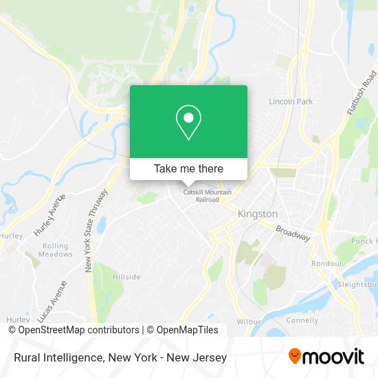
See Rural Intelligence, Kingston, on the map
Public Transit to Rural Intelligence in Kingston
Wondering how to get to Rural Intelligence in Kingston? Moovit helps you find the best way to get to Rural Intelligence with step-by-step directions from the nearest public transit station.
Moovit provides free maps and live directions to help you navigate through your city. View schedules, routes, timetables, and find out how long does it take to get to Rural Intelligence in real time.
Looking for the nearest stop or station to Rural Intelligence? Check out this list of stops closest to your destination: Wall St & N Front St; Clinton Ave @ Westbrook La; Governor Clinton; Lucas & Washington Ave; Kingston; Kingston Plaza.
Bus: CL ROUTE, KPL-NB, PHK 704, PHK 740, PHK 758, BLUE, S2, YELLOW, EU-SB, Z-WB, PHK 701, PHK 702, PHK 703, PHK 705, EU-NB, KPL-SB, KS-NB, KS-SB.
Want to see if there’s another route that gets you there at an earlier time? Moovit helps you find alternative routes or times. Get directions from and directions to Rural Intelligence easily from the Moovit App or Website.
We make riding to Rural Intelligence easy, which is why over 1.5 million users, including users in Kingston, trust Moovit as the best app for public transit. You don’t need to download an individual bus app or train app, Moovit is your all-in-one transit app that helps you find the best bus time or train time available.
For information on prices of bus, train and subway, costs and ride fares to Rural Intelligence, please check the Moovit app.
Use the app to navigate to popular places including to the airport, hospital, stadium, grocery store, mall, coffee shop, school, college, and university.
Location: Kingston, New York - New Jersey
- Mid-Hudson Home Inspectors,
- Reracked,
- Outdated, Antique Cafe,
- Elephant Tapas & Wine Bar,
- Primelending, A Plainscapital Company - Kingston,
- Gpro Digital Media,
- Centennial Mortgage,
- Jennifer Lynn Interiors,
- Enve Sweetz,
- Zara Starchild Ascension Guide,
- Market Basket,
- Massive Clouds Llc,
- Brandi Ware and Associates,
- Brainstorm Computers,
- Johnny Wonder,
- Toucan Hats,
- Blue Byrd's Haberdashery and Music,
- The Gilded Needle Tattoo,
- Capital Design and Takeoffs,
- Catherine A Lenz
Places Near Rural Intelligence (Kingston)
- Wall Street, Manhattan,
- Mountainside Hospital, Glen Ridge,
- 376 Hudson Street, Manhattan,
- 26 Federal Plaza, Manhattan,
- SoHo, Manhattan,
- Bellevue Hospital, Manhattan,
- Chinatown, Manhattan,
- 911 Memorial, Manhattan,
- qqqq, Manhattan,
- Katz's Deli, Manhattan,
- 111 Centre New York City Supreme Court, Manhattan,
- 66 John Street, Manhattan,
- 1 Police Plaza, Manhattan,
- 3 Stone St, Manhattan,
- Hudson Yards, Manhattan,
- Queens Center Mall, Queens,
- Times Square, Manhattan,
- San Gennaro Feast, Manhattan,
- Rockefeller Center, Manhattan,
- Pier 83, Manhattan
How to get to popular places in New York - New Jersey with public transit
Get around Kingston by public transit!
Traveling around Kingston has never been so easy. See step by step directions as you travel to any attraction, street or major public transit station. View bus and train schedules, arrival times, service alerts and detailed routes on a map, so you know exactly how to get to anywhere in Kingston.
When traveling to any destination around Kingston use Moovit's Live Directions with Get Off Notifications to know exactly where and how far to walk, how long to wait for your line, and how many stops are left. Moovit will alert you when it's time to get off — no need to constantly re-check whether yours is the next stop.
Wondering how to use public transit in Kingston or how to pay for public transit in Kingston? Moovit public transit app can help you navigate your way with public transit easily, and at minimum cost. It includes public transit fees, ticket prices, and costs. Looking for a map of Kingston public transit lines? Moovit public transit app shows all public transit maps in Kingston with all Bus, Train, Subway, Light Rail, Ferry and Cable Car routes and stops on an interactive map.
New York - New Jersey has 6 transit type(s), including: Bus, Train, Subway, Light Rail, Ferry and Cable Car, operated by several transit agencies, including MTA Subway, Metro-North Railroad, LIRR, PATH, MTA New York City Transit - Express routes, MTA Bus, NJ Transit, NYC Ferry, NICE bus, Bee-Line Bus, NJ Transit Rail, Norwalk Transit District, Hartford Line, River Valley Transit and HART