How to get to Rural Nursing Home by bus?
Click on the bus route to see step by step directions with maps, line arrival times and updated time schedules.
From Providence Cristo Rey High School, Indianapolis City (Balance)
40 minFrom Lilly Corporate Center (Eli Lilly & Co), Indianapolis City (Balance)
34 minFrom IU Health Simon Cancer Center (IUSCC) (SN) (Cancer Center), Indianapolis City (Balance)
43 minFrom Indiana Discount Mall, Indianapolis
59 minFrom Indy Go Gas, Indianapolis City (Balance)
63 minFrom Christian Faith Baptist, Indianapolis City (Balance)
50 minFrom Indianapolis Motor Speedway, Speedway
54 minFrom Southern Plaza Shopping Center, Indianapolis City (Balance)
63 minFrom Indy 500 Snake Pit, Speedway
67 minFrom JBN Family Applian, Indianapolis City (Balance)
49 min
Bus stops near Rural Nursing Home in Indianapolis City (Balance)
Bus lines to Rural Nursing Home in Indianapolis City (Balance)
What are the closest stations to Rural Nursing Home?
The closest stations to Rural Nursing Home are:
- Rural St & 16th St is 5 yards away, 1 min walk.
- Brookside Ave & Rural St is 500 yards away, 6 min walk.
- Brookside Pkwy S Dr & Nowland Ave is 677 yards away, 8 min walk.
Which bus lines stop near Rural Nursing Home?
These bus lines stop near Rural Nursing Home: 11, 21, 26.
What’s the nearest bus station to Rural Nursing Home in Indianapolis City (Balance)?
The nearest bus station to Rural Nursing Home in Indianapolis City (Balance) is Rural St & 16th St. It’s a 1 min walk away.
What time is the first bus to Rural Nursing Home in Indianapolis City (Balance)?
The 11 is the first bus that goes to Rural Nursing Home in Indianapolis City (Balance). It stops nearby at 5:15 AM.
What time is the last bus to Rural Nursing Home in Indianapolis City (Balance)?
The 26 is the last bus that goes to Rural Nursing Home in Indianapolis City (Balance). It stops nearby at 11:05 PM.
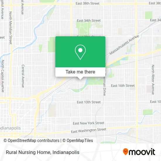
See Rural Nursing Home, Indianapolis City (Balance), on the map
Public Transit to Rural Nursing Home in Indianapolis City (Balance)
Wondering how to get to Rural Nursing Home in Indianapolis City (Balance)? Moovit helps you find the best way to get to Rural Nursing Home with step-by-step directions from the nearest public transit station.
Moovit provides free maps and live directions to help you navigate through your city. View schedules, routes, timetables, and find out how long does it take to get to Rural Nursing Home in real time.
Looking for the nearest stop or station to Rural Nursing Home? Check out this list of stops closest to your destination: Rural St & 16th St; Brookside Ave & Rural St; Brookside Pkwy S Dr & Nowland Ave.
Bus: 11, 21, 26.
Want to see if there’s another route that gets you there at an earlier time? Moovit helps you find alternative routes or times. Get directions from and directions to Rural Nursing Home easily from the Moovit App or Website.
We make riding to Rural Nursing Home easy, which is why over 1.5 million users, including users in Indianapolis City (Balance), trust Moovit as the best app for public transit. You don’t need to download an individual bus app or train app, Moovit is your all-in-one transit app that helps you find the best bus time or train time available.
For information on prices of bus, costs and ride fares to Rural Nursing Home, please check the Moovit app.
Use the app to navigate to popular places including to the airport, hospital, stadium, grocery store, mall, coffee shop, school, college, and university.
Rural Nursing Home Address: 1735 N Rural St street in Indianapolis City (Balance)
- Apex Property Management,
- Moore Locksmith Services,
- D & J's Used Tires & Batteries,
- 2937 E 16th St,
- Jamie's Nail Salon,
- Brookside Park,
- Hunt Brothers Pizza,
- bp,
- Environmental Works, Inc.,
- Rural Street And Brookside Parkway,
- GS World of Technology Recycle,
- CFM Enterprises,
- King Trucktrailer Repair,
- Krispy Krunchy Chicken,
- E Roosevelt Ave,
- Priority Ambulance,
- Indiana Afl Cio,
- Hoosier Heartland Area Labor Federation,
- Sutton-Garten Dry Ice,
- Paramount School of Excellence
Places Near Rural Nursing Home (Indianapolis City (Balance))
- Indianapolis Airport Zone 2, Indianapolis City (Balance),
- Jersey Barn, Indianapolis City (Balance),
- I-465 / I-65 Interchange, Indianapolis City (Balance),
- Lucas Oil Stadium, Indianapolis City (Balance),
- THE BALT, Indianapolis City (Balance),
- Indiana Convention Center, Indianapolis City (Balance),
- Train Ride At Castleton Mall, Indianapolis City (Balance),
- Indiana, Indianapolis City (Balance),
- Plainfield, IN, Plainfield,
- St. Vincent entrance #1, Indianapolis City (Balance),
- I U Health Methodist Hospital, Indianapolis City (Balance),
- Lilly Corporate Center (Eli Lilly & Co), Indianapolis City (Balance),
- Indianapolis Motor Speedway, Speedway,
- Cotter's Massage Parlor With Happy Endings, Indianapolis City (Balance),
- 119 W 19th St Parking, Indianapolis City (Balance),
- Gainbridge Fieldhouse, Indianapolis City (Balance),
- Methodist Hospital of Indianapolis, Indianapolis City (Balance),
- Eskenazi Hospital, Indianapolis City (Balance),
- Castleton Square Mall, Indianapolis,
- St. Vincent Hospital - Indianapolis, Indianapolis City (Balance)
How to get to popular places in Indianapolis with public transit
Get around Indianapolis City (Balance) by public transit!
Traveling around Indianapolis City (Balance) has never been so easy. See step by step directions as you travel to any attraction, street or major public transit station. View bus and train schedules, arrival times, service alerts and detailed routes on a map, so you know exactly how to get to anywhere in Indianapolis City (Balance).
When traveling to any destination around Indianapolis City (Balance) use Moovit's Live Directions with Get Off Notifications to know exactly where and how far to walk, how long to wait for your line, and how many stops are left. Moovit will alert you when it's time to get off — no need to constantly re-check whether yours is the next stop.
Wondering how to use public transit in Indianapolis City (Balance) or how to pay for public transit in Indianapolis City (Balance)? Moovit public transit app can help you navigate your way with public transit easily, and at minimum cost. It includes public transit fees, ticket prices, and costs. Looking for a map of Indianapolis City (Balance) public transit lines? Moovit public transit app shows all public transit maps in Indianapolis City (Balance) with all bus routes and stops on an interactive map.
Indianapolis has 1 transit type(s), including: bus, operated by several transit agencies, including IndyGo, FlixBus-us and Greyhound-us