Directions to Rural X (Cascatinha) with public transportation
The following transit lines have routes that pass near Rural X
How to get to Rural X by bus?
Click on the bus route to see step by step directions with maps, line arrival times and updated time schedules.
From Rua Alcino Guanabara, Hauer
77 minFrom Rua Santa Catarina 65, Água Verde
49 minFrom Rua Fulvio José Alice 381, Bairro Alto
48 minFrom Terminal Do Carmo, Hauer
49 minFrom Rua Lodovico Geronazzo, Boa Vista
63 minFrom Avenida Monteiro Tourinho 1506, Atuba
47 minFrom Rua Pedro Gusso, Capão Raso
71 minFrom Rua José de Alencar, Juvevê
38 minFrom Guabirotuba, Guabirotuba
74 minFrom Posigraf, Cic
69 min
Bus stops near Rural X in Cascatinha
Bus lines to Rural X in Cascatinha
- 965 SÃO BERNARDO, Terminal Santa Felicidade → Praça Tiradentes,VIEW
- 972 JARDIM ITÁLIA, Terminal Santa Felicidade → Travessa Nestor de Castro,VIEW
- 989 MAD. SANTA FELICIDADE, Praça Rui Barbosa ↺ Santa Felicidade (Circular),VIEW
- 901 SANTA FELICIDADE, Travessa Nestor de Castro → Terminal Santa Felicidade (via Trombini),VIEW
- 967 JÚLIO GRAF, Praça Tiradentes → Júlio Graf,VIEW
What are the closest stations to Rural X?
The closest stations to Rural X are:
- Rua Juvenal Dos Santos, 101-237 is 162 meters away, 3 min walk.
- R. Ângelo Domingos Durigan, 819 is 749 meters away, 10 min walk.
- R. Ângelo Domingos Durigan, 820 is 765 meters away, 10 min walk.
- Trombini Embalagens is 1195 meters away, 16 min walk.
Which bus line stops near Rural X?
965 SÃO BERNARDO (Praça Tiradentes → Terminal Santa Felicidade)
What’s the nearest bus station to Rural X in Cascatinha?
The nearest bus station to Rural X in Cascatinha is Rua Juvenal Dos Santos, 101-237. It’s a 3 min walk away.
What time is the first bus to Rural X in Cascatinha?
The 989 MAD. SANTA FELICIDADE is the first bus that goes to Rural X in Cascatinha. It stops nearby at 3:54 AM.
What time is the last bus to Rural X in Cascatinha?
The 989 MAD. SANTA FELICIDADE is the last bus that goes to Rural X in Cascatinha. It stops nearby at 2:45 AM.
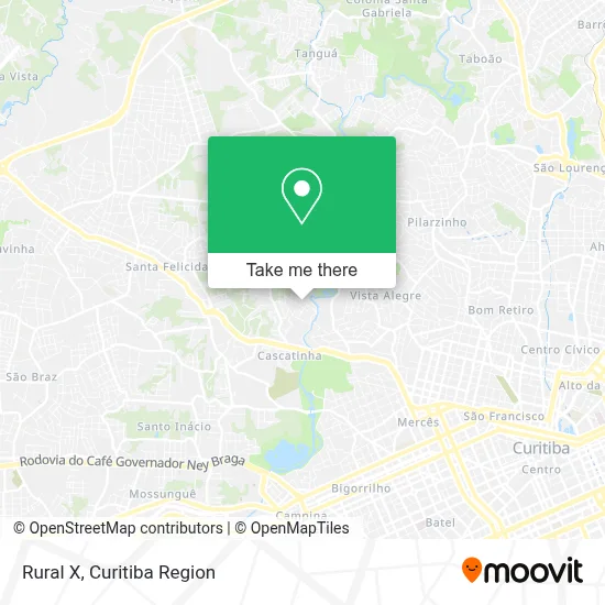
See Rural X, Cascatinha, on the map
Public Transit to Rural X in Cascatinha
Wondering how to get to Rural X in Cascatinha? Moovit helps you find the best way to get to Rural X with step-by-step directions from the nearest public transit station.
Moovit provides free maps and live directions to help you navigate through your city. View schedules, routes, timetables, and find out how long does it take to get to Rural X in real time.
Looking for the nearest stop or station to Rural X? Check out this list of stops closest to your destination: Rua Juvenal Dos Santos; R. Ângelo Domingos Durigan; R. Ângelo Domingos Durigan; Trombini Embalagens.
Bus: 965 SÃO BERNARDO, 972 JARDIM ITÁLIA, 989 MAD. SANTA FELICIDADE, 901 SANTA FELICIDADE, 967 JÚLIO GRAF.
Want to see if there’s another route that gets you there at an earlier time? Moovit helps you find alternative routes or times. Get directions from and directions to Rural X easily from the Moovit App or Website.
We make riding to Rural X easy, which is why over 1.5 million users, including users in Cascatinha, trust Moovit as the best app for public transit. You don’t need to download an individual bus app or train app, Moovit is your all-in-one transit app that helps you find the best bus time or train time available.
For information on prices of bus, costs and ride fares to Rural X, please check the Moovit app.
Use the app to navigate to popular places including to the airport, hospital, stadium, grocery store, mall, coffee shop, school, college, and university.
Rural X Address: Rua Antônio de Paula França, 233 Cascatinha Curitiba-PR 82025-020 street in Cascatinha
- Associacao Comunitaria Sao Bernardo,
- Restaurante Salpicão,
- Construtora Alfrigg,
- Bme,
- Muller It Solutions,
- MS Serviços Administrativo,
- Salão Catarinense,
- Rua Juvenal dos Santos, 360 - Cascatinha,
- Lux Informática,
- Gaby& Matheus Casa de Pães e Confeitari,
- Metais Santa Felicita,
- Trombini Embalagens,
- Demetrio & Campos Transportes e Servicos Ltda,
- Ieq Cascatinha,
- Rua Olympio Trombini 135,
- Atacado de Livros Curitiba,
- Rua Lauro Mallin 1,
- Dot Engenharia,
- Uma Psicológia,
- Risotolandia Serviços de Alimentacao
Places Near Rural X (Cascatinha)
- Shopping Estação, Rebouças,
- Park Shopping Barigüi, Mossunguê,
- Parque Barigui, Mercês,
- Jockey Plaza Shopping Center, Tarumã,
- Hospital Erasto Gaertner, Jardim Das Américas,
- Jardim Botânico de Curitiba PR, Centro,
- Hospital Da Cruz Vermelha, Batel,
- Hospital de Clínicas (HC - UFPR), Centro,
- Hospital Universitário Evangélico de Curitiba, Bigorrilho,
- Hospital do Rocio, Campo,
- Rua Martim Afonso 558, Mercês,
- Shopping Palladium, Portão,
- Hospital Madalena Sofia, Bairro Alto,
- Hhhhh, Fazendinha,
- Arena Da Baixada - Curitiba,
- Rua General Mário Tourinho, Campina Do Siqueira,
- Hospital Angelina Caron, Campina Grande Do Sul,
- Pontifícia Universidade Católica do Paraná (PUCPR), Prado Velho,
- Campo Largo, Campo,
- Hospital Nossa Senhora Das Graças, Mercês
How to get to popular places in Curitiba Region with public transit
Get around Cascatinha by public transit!
Traveling around Cascatinha has never been so easy. See step by step directions as you travel to any attraction, street or major public transit station. View bus and train schedules, arrival times, service alerts and detailed routes on a map, so you know exactly how to get to anywhere in Cascatinha.
When traveling to any destination around Cascatinha use Moovit's Live Directions with Get Off Notifications to know exactly where and how far to walk, how long to wait for your line, and how many stops are left. Moovit will alert you when it's time to get off — no need to constantly re-check whether yours is the next stop.
Wondering how to use public transit in Cascatinha or how to pay for public transit in Cascatinha? Moovit public transit app can help you navigate your way with public transit easily, and at minimum cost. It includes public transit fees, ticket prices, and costs. Looking for a map of Cascatinha public transit lines? Moovit public transit app shows all public transit maps in Cascatinha with all Bus and Cable Car routes and stops on an interactive map.
Curitiba Region has 2 transit type(s), including: Bus and Cable Car, operated by several transit agencies, including Sistema Integrado de Mobilidade (URBS), Sistema Integrado de Mobilidade (AMEP), URBS (Cartões bancários e Dinheiro), URBS (Cartões bancários / Cartão URBS), AMEP (Cartões bancários / Cartão MetroCard), AMEP (Cartões bancários / Cartão MetroCard / Dinheiro), Viação Colombo (Dinheiro), TRIAR (Cartão TRIAR / Dinheiro), Empresa Curitiba Cerro Azul (Dinheiro), Expresso Nossa Senhora da Penha (Dinheiro), Empresa Campo Alto Tijucas (Dinheiro), Auto Viação São José (Cartão VEM / Dinheiro), BRT S/A (Cartão VEM / Dinheiro), TransPiedade (Cartão Cidadão / Dinheiro) and Oceânica Sul (Cartão Transporte / Dinheiro)